Tag Archives: fortress

Norway

Norway is the country that has been terrifying me for a very long time now. Everything that we have heard, from everyone we have met, has told us that Norway is the most expensive country in the world.

When in Iceland we paid 17 euros for a beer (about $28 AUD), their comment was that at least they were cheaper than Norway.

For those that remember our foray into Switzerland, on the first night we bought a (very ordinary) kebab and a soft drink each with a final bill of over $61 . The next night we ended up eating salad (bought from the supermarket) on our bed because we could not afford to eat out at the restaurants. The three most expensive countries worldwide are Norway, Switzerland, Iceland. These countries stand out for their high cost of living, groceries, accommodation, dining out, and purchasing power.

Despite my fears, it wasn’t that bad. In fact both Switzerland and Iceland were worse and their claims of being cheaper than Norway were false. Don’t get me wrong, this place is still seriously expensive, but not as terrifying as I had been led to believe. Although, we met others shortly afterwards that claimed that once you got out of the capital that the prices skyrocketed.

Norway is a Scandinavian nation with a population of 5.5 million and has has an extensive coastline facing the North Atlantic Ocean and the Barents Sea. The unified kingdom of Norway was established in 872 (merging smaller ‘petty kingdoms’) and has existed continuously ever since. Norway was neutral during WWI, and in the WWII until it was invaded by Nazi Germany in 1940 who held control until the end of the war.

Oslo

At the end of the Oslo fjord lies Oslo,it is a green and modern city with a population of around 700,000. Oslo’s history goes back 1000 years. In 1624, all of old Oslo burnt to the ground. King Christian IV decided that the city should not be rebuilt at the same location and instead be built to the north of the Fortress. It became the capital city of Norway after the constitution was drafted in 1814.

During Viking times, there was a large settlement in Oslo, but there are very few traces of Vikings in the area. About a 90 minute drive away at the Vestfold County is where the viking relics and evidence of occupation can be found.

Vikings

The Viking legacy is strong in Norway, the Viking Age began in 793 with an attack on the Lindisfarne monastery in England (which is the first known Viking raid). The slaying of King Harald Hardrada at the Battle of Stamford Bridge in 1066 is thought to be the event that marks the end of their glory days.

The Vikings are mostly known for their relentless pillaging but many of them lived peacefully as traders and farmers with many expeditions main aims being barter deals. Those who stayed home supported their families through farming . But it was mostly raids looting, colonisation, and trade that brought the Vikings to so many destinations.

Longships sailed across the Baltic Sea, down Russian rivers to the Black and Caspian Seas, across to Byzantium (Istanbul) and to Baghdad (Iraq). Vikings were the first Europeans to reach Greenland and North America. In fact, the Viking explorer Leiv Eiriksson arrived on the shores of North America around 500 years before Christopher Columbus.

Vikings are known to have settled many cities (including Dublin and the region of Normandy in France). Dublin was held as a significant viking settlement for more than three centuries. Between 879 and 920, Vikings colonised Iceland, which became the springboard for the colonisation of Greenland. Remains of a viking settlement in Newfoundland have been carbon dated to 1000.

Our adventure

After the drama of getting here (see the Sweden post), our accommodation was a short (800m) walk from the central railway station and a similar distance from the docks that we would end up sailing out of. Being so centrally located, and a little delayed we were on a tight timeline to get out and explore. Thankfully Oslo CBD and tourist attractions are compact and easily navigable.
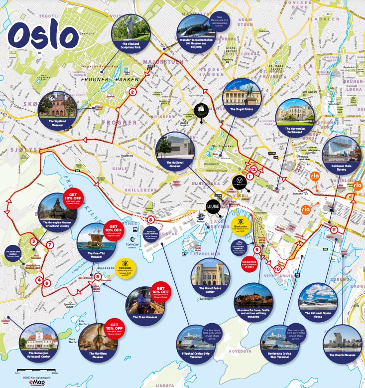
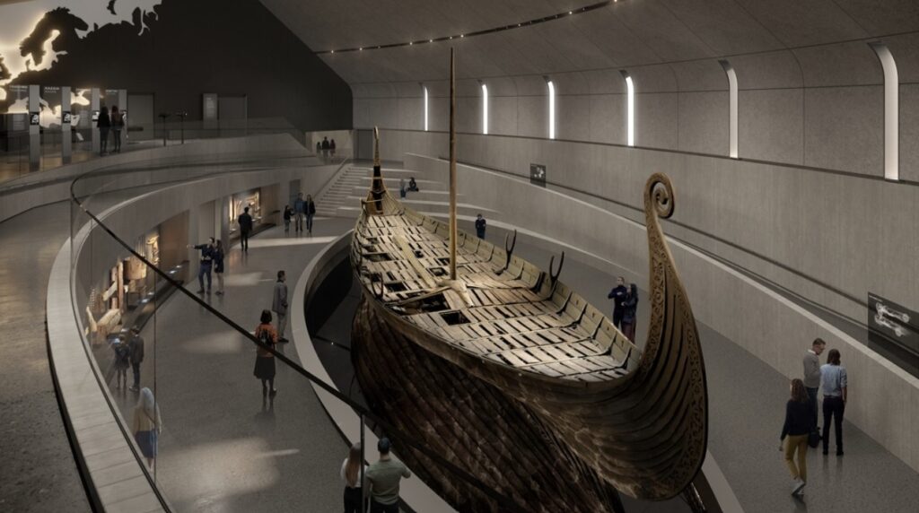
The first thing we wanted to see was the Museum of the Viking Age. But the website immediately notified us that it was closed and will not reopen until 2027.

With the Museum out we aimed for the Cathedral (Oslo Domkirke) right in the heart of town. Along the way we came across funky little square (Christiania Torv) with some of Oslo’s oldest buildings found around it, including first town hall from 1641 (today a restaurant). The square is known for its fountain, with a sculpture of a hand pointing to the ground. This is allegedly where the Danish-Norwegian king (Christian IV) pointed to this spot and said: “The new town will lie here!”. Continuing past the square we got to the the Cathedral which is the seat of the Bishop of Oslo. It was first consecrated in 1697, but needed to be restored back to its original baroque interior after WWII.

From here we were in full swing and headed along the Karl Johans gate. This is a popular avenue that stretches from the Oslo Central Station to the Royal Palace. Along the way we stopped at the Eidsvoll plass which is the park that sits in front of the Norwegian Parliament building.

As you keep walking through the park and along the Karl Johans gate you come across some truly lovely old buildings. Including the National Theatre, one of Norway’s largest avenues for performing arts.
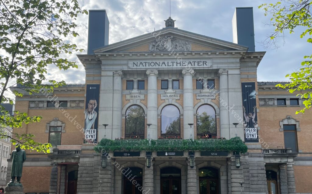
The photos below are just a collection of really cool old buildings as you yellow building below has been a restaurant since the 18th century and the next has been a hotel for about the same period, some funky old banks and university buildings and the national theatre.

As the walk continues you find yourself at Slottsparken (the Royal Gardens) and then Slottsplassen (‘The Palace Square’) and of course the Palace itself.

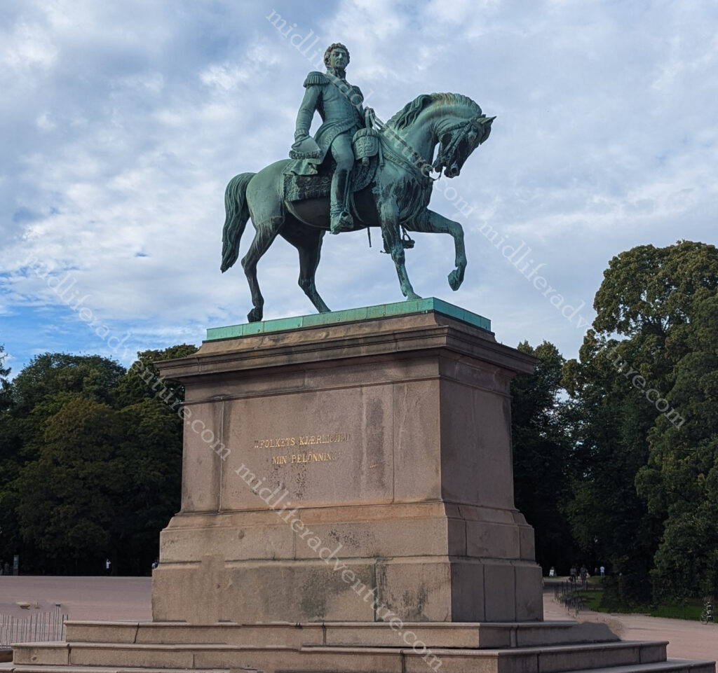
Directly in front of the palace you find the statue of Charles John of Norway and Sweden.

It was sculpted and erected in 1875.
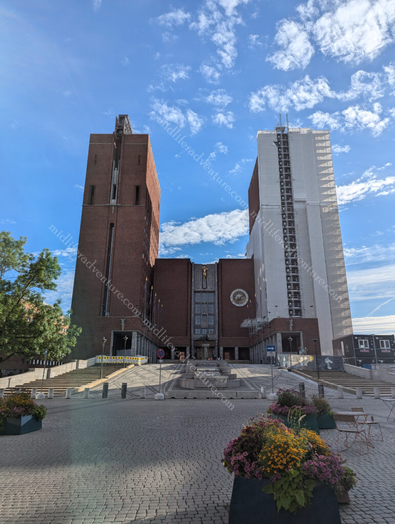
Coming back along the other side of the park and you wander past the Oslo City Hall (Radhuset).

The building has two towers (63 and 66 meters tall) with the eastern tower hosting a carillon set of 49 bells.

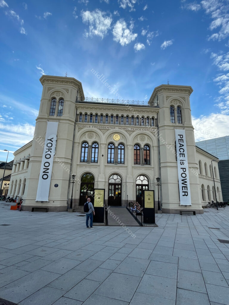
Behind the city hall is the Oslo Fjord waterfront. This area holds the National Museum and the Nobel Peace centre.

This museum marks the start of the Oslo city harbour promenade.

Here you can walk along the Oslo harbour for almost 10 kilometres, with no interruptions.
Shipyards, container facilities and heavy traffic have given way to pedestrian walkways, parks and benches. And of course an upscale pier full of restaurants and shops (that we couldn’t afford) and at the very end of the walk is the Astrup Fearnley Museum which is the museum for contemporary art.

One of the more interesting things that we discovered on this amble along the waterfront was the spotting of floating saunas. apparently, urban sauna culture has taken Oslo by storm. In the city centre several options have appeared for combining a trip to the sauna with a following dip into the fjord. There were a bunch of saunas anchored to the docks that accommodate up to 7 people. There is an additional option where you can rent a sauna and take it for a cruise into the harbour and out to see the Fjord.

While we were there we saw this one lone little sauna (about the size of a 1970’s caravan) bobbing up and down on the bay while the bigger boats and ferries beeped their horn and all but ran it over.

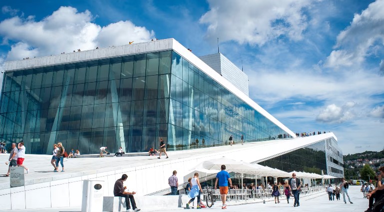
Having almost looped the city we found ourselves back near the main railway station (on the water) staring at the Oslo Opera House.
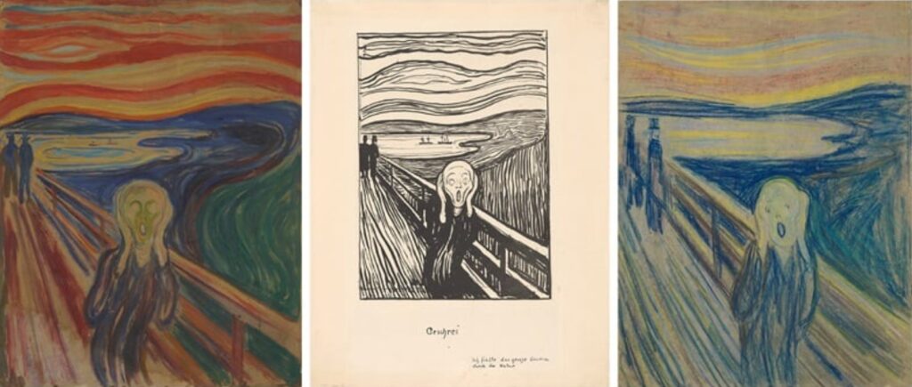
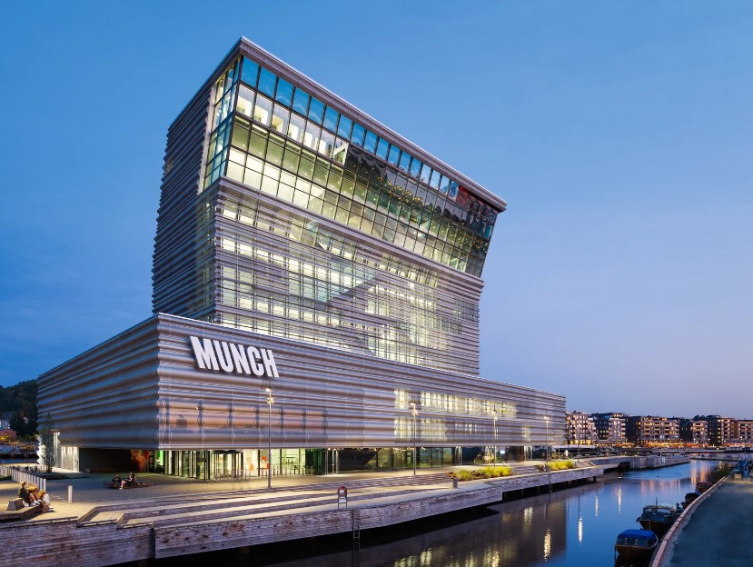
And just next door to this is the Munch Museum. This is home to the collection of work by Norwegian artist Edvard Munch and includes the three versions of his iconic painting, The Scream.
Akershus Fortress is known to be the most haunted castle in Norway and attracts more than three million visitors every year. It was built around 1290 by King Haakon V as a defensive stronghold for Oslo. It was once used as a prison for Norway’s most infamous criminals and during WWII, Nazis occupied the castle and conducted executions there. Today the fortress area is a popular venue for major events, including concerts, public holiday celebrations and ceremonies.

Trolls

Once upon a time (according to folklore) trolls roamed freely in the Norwegian mountains and forests. But the trolls only went out at night, in the dark because if they were caught in the sunlight the first rays of the sunlight would turn them into stone. Because of this you can still see their faces and bodies carved into the mountain sides, cliffs and stones all around the country. These rock formations and mountains with troll-like-shapes have mesmerised people all over Norway for thousands of years. Now, most of the trolls can be seen at the tourist shops.

Oslo hosts The Viking Planet the world’s first digital Viking museum that uses VR technology, holograms, interactive screens and 270-degree film to explore the life of the Vikings. The venue allows you to learn and experience the everyday life of the Vikings, join a voyage, climb aboard a Viking ship in a storm and take a picture of yourself as a Viking.

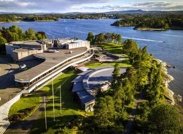
About 15 kilometers around the Fjord you can find the Henie Onstad Art centre and sculpture park, Our time did not allow us to get here but it does look amazing.
Poncy statues

For a nation with such a strong and bold viking history, Oslo sure had the poonciest set of statues we have ever seen. We had expected to find butch and manly men and strong shieldmaiden type women immortalised in the statues around town. What we found could not have been more opposite.

The Polar Exploration (Fram) Museum is literally built around the two ships that define Norwegian polar exploration: the Fram and the Gjøa. Housed in two tall buildings designed to accommodate the ships, it comprises numerous exhibitions and offers an opportunity to board and explore the Fram.

Leaving Norway we hopped on the ferry (once again more like a cruise ship) to take us the 600 kilometers from Oslo to Copenhagen in Denmark. The ship leaves Oslo at about 3pm, travels overnight with a quick stop in Frederikshavn (Denmark) and delivers you at docks in Copenhagen at 10am the next morning.

Malta

Malta is an island country in the Mediterranean Sea consisting of 3 islands (Gozo, Comino and Malta). It lies 80 km south of Sicily, 284 km east of Tunisia, and 333 km north of Libya.

Malta has been inhabited since around 5900 BC and its prime location in the centre of the Mediterranean and deep harbour has made it a vital area of strategic importance, particularly as a naval base. As such, every man and his dog has had a crack at owning and ruling the islands. The list includes the Phoenicians and Carthaginians, Greeks, Romans, Arabs, Normans, Aragonese, Knights of St. John, French, and British. In 1964 it finally got independence from the UK and became a republic in 1974.

Ok lets get this in perspective right up front, the place is tiny. It has an area of around 320 square kilometers and a population of a bit over half a million. The main island is 27 km long and 14.5 km wide. For perspective the entire nation is a quarter the size of Hobart with double the population.

Getting Around

Getting around Malta is pretty easy, cheap and efficient. The taxis are metered and there are fixed-price options available if you are coming from the airport. Uber and Bolt are competing fiercely to get control over the ride share options and the bus system is extensive, regular, cheap and and efficient.

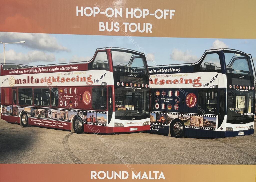
Our option was the HOHO. The Hop On Hop Off bus. We have used these in some locations and they have been magnificent and have inquired in other places and they have been highway robbery. Here in Malta they are magnificent.

The Malta HOHO has a northern and a southern route and there is so much to see that a full day on each is more than warranted. There is also a package that you can do that on day 3 you can include a harbour cruise. We didn’t take the package but did end up doing a harbour cruise because the forts are really best seen from the water.

Yes, you could do it cheaper by local bus, but 20 euros for a full lap of the island, stopping at all the main sights, with an audio guide in about 12 languages is pretty tough to beat. By comparison, the one in Paris is more than double this price and travels a shorter distance and the one in Sydney starts at $50 for a single day.

Day One

After getting in, settling in and finding a (magnificent) feed (our flight had been delayed several hours) after we had missed breakfast and lunch, our first day was pretty much over.

But we did manage to have a lovely walk along the waterfront of Sliema (the Jutty Outy bit above Valetta).

Which has some pretty amazing views over the old city.

So we ate, did our research and crashed for the day ahead.

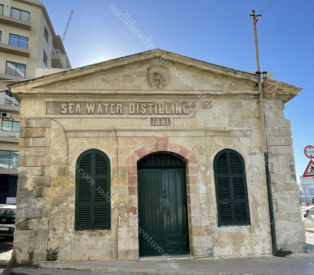
Almost right outside our hotel we came across the Sea Water Distilling Plant. As Malta is an island, access to potable water has always been a problem. This plant was constructed in Sliema in 1881 to provide drinking water for Tigné Barracks.

Today, the building houses a printing press.

Day two saw us getting up early and hopping on the HOHO for the northern route. It took us past the harbour and marina, delivering views of Manaoel Island (one of the many fortifications) on the way until we got to the gates of Valetta. This was the identical route that we would take the next day but tomorrow we got off in Valletta.

Instead we stayed on and made our way through some very funky suburbs and on to the San Anton Palace and Gardens. From 1802 until 1964, San Anton Palace was the official residence of the British Governor and is now the residence of the Maltese President. From here it was on to see the Mosta Dome which is the third largest unsupported dome in the world. It has an outside diameter of 56.2 metres, an inside diameter of 39.6 metres and an internal height of 54.7metres. It became famous during WWII when a bomb pierced the dome, landed and slid across the church floor without exploding! The church was crowded when the bomb hit and all were spared.

The next was the aviation museum and then a few stops were arts and crafts stops (glass factory, craft village etc.) But then the main attraction of the Northern Route, the town of Mdina. The city was founded as Maleth around the 8th century BC by Phoenician settlers. The history of Mdina traces back more than 4000 years. According to tradition it was here that in 60 A.D. that the Apostle St. Paul is said to have lived after being shipwrecked on the Islands.

The city was the capital of Malta throughout the Middle Ages, until the arrival of the 1530.

Directly outside the gates of Mdina is the town of Rabat, although it was once thought to be within the confines of the city. It is home to some impressive catacombs and archaeological remains not to mention some pretty incredible religious bling.

From here there are a few beach and ruin stops and we hopped off for lunch in Bugibba which is a lively seaside town with bars, restaurants, and hotels. Nothing particularly historic here but a lovely little spot. The next stop was the National Aquarium then another beachside town and it follows up with a scenic drive through a series of very pretty seaside bays on the way back.

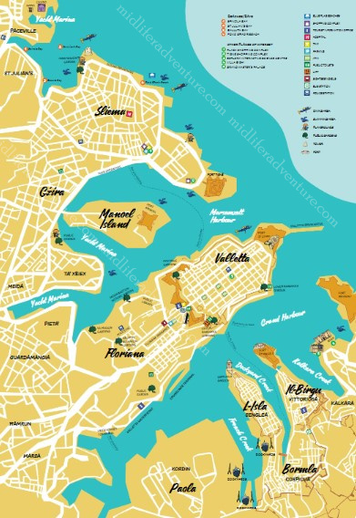
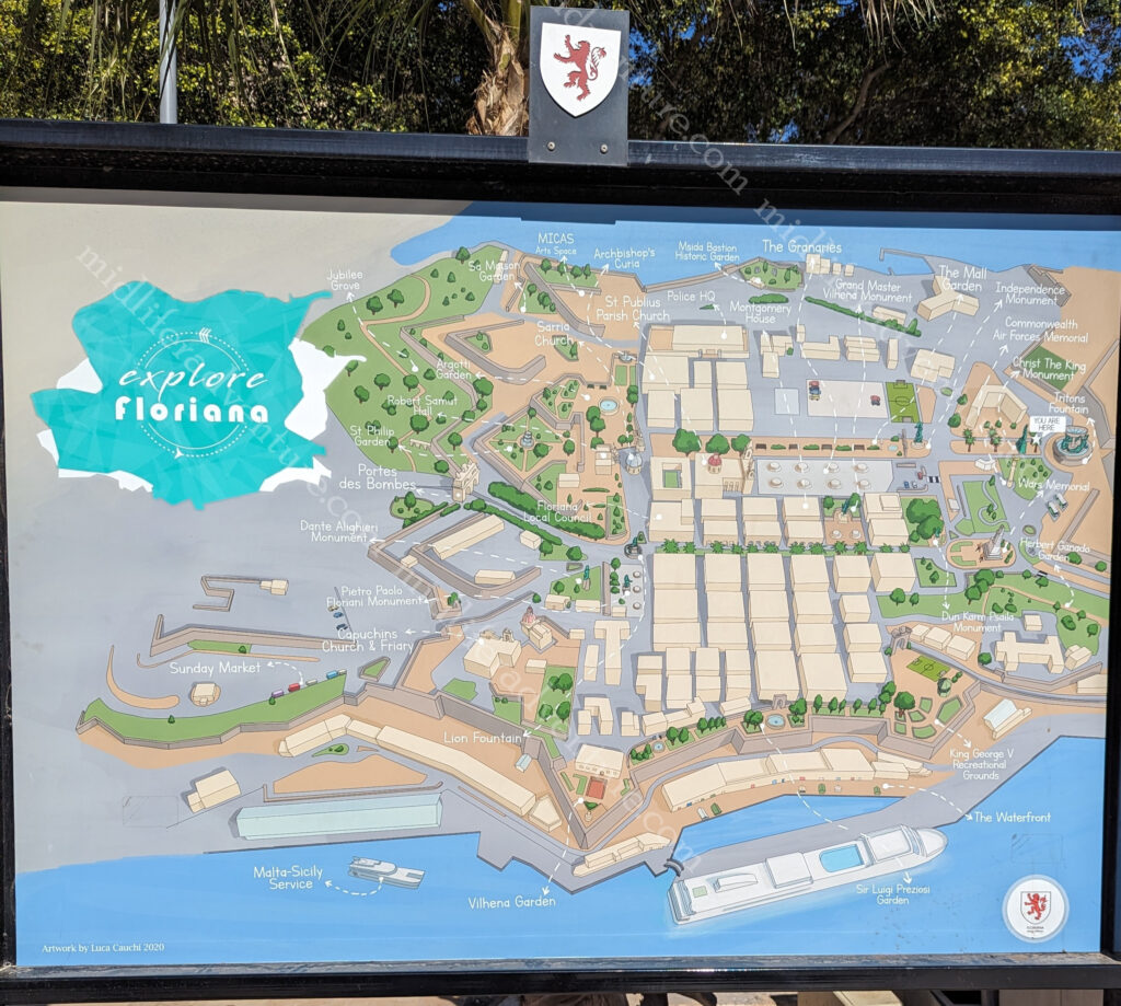
Day three saw us hopping on the HOHO for the southern route. The first stop was of course, the nation’s capital (Valetta), which is less than a square kilometre in size. It occupies the peninsula between Marsamxett Harbour (west) and the Grand Harbour (east) in a suburb known as Floriana. .

It is essentially just an old town CBD, perched on an isthmus. But there is so much in there. UNESCO has described Valetta as ‘one of the most concentrated historic areas in the world

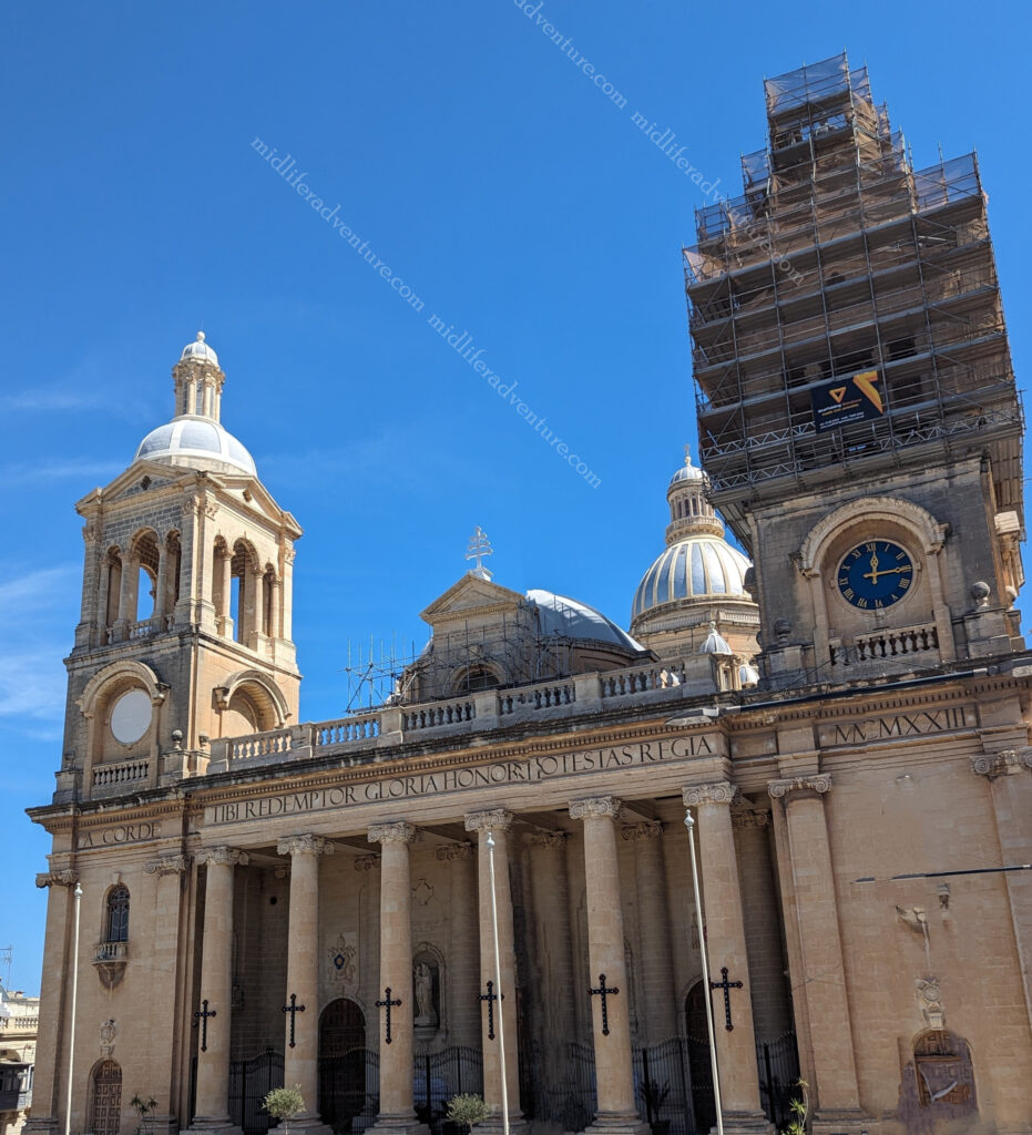
When you hop off the bus you find yourself at the Independence monument opposite the Saint Publius Parish Church.  The first stone was laid down in 1733 and construction was complete in 1768, when the relic of Saint Publius was brought to the church.

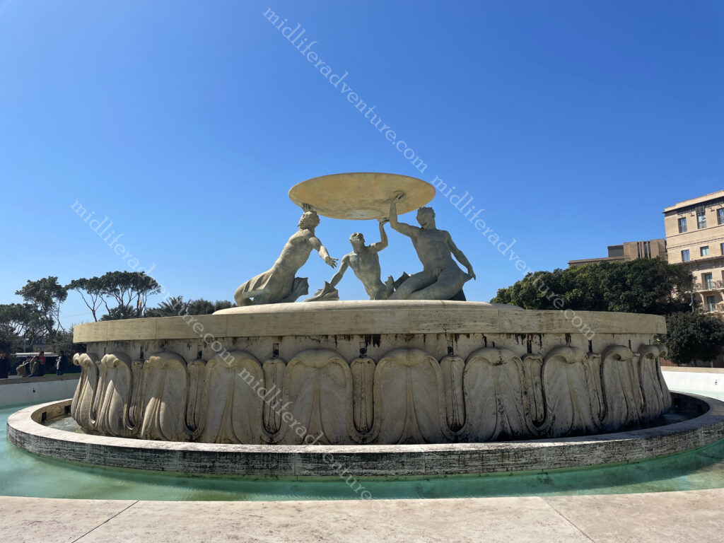
from here a very scenic walk begins towards and through the area that is Valetta. The first thing to signal your arrival is the Triton Fountain.

Triton Fountain consists of three bronze Tritons holding up a large basin. It was built out of concrete and was clad in travertine slabs.

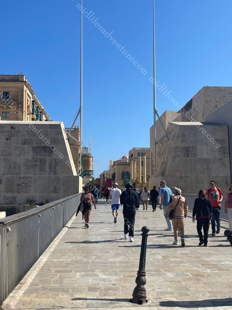
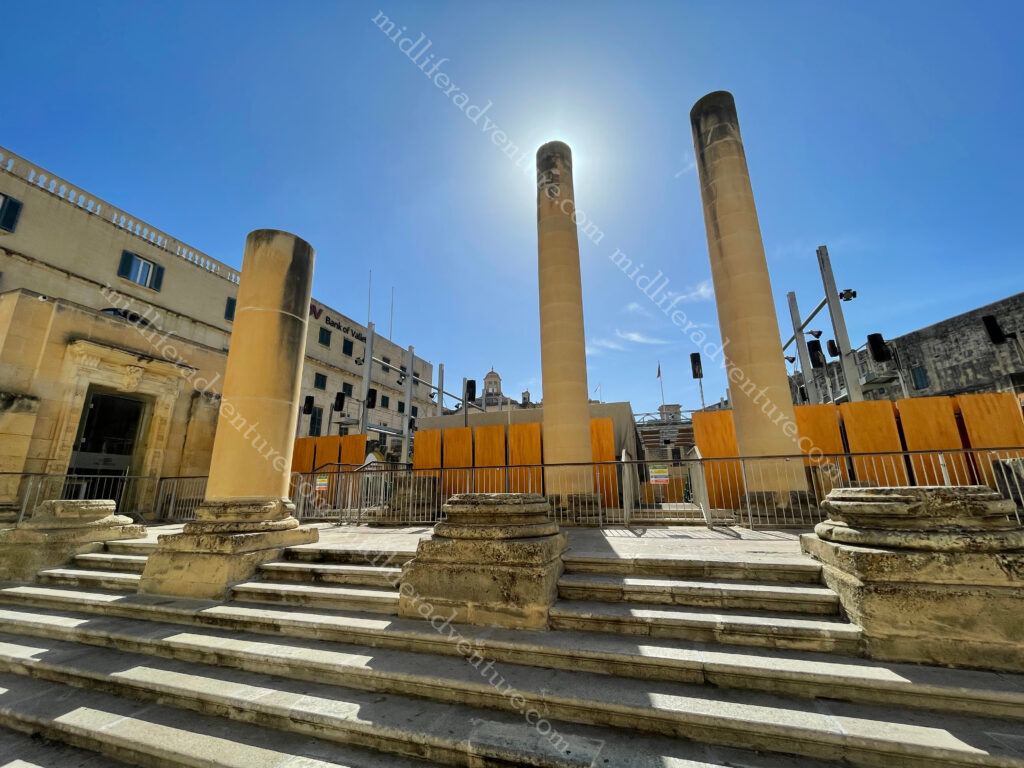
The City Gate was originally built by the Knights of Malta but was destroyed in WWII. It was replaced in the ’60s with a lavish version but people didn’t like it. So there is now a minimalistic bridge.

On either side of the gate is a pole symbolising swords, saluting everyone entering the city.

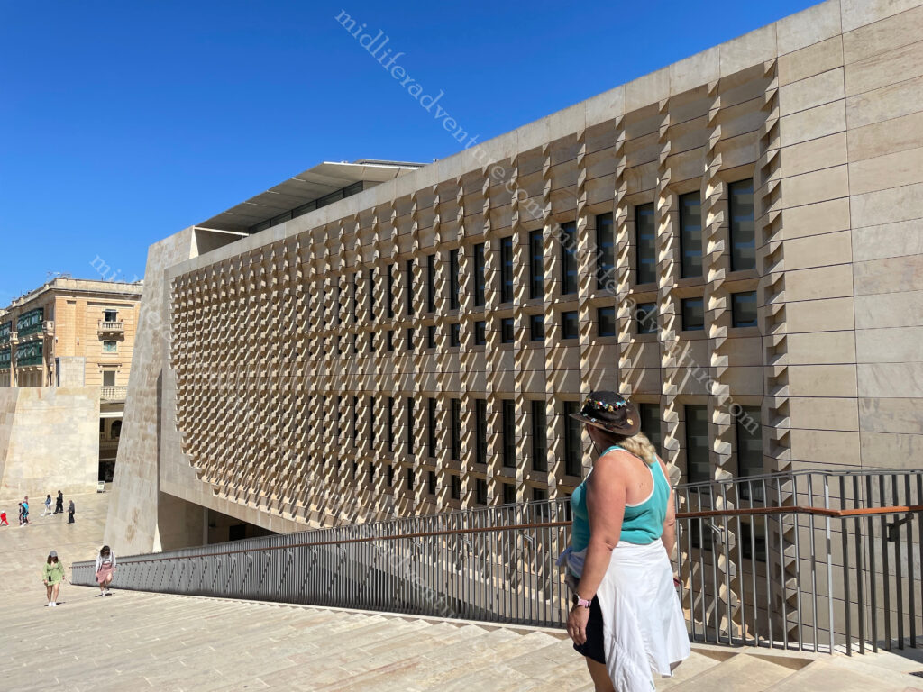
Through the gate on the right you will see the Parliament House of Malta. It was built between 2011 and 2015 on the site of the old railway station .

A bit further down and you run into the Opera House. The theatre received a direct hit from aerial bombing in 1942 during WWII.

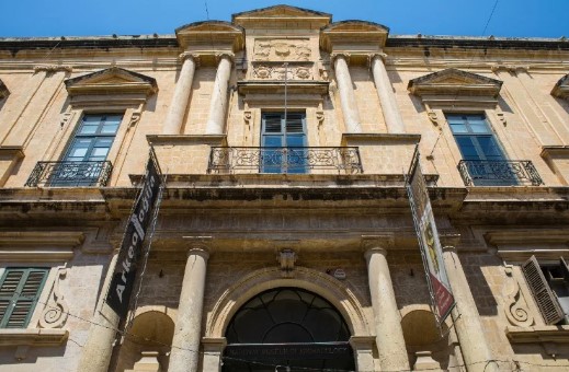
Down one more block and you are at the National Museum of Archaeology.

One more block and you hit the Saint-John’s Cathedral Museum.

And now you find yourself in St Georges Square which is the central square that is surrounded by a whole heap of stuff. All of this up until this point and all you have had to do was walk in a straight line for 700 meters.

Not least of those to be found in the square is the Grandmaster’s Palace which was Parliament House until the opening of the new one.

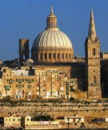
St Pauls Cathedral (Anglican) is the huge spire next to the dome that dominate the skyline of Valetta. Built in the 18th century it occupies prime location in Independence Square.

The dome is the Basilica of Our Lady of Mount Carmel (Roman Catholic). It was originally built in the 16th century but was destroyed in WWII.

Keep walking in a straight line and you hit the end of the isthmus and find yourself at St Elmo Fort. This area also includes a war memorial. A bit further along (coming back to the right) you find another war memorial with the Siege Bell. Then you end up hitting the Upper and Lower Barakka Gardens, these are in essence both more war memorials with plaques and statues celebrating those who paid great service to Malta over the centuries.

The Upper Barrakka Gardens are located on the top of the Valletta bastions, they offer stunning views of the Three Cities. They were built in the 16th century by the Knights of St John as a private gardens for the Grand Master and the Knights of St John.

Across the Grand Harbour from Valetta sits the Three Cities. Each of the cities have two names that are used interchangeably, the original Maltese name and the newer name given to them by the Knights of Malta.

Birgu – Vittoriosa

 Isla – Senglea

Bormla – Conspicua

The first two occupy peninsulas jutting into the Grand Harbour while the third sits behind them (but also has a port area). There is another peninsula that doesn’t seem to make the grade in the cities debate (Kalkara) but it has two major defensive forts in place (Fort Ricasoli and Fort Rinella). In total there have been nine separate forts established just to defend the Grand Harbour.

Birgu (Vittoriosa) is the oldest and was built up by the Knights of Malta as their headquarters when they arrived on Malta in 1530. Senglea (Isla) gives more of a local experience with few formal sights, while Bormla (Conspicua) is set back behind these peninsulas. Also jutting into the harbour is the peninsula of Kalkara, which can be seen from across the marina.

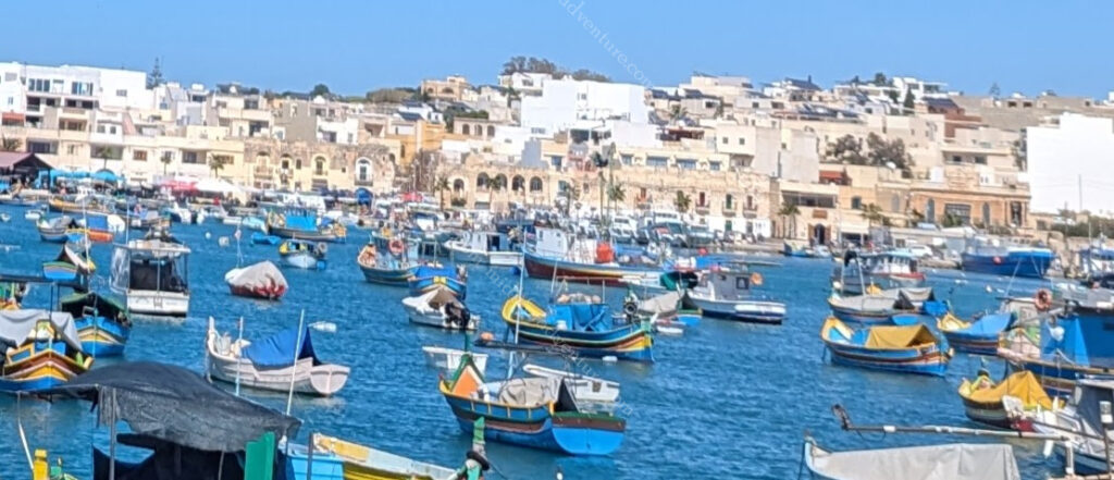
Back on the bus and there was a stop at the Marsaxlokk fishing village which would have been an awesome stop for lunch but we had spent too long exploring Valetta and were pushed for time now.

Next (major) stop was to the Blue Grotto which are a series of sea caverns on the south east coast of Malta. Set against a cliffy terrain near a local fishing harbour the blue grotto and neighboring caves offers spectacular views of rugged coastlines, sea caves opposite a small uninhabited islet (Filfla) which is a bird sanctuary.

Malta has often been called the ‘Fortress Island’ due to the great mass of military architecture that can be seen everywhere. This is a legacy of the islands’ history which saw them being fought over, time and again, due to their strategic location and deep, safe harbours.

So the best way to see these forts built to defend from attacks from the sea, is by boat. Which is exactly what we did. The fortifications that can be seen today come from two distinct periods: those of the Knights and those of the British era. Hopping on at Sliema (our home for the week) we took a 2 hour ride around the harbour takin in most of the 9 forts that were built to defend the harbours.

First on the list was Fort Manoel which sits on its own island between Valetta and Sliema and commands Marsamxett Harbour. The fort is built in the shape of a square, with a pentagonal bastion on each corner, giving it the shape of a star fort. It was built in the 18th century by the Order of Saint John and was named after their Grandmaster of that time. It sits between

The next in line is Valetta itself with Fort St Elmo guarding the approaches to both Grand and Marsamxett Harbours. We had seen it from the ground the previous day and now we got to see just how imposing it would have been to try and attack this place from the water. It was the scene of a heroic defence during the Great Siege of 1565.

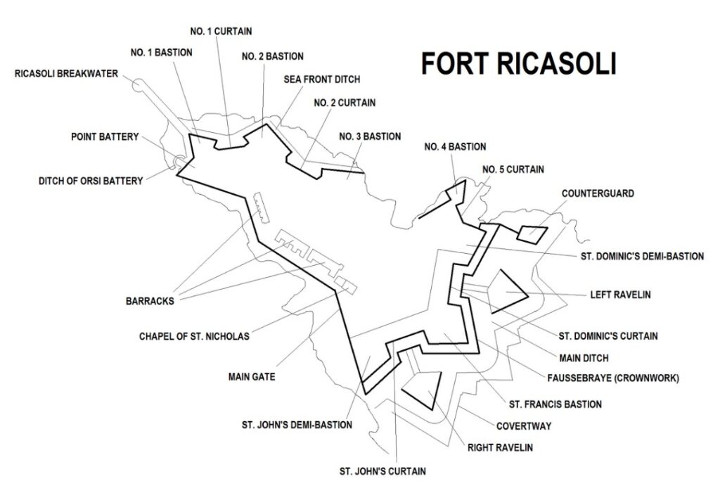
Fort Ricasoli is over 300 years old, being built by the Knights Hospitaller between 1670 and 1698. It is the largest fort in Europe . It was built to protect the Grand Harbour.

But today most of the fort is leased to the Malta Film Commission. As such it has been used extensively as a location for various films and serials.

In recent years, it has been used for the films Gladiator (2000) and Troy (2004) standing in for Rome and Troy respectively. The fort was also used in the filming of Assassin’s Creed (2016). In addition the TV miniseries Julius Caesar (2002) and Helen of Troy (2003) were partially filmed at the fort and in the first season Game of Thrones it was used as the Red Keep.

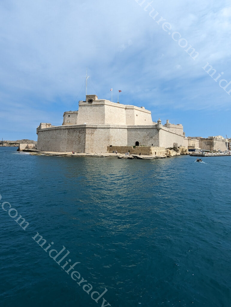
Fort St. Angelo is located at the centre of the Grand Harbour. It was originally built in the medieval period as a castle called the Castrum Maris.

It was rebuilt by the Order of Saint John as a fort and named Fort Saint Angelo between the 1530s and the 1560s.

Many believe it to be the jewel in the crown of The Maltese Islands’ military heritage.

The Ħal Saflieni Hypogeum is an underground complex of halls and burial chambers dating to around 4000 B.C. It was in use between 4000 BC and 1500 BC and covers an area of around 500 square metres. This one we didn’t get to as time just evaporated on us here in Malta with so much to see and do. Next time I guess.

Maltese food

I am sure that there is a bunch of traditional Maltese dishes that are floating around out there just waiting to be absorbed, but suffice to say that you are on an island close to Italy, Greece, Turkey and northern Africa. There is so much good food to be had here that you literally can not go wrong. We had plates and platters and pizza’s, soups and rolls. We had rabbit, pork, seafood and we had sweets and savouries.

And it was all fantastic, and reasonably priced.

When we were coming here we had little knowledge of what to expect and therefore our expectations were low. But this place has absolutely blown us away. An abundance of things to see and do, coupled with our ignorance of what we would find meant that we have seriously undercooked how much time we needed. We were here for 5 days, thinking that we could just kick back and relax (given that it was so small) but found ourselves at a full sprint almost the whole time and still missed out on seeing things.

I guess that is the beauty of travel, we will just have to come again and spend more time next time around.

Serbia

Serbia is a landlocked country in the Balkans. It shares land borders with Hungary (north), Romania (northeast), Bulgaria (southeast), North Macedonia (south), Croatia and Bosnia and Herzegovina (west), and Montenegro (southwest), and Kosovo.

Serbia has about 6.6 million people.

Having loved our (240 km and 8 hour) bus ride into Bosnia and Herzegovina we decided to fly out for a 40 minute puddle jump into Serbia, more specifically Belgrade.

Belgrade

Belgrade is the capital and largest city of Serbia. It is located at the junction of the Sava and Danube rivers with a population of around 1.6 million. Belgrade is one of the oldest continually inhabited cities in the world with the first dated records of habitation going back to the the 3rd century BC.

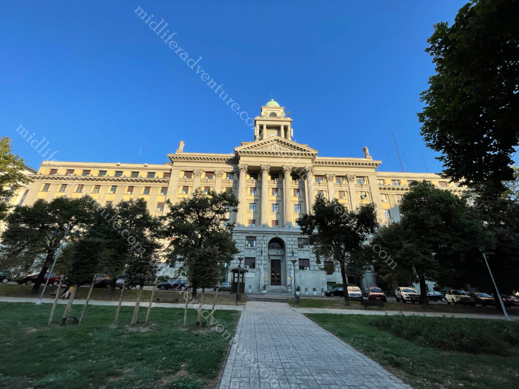
Our accommodation saw us perched between the old and new town directly opposite the old main railway station and associated park.

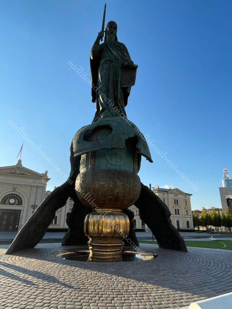
The park is amazing with an incredibly impressive monument to Stefan Nemanja (over 20m high).

He was a medieval Serbian nobleman who together with his son Sava (who the big church is named after) are considered the fathers of the Serbian Orthodox Church).

As it was early enough we dropped off our gear and headed out on a walk to see the sights. We chose to hit the ones that were away from old town, where we would be spending most of our time the following day. So we turned the corner from our hotel and started our way up the hill aiming towards St Sava Temple.

But within two blocks we had already landed upon the railway museum, which was incredibly impressive in its own right.

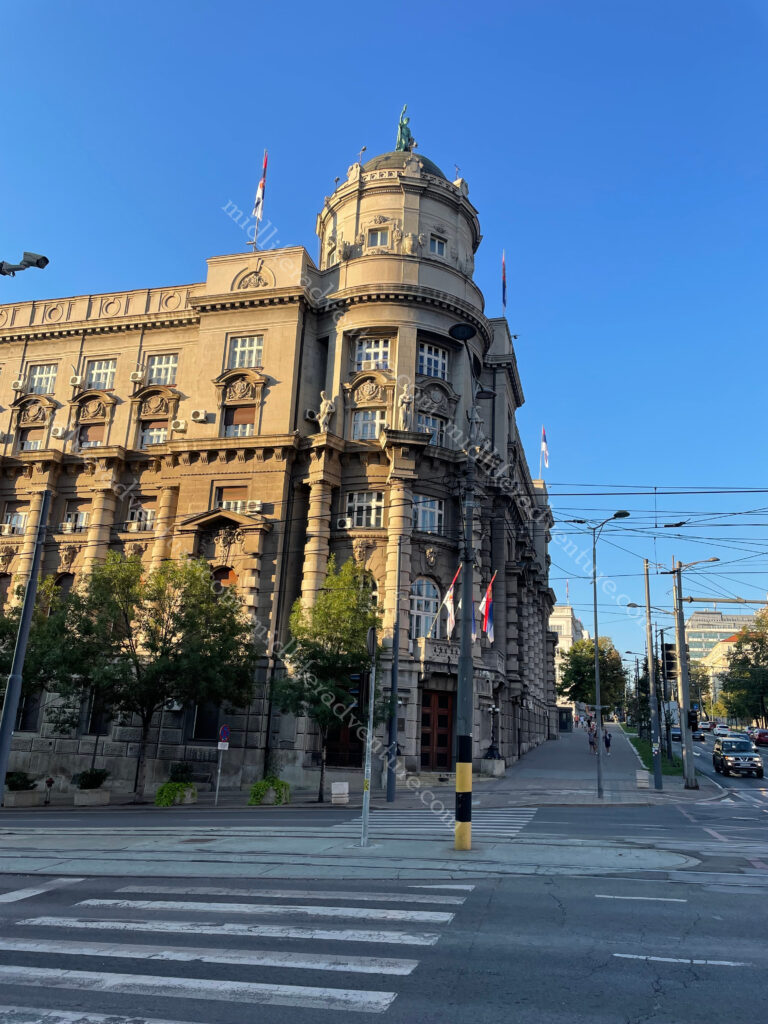
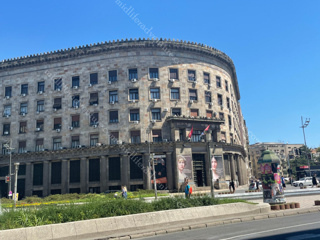
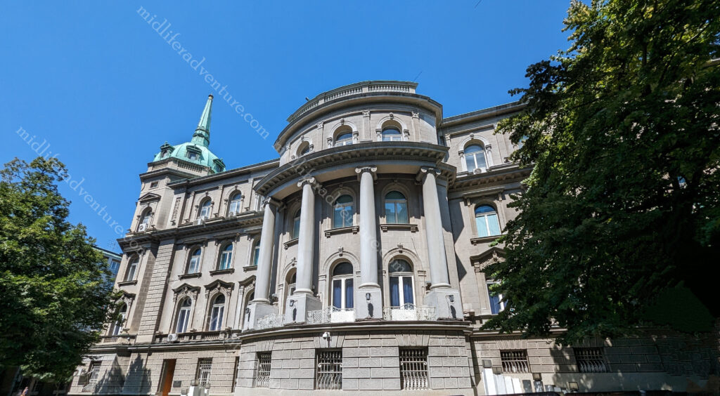
Half a block up and across the street we came upon the Government of the Republic of Serbia building.

This was built in the 1920s and was the first public building built in Belgrade for the purposes of the public administration of the newly formed Kingdom of Serbs, Croats and Slovenes.

Next came the Department of Defence, the Ministry of Foreign Affairs, the Belgrade city museum, public health department. And they were all housed in amazing soviet era architecturally designed buildings that were incredibly impressive.

Anyway, we did eventually make it to St Sava Temple which again, blew our socks off. The church is dedicated to Saint Sava (son of the dude with the big statue opposite our hotel), the founder of the Serbian Orthodox Church and an important figure in medieval Serbia. It was built on the location of St. Sava’s grave.

The next morning we were up and off to the 160 acre Belgrade Fortress. For many centuries the entire town existed within the walls of the fortress. It sits at the meeting of the Sava and Danube rivers.

As with all of Europe, the warring tribes saw this piece of land change hands many times over the millennia. The romans had their turn and according to wiki “in the period between 378 AD and 441 the Roman camp was repeatedly destroyed in the invasions by the Goths and the Huns. Legend says that Attila’s grave lies at the confluence of the Sava and the Danube (under the fortress)”. In the following centuries the fortress suffered continuous destruction under the Avar sieges. 

The name Belgrade was first mentioned in AD 878 by Bulgarians. The fortress kept changing its master as Bulgaria had it then the Byzantines and then Bulgaria again, in the 11th century it was given to the new Serbian state as a wedding gift. In the 15th century it was conquered by the Turks (with short periods of Austrian and Serbian occupation), but it remained under Ottoman Empire rule until 1867, when the Turks withdrew from Belgrade and Serbia. 

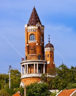
From the fortress you got a fair view of the Gardoš Tower or Millennium Tower.

It was built and opened in 1896 to celebrate a thousand years of Hungarian settlement in the region.

Within the walls is St Petka’s Chapel which was built in 1417 and was allegedly erected over a sacred spring. At one time it held the holy relics of St Petka. With all of the destruction of the fortress over the years, the exact location of this chapel is not known so a replacement was built on the grounds in the 1930s.

The amazing thing for us was that to visit and walk through the fortress and associated grounds was 100% free.

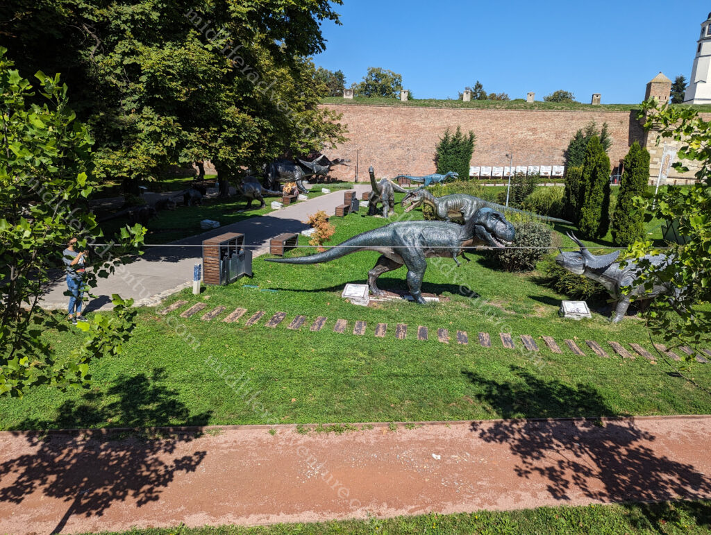
There was one odd children’s playground area with dinosaurs in it that had a small fee.

But as we did not want to play on the playground, we avoided that cost.

From the fortress, you spill out into the remainder of old town and the main tourist and shopping district of Belgrade. This part of town is full of funky old buildings with tons of character.

As you wander through you come upon the Cathedral Church of St. Michael the Archangel or simply St Michael’s Cathedral. This is a Serbian Orthodox church in the centre of the old part of Belgrade. It was built around 1840, on the site of an older church dedicated to Archangel Michael.

The Historical Museum of Serbia is currently in this building but it has been granted the building opposite our hotel (the old main railway station) as its permanent home and will be moving soon.

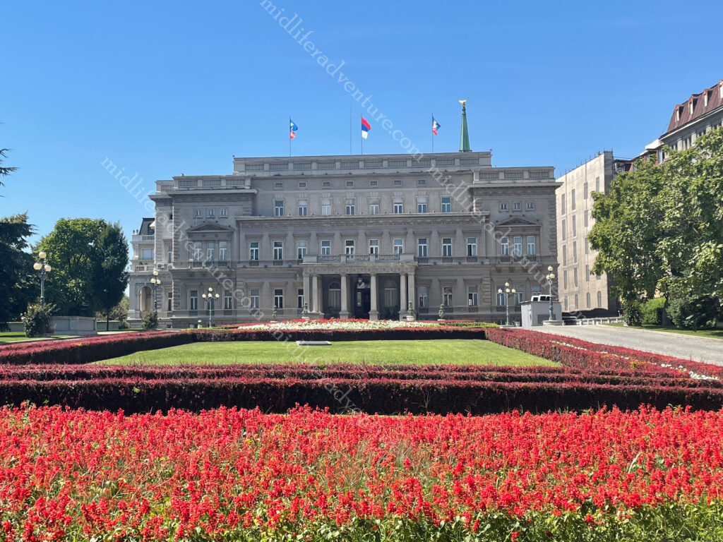
The Stari Dvor or old palace was the royal residence of the Obrenović dynasty (1800’s).

Today it houses the City Assembly of Belgrade. 

Novi Dvor or new palace was was a royal residence of the Karađorđević dynasty (late 1700 & 1800’s)

Today it is the seat of the President of Serbia. 

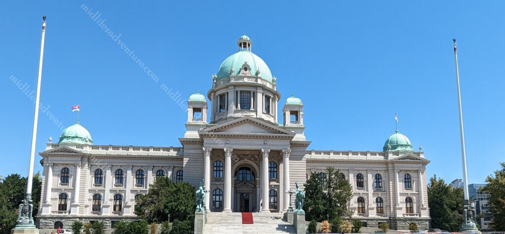
House of the National Assembly was built in 1936 and has served as the seat of parliament for the Parliaments of Yugoslavia, Serbia and Montenegro and since 2006, Serbia.

For the most part, Serbia has been great. The food is good (if not exactly heart smart), the prices are reasonable, the beer is well-priced, and there is plenty to see and do (mostly without charge). I would certainly not hesitate in coming back.

The Golubac Fortress is somewhere that looked amazing but sadly (at about 120km from Belgrade) we could not get to. It was a medieval (fortified) town on the Danube 4 km downstream from the current town of Golubac. The fortress was built during the 14th century and has ten towers. Most of these started square but evolved to get many-sided reinforcements to accommodate modern firearms.

Dubrovnik

Dubrovnik is basically the most famous Game of Thrones (GoT) filming destination on the planet. It was the filming location for the city of Westeros, Kings Landing. Within the walls of Old Town there were many GoT scenes shot. And today you can barely walk the streets without crashing into a GoT tour, shop, memorabilia outlet or sign highlighting how it related to the show. Suffice to say, that almost everything you see or that I will mention in the following is related in some way shape or form to the show.

Our accommodation (thankfully) was out of the craziness that is the old town. We were down on the water, a few kilometers away near the port. The setting was stunning and at least (while we did not know it at the time) we were away from the insanity. We arrived after 8pm and headed out for a lovely meal by the water, vowing to brave the tourist sights the next morning.

Our first introduction to what was to follow was the slow walk that we decided to take to Old Town (rather than catch the local bus). And this introduction was boat load after boat load of party boats stocking up on their quota of tourists for the day trips. The waterfront was packed with boats, each jamming 50+ people per boat and the bigger ones doing way more. And of course there is the daily cruise ships

Dubrovnik Old Town is known as one of the world’s finest and most perfectly preserved medieval cities in the world. For centuries it rivalled Venice as a major trading port. It was built between the 11th and 17th centuries, affording protection to the main entry gate.

The main attractions within old town include the city walls (which you can walk around (for 35 euros a head) this will include towers, walls and defences. Inside the city proper are the clock and bell tower, churches (Sveti Vlaho, Saint Saviour and the Cathedral), monasteries (Dominican and Franciscan), squares (Stradun, Placa, Lužaand and Gunduliceva), and the GoT favourite the Jesuit Stairs.

Having navigated past the harbour we kept walking towards the old town figuring we would see some cool stuff along the way. The first sight we came across was the Lovrijenac Fortress. This is a 16th Century Fortress with 12 metre thick Fortress walls. Over the centuries the fortress played a pivotal role in the defence of Dubrovnik.

This and the Bokar Fortress (opposite side of the inlet) create a fairly imposing landing point for any old-time invading force. Bokar Fortress was built in the 15th century to defend the town’s main entrance. It is the round lump that hangs off the end of old town just to the side of the main entry gate. Currently, in its interior, there are several cannons on display as well as a small precious stones (lapidary) collection.

Pile Gate is the main entrance to Dubrovnik City, and is one of only two entrances to the city. We were here relatively early in the morning and it was already seriously busy, with bodies all over the place and hellish tour groups taking up all the available space.

As you pass through the Pile Gate you are met with two imposing buildings and a fountain. To the left if the Franciscan Monastery and to the right is the St Claire Convent with the Onofrio’s fountain directly in front. The other thing you are met with is a wall of humanity. Everyone gets through the gates and stops to take pictures. As we were here early it was fairly manageable but by the time we were ready to leave this place was a debacle.

Between the two runs the Stradun (main street) which connects the western and eastern entrances to the city. It was created at the end of the 9th century and was rebuilt after an earthquake in 1667. At the beginning and end of Stradun, there are two fountains (Big and Small Onofrio’s Fountain) and two bell towers (City bell tower and the bell tower of the Franciscan church and monastery).

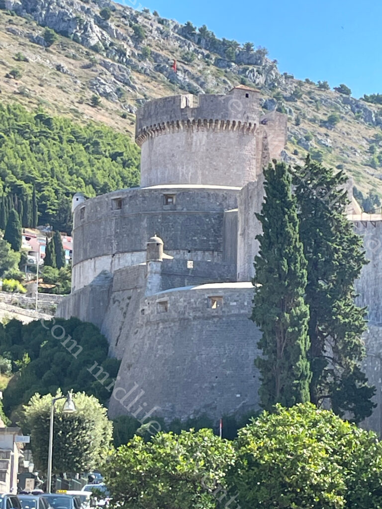
Minceta Tower is the highest point in Dubrovnik City and as you would expect, delivers impressive views over the sea and the Old Town.

Locally known as Tvrđava Minčeta, the tower was built in 1319.

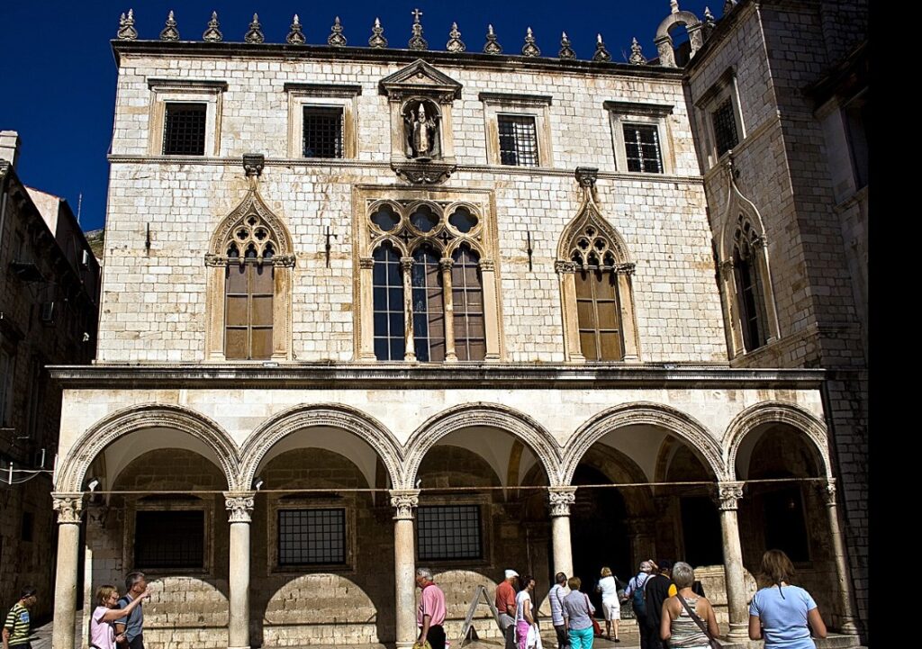
Palace Sponza was built in the 16th century and has been used as the customs house, armoury, treasury, bank and school.

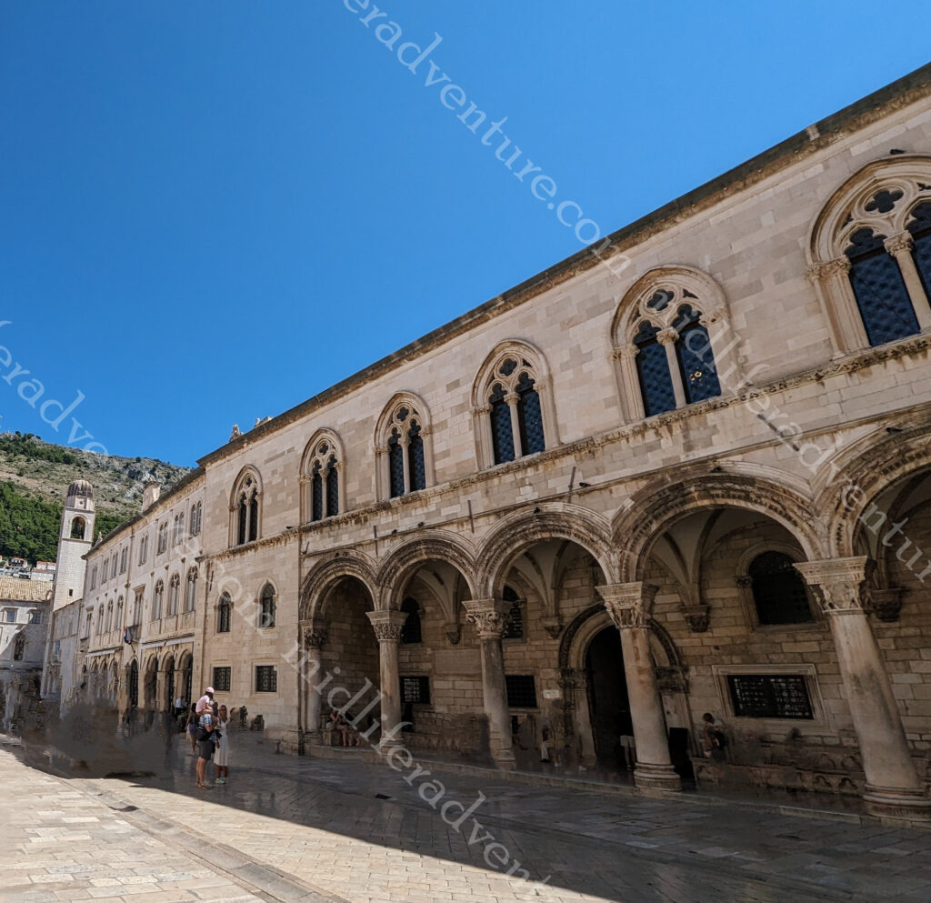
The Rector’s Palace or Knežev dvor used to serve as the seat of the Rector between the 14th century and 1808. Originally it was a site of a defence building in the early Middle Ages. It was destroyed by a fire in 1435 and the city-state decided to build a new palace.

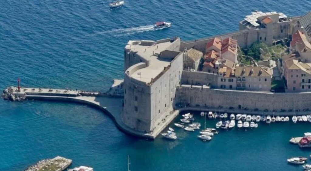
Sveti Ivan tower was built in the 14th century on the south side of old town. On its ground floor there is an aquarium, and on the 1st and 2nd floor there is a Maritime Museum.

Lokrum Island is located just off the Dubrovnik coast. According to legend Richard the Lion-Heart was cast ashore here after being shipwrecked in 1192 while returning from the Crusades. The vow he made to build a church on the spot where he came ashore should he be saved was kept at least in part. Although he came ashore in Lokrum, at the request of the people of Dubrovnik, he agreed to have the church built in the city itself.

At its center is a medieval Benedictine monastery complex that’s surrounded by botanical gardens planted with exotic trees, flowers, and bushes.  Inside the Visitors Centre on Lokrum Island is a small exhibition dedicated to GoT and it is the final resting place of the original Iron Throne.

Located near Gundulic Square in the centre of Dubrovnik Old Town the Jesuit Staircase and St Dominika Street are the two most popular areas in the whole of old town. This is the area where one of the most famous GoT scenes were filmed (Cersei’s infamous walk of shame).

We were totally over the crowds and the people and were on our way out of old town by 11am. On our way out the bedlam that we saw on the way in was multiplied by about 5 times. The lines were longer, the crowds were denser and the tempers were shorter.

Dubrovnik is an absolutely lovely city to visit. Just don’t do it in peak season. July and August are hellish and should be avoided at all costs. Don’t get me wrong, you really want to come here, but the peak-season crowds make this place unbearable.

Knin and Split

Knin

Our journey to Split started with an early morning train from Zagreb. What we did not realise was that we were travelling on the 5th of August, which is a national day of celebration and remembrance. On this day in 1995 the town of Knin was liberated from Serbian forces in a combined military and police operation “Storm”. 

In the course of the operation several towns liberated and at exactly noon, a twenty-meter Croatian flag was hoisted at the Knin Fortress. After 84 hours, Knin and additional 11,000 square kilometers of occupied territory were freed. The Croatian Army and Police forces liberated area up to the internationally recognized border between Croatia and Bosnia and Herzegovina. 

From 1996 till today this day has been marked as a public holiday that is now called Victory and Homeland Thanksgiving Day and the Day of Croatian Defenders.

And we were belting past and briefly stopping on the train. The first sign was a bunch of military uniforms and checkpoints. The next was monster tanks and rocket launchers. A look up the hill showed the fortress and what appeared to be quite a lot of commotion, which at the time we were oblivious to.

Split

We arrived in split mid afternoon and immediately descended into a nightmare. The train station, bus station and tourist docks were all in one very tiny spot of land and there were bodies and vehicles going in every direction. It was bedlam.

Thankfully our hotel was only about half a kilometre away (up the hill) and was near Bacvice Beach (the main tourist beach in town). As it was the national holiday, most of what was available was closed.

Split is the second-largest city of Croatia after the capital Zagreb, the largest city in the region of Dalmatia and the largest city on the Croatian coast. It lies on the eastern shore of the Adriatic Sea and is spread over a central peninsula.

The most important thing to know is that there are three Splits.

The first is Land Split – which is full of old buildings, castles and palaces along with Game of Thrones (GoT) filming locations.

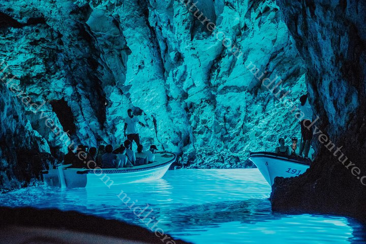
The second Split is Water Split which takes in stunning water locations such as the blue cave, blue lagoon, shipwrecks.

Unfortunately this also runs into the third Split, Party Split.

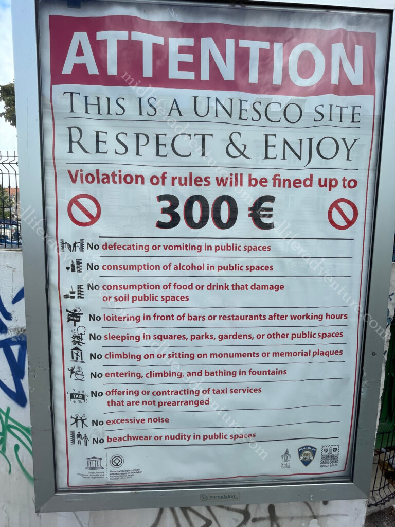
A ton of 18-20 somethings are being fed unlimited fixed price drink packages in a sunny and decadent location. This is a recipe for disaster. I’m sure in my 20’s I would have loved it.

Sadly, third Split necessitates the printing and signposting of this photo.

The main show in town is the Diocletian’s Palace. The ruins of the Roman Emperor Diocletian’s palace date back to the late 3rd to early 4th century A.D. This isn’t just a palace or a ruin, rather it has been consumed by and now constitutes the entire old town centre. The ancient walls, gates and columns ring the palace but over the period (1700 years or so) the Renaissance houses, palaces, cobbled streets and squares all grew within the space that was once the palace.

The Cathedral of Saint Domnius was built in the 4th century and is known locally as the Sveti Dujam. Strictly the church is dedicated to the Virgin Mary, and the bell tower to Saint Domnius. Together they form the Cathedral of St. Domnius. It was consecrated at the turn of the 7th century AD, is regarded as the oldest Catholic cathedral in the world that remains in use in its original structure. The structure itself was built in AD 3.

In the Palace is a Game of Thrones Museum that allows fans to step inside Meereen and the GoT more broadly. The museum has some original artifacts, props, costumes, actual size figures, weapons, city dioramas, sets and more.

Froggyland – well, let’s just let the pictures speak for themselves.

About 14 kilometres out of town you can find the Klis Fortress perched in the mountain pass between Mosor and Kozjak. Getting here was a simple 20 minute bus ride on the local transport for the princely sum of three euros.

The fortress has a history going back more than 2000 years, beginning with the Illyrian tribe called Dalmatae that used it as a stronghold before it was taken by the Romans. After the fall of the Roman Empire, the site became a seat for several Croatian kings. And of course, the fortress was used as a GoT film set.

Jill even found herself in her own drama with an overly entitled Instagrammer. We were appalled to hear this whiny nasal voice telling everybody to move as she was trying to take a “real photo”.

As soon as the path cleared a bit another person would step into the shot (it is a pretty popular place) causing another round of whining. I made sure to step in and get my photos and Jill stepped in a short while later to get hers, ensuring to take her time. When the girl tried to pull Jill on, she responded that we had all paid the same amount of money and were all able to get our photographs and that she was not going to pander to her sense of entitlement.

This was met by giggles from those around and prompted a steadily annoying stream of people standing exactly where she was trying to clear. The worst thing about all of this, the whiny, nasal voice was accompanied by an overtly Australian accent. I am hoping that this is not the future touring reputation that Australians will get.

Back to town to see the remainder of the Palace and old town and then back to our accommodation to prepare for the next leg through to Dubrovnik.

The next day we had hours to kill while we waited for the bus trip that we had been dreading for a while now. The further east you go in Europe, the shittier things get. The organisation and schedule of Germany falls by the wayside and is replaced with increasingly half-assed versions. The trains go from fast, comfortable transports through to old diesel clunkers. And eventually the trains disappear all together and bus transfers are all that is left.

This was the first of the bus transfers. And our dread manifested immediately at the chaos that was the bus station. There were about a thousand (literally) people with luggage waiting and no board available to figure out where/when (if at all) your bus may turn up. Busses turned up and left with little or no explanation and the poor drivers were besieged by confused (and annoyingly needy) tourists.

Ok first things first, the Croatian coastline is stunning. After the debacle that was the bus station, the rest of the trip was perfectly satisfactory. There were some overly chatty (chain-smoking) bus drivers that answered every question (from each other) 4 -5 times. So the bus was filled with second hand smoke and the sounds of da da da da da or ya ya ya ya ya ya. But otherwise, the trip was great and the scenery was incredible.