Halifax is the capital and most populous city (about half a million) of the Canadian province of Nova Scotia. The native name Kjipuktuk (che-book-took) means “Great Harbour” in the native Mi’kmaq language. It owes its existence to its location as it sits on one of the largest and deepest ice-free natural harbours in the world.
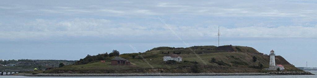
Our ship pulled into the docks with the town on the right and Georges Island on the left. Georges Island is the home of Fort Charlotte, an old fortification with a maze of brick tunnels that once housed the ammunition for the fort’s powerful guns in bomb-proof security.
The right hand side featured one of the best developed port and dock facilities that we have experienced so far. This place has truly developed to maximise its harbourside and centralise the tourism. The wide boardwalk and infrastructure that has been built on the harbourfront really makes it a tourist friendly environment.
The waterfront is several kilometers long, with cafe’s, shops, restaurants, breweries and bars lining almost every step of the way. The boardwalk has statues, parks, swings, historical markers, and educational signposts all the way along. Some places do their ports well, but this place was a step above.
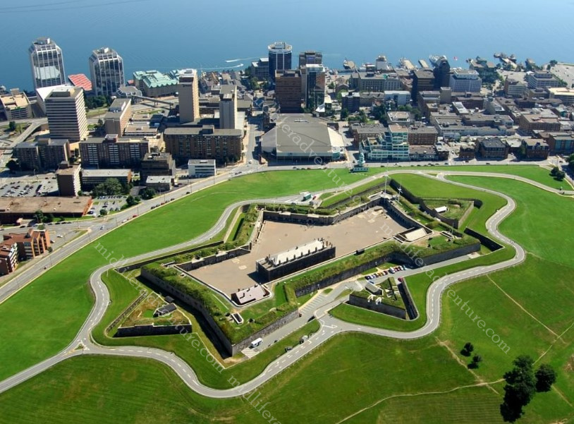
The city itself is dominated by the hilltop Citadel, a star-shaped fort completed in the 1850’s. Four fortifications have been constructed on Citadel Hill since the city was founded by the English in 1749
All but the third iteration have been called the Halifax Citadel. The last part built is a concrete star fort. While never attacked, the Citadel has long been the keystone to defence of Halifax Harbour.
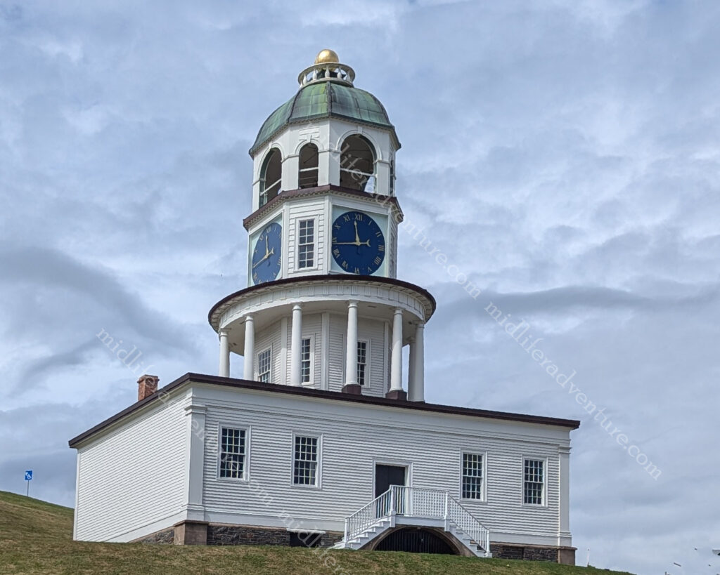
At the approach to the Citadel you find the Town Clock (sometimes called the Citadel Clock Tower). It is a three-tiered octagonal tower built in 1803 on a box, originally facing the barracks. It is four-sided so that soldiers had no excuse for tardiness.
With over 13,000 kilometers of coastline, Nova Scotia offers an abundance of seaside entertainment options. Most notably it is known for its lobster and seafood.
Nova Scotia has some of the most fertile lobster fishing grounds on the planet. It has become the lifeblood of many working fishing communities in Nova Scotia as they hunt for the Atlantic Lobster. The tourism board has developed the Lobster Trail which is a collection of lobster restaurants and diners around Nova Scotia. On offer along the trail include traditional lobster dinners, chowders and rolls. Then there are some rather odd offerings like lobster poutine, lobster tacos, and lobster mac & cheese.
Along with the Lobster trail, Nova Scotia also has a Good Cheer Trail. This trail celebrates the abundance of wineries, breweries, cideries, distilleries and meaderies that are throughout the province. The Good Cheer Trail celebrates all five of these craft beverages.
Along with the waterfront, the rest of the town has a nice collection of Street Art. Interesting murals abound and almost every corner reveals something new or surprising.
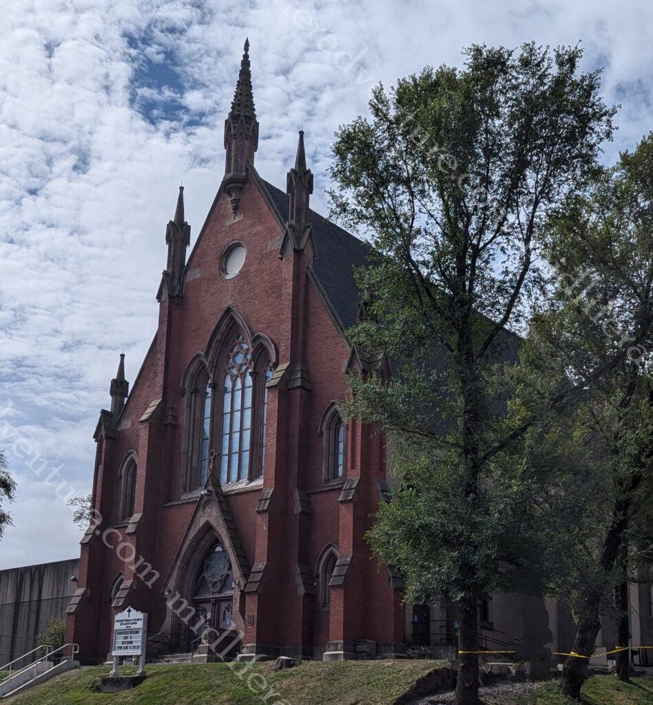
The Presbyterian Church of Nova Scotia, was founded in 1817 but did not have its permanent home in Halifax until it took over the old Methodist church and established the Church of Saint David.
Originally built in 1868-69 the Church overlooks and is surrounded by the old Methodist burial ground.
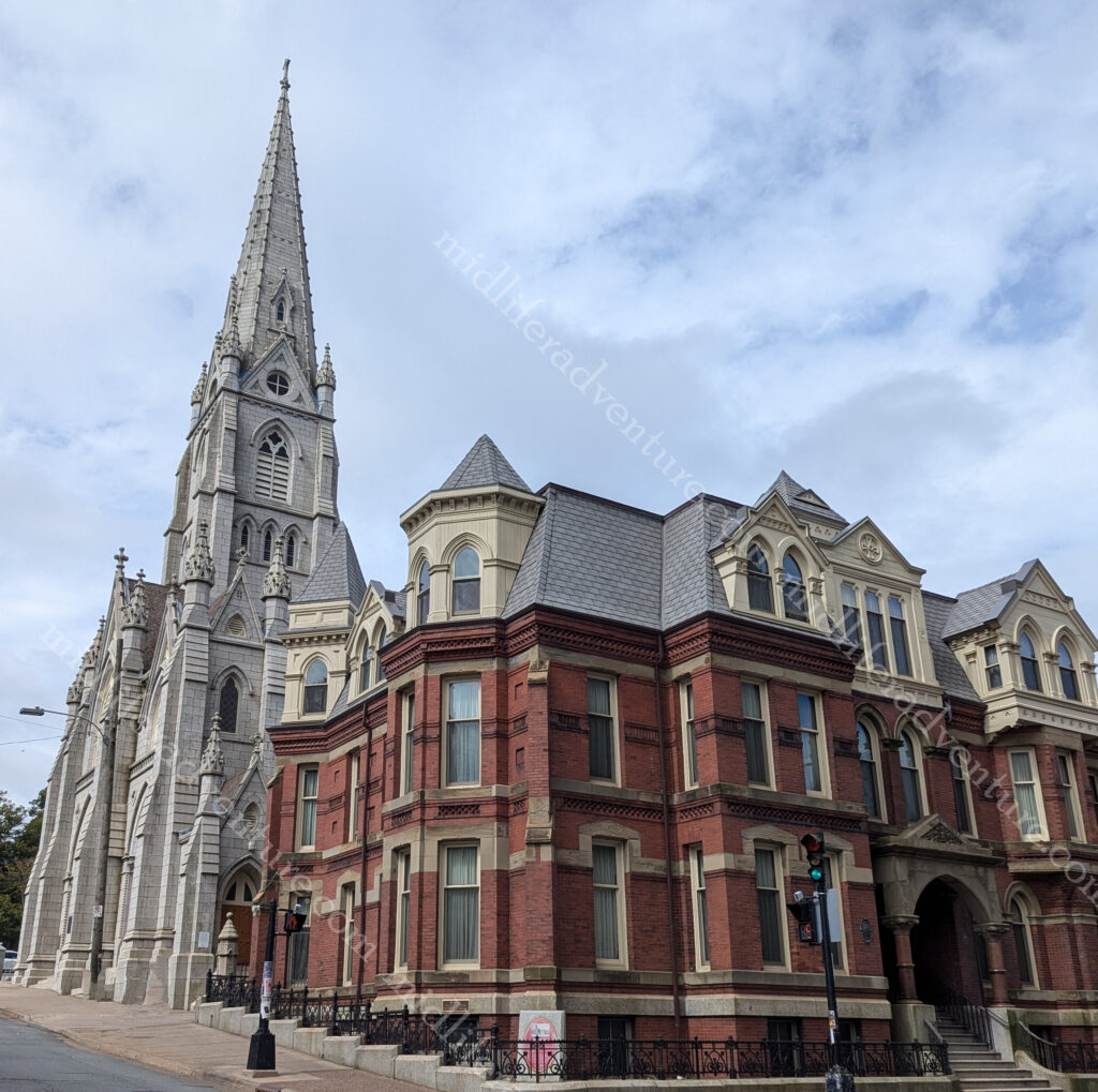
Saint Mary’s Cathedral Basilica is a Gothic Revival Catholic cathedral in downtown Halifax.
Pope John II visited the cathedral back in 1984 to commemorate the 200th anniversary of the Cathedral.
With thousands of kilometers of coastline, it’s no surprise Nova Scotia has the largest number of lighthouses of all of the Canadian provinces. There are more than 150 dotting the coastline. Lighthouses are a common sight along the coasts and remain an important symbol of the past, and highlight the coastal landscapes. Some lighthouses are open to the public with guided tours, while others can be accessed from short trails and hikes.
The town is small with not that much going on, but everything that there is is on full display and is easily accessible. I am not entirely sure that I have ever been in a city or town with as many pubs, restaurants and bars. It seems like every block has at least 5 bars on it. This doesn’t sound like a lot, but as you walk block after block the numbers really add up.
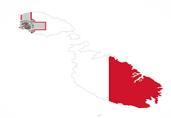
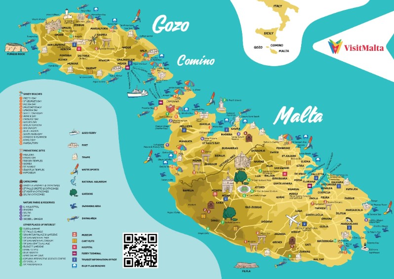
Malta is an island country in the Mediterranean Sea consisting of 3 islands (Gozo, Comino and Malta). It lies 80 km south of Sicily, 284 km east of Tunisia, and 333 km north of Libya.
Malta has been inhabited since around 5900 BC and its prime location in the centre of the Mediterranean and deep harbour has made it a vital area of strategic importance, particularly as a naval base. As such, every man and his dog has had a crack at owning and ruling the islands. The list includes the Phoenicians and Carthaginians, Greeks, Romans, Arabs, Normans, Aragonese, Knights of St. John, French, and British. In 1964 it finally got independence from the UK and became a republic in 1974.
Ok lets get this in perspective right up front, the place is tiny. It has an area of around 320 square kilometers and a population of a bit over half a million. The main island is 27 km long and 14.5 km wide. For perspective the entire nation is a quarter the size of Hobart with double the population.
Getting Around
Getting around Malta is pretty easy, cheap and efficient. The taxis are metered and there are fixed-price options available if you are coming from the airport. Uber and Bolt are competing fiercely to get control over the ride share options and the bus system is extensive, regular, cheap and and efficient.
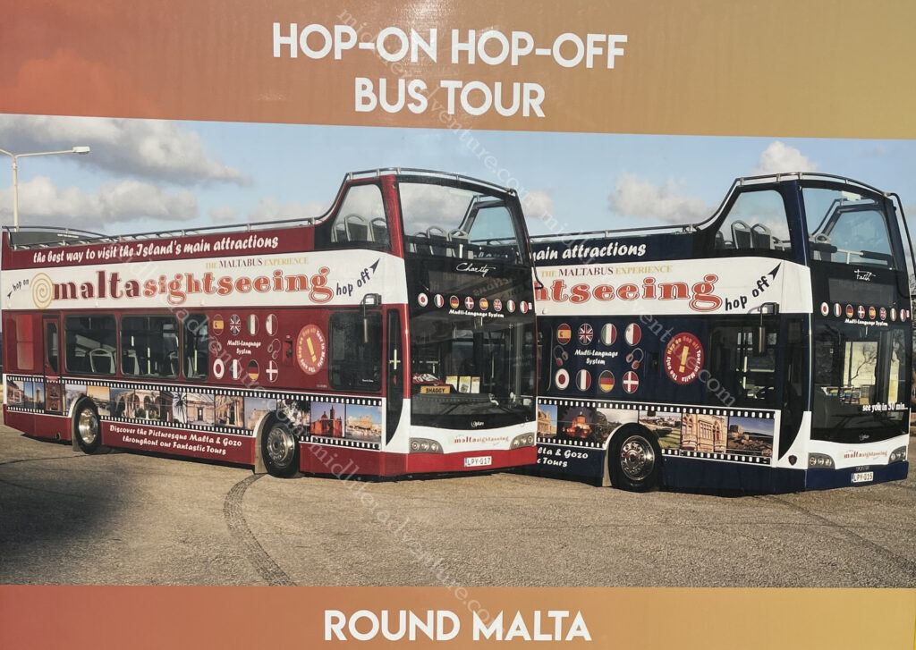
Our option was the HOHO. The Hop On Hop Off bus. We have used these in some locations and they have been magnificent and have inquired in other places and they have been highway robbery. Here in Malta they are magnificent.
The Malta HOHO has a northern and a southern route and there is so much to see that a full day on each is more than warranted. There is also a package that you can do that on day 3 you can include a harbour cruise. We didn’t take the package but did end up doing a harbour cruise because the forts are really best seen from the water.
Yes, you could do it cheaper by local bus, but 20 euros for a full lap of the island, stopping at all the main sights, with an audio guide in about 12 languages is pretty tough to beat. By comparison, the one in Paris is more than double this price and travels a shorter distance and the one in Sydney starts at $50 for a single day.
Day One
After getting in, settling in and finding a (magnificent) feed (our flight had been delayed several hours) after we had missed breakfast and lunch, our first day was pretty much over.
But we did manage to have a lovely walk along the waterfront of Sliema (the Jutty Outy bit above Valetta).
Which has some pretty amazing views over the old city.
So we ate, did our research and crashed for the day ahead.
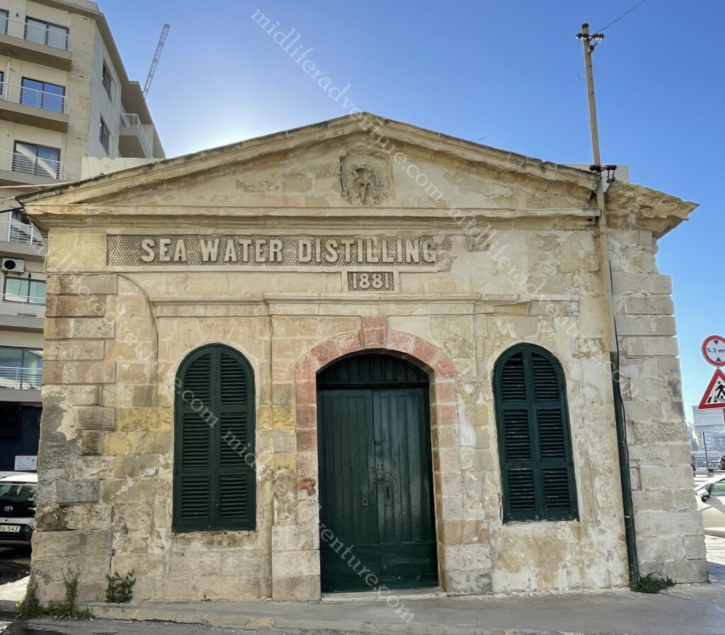
Almost right outside our hotel we came across the Sea Water Distilling Plant. As Malta is an island, access to potable water has always been a problem. This plant was constructed in Sliema in 1881 to provide drinking water for Tigné Barracks.
Today, the building houses a printing press.
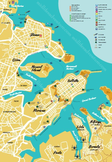
Day two saw us getting up early and hopping on the HOHO for the northern route. It took us past the harbour and marina, delivering views of Manaoel Island (one of the many fortifications) on the way until we got to the gates of Valetta. This was the identical route that we would take the next day but tomorrow we got off in Valletta.
Instead we stayed on and made our way through some very funky suburbs and on to the San Anton Palace and Gardens. From 1802 until 1964, San Anton Palace was the official residence of the British Governor and is now the residence of the Maltese President. From here it was on to see the Mosta Dome which is the third largest unsupported dome in the world. It has an outside diameter of 56.2 metres, an inside diameter of 39.6 metres and an internal height of 54.7metres. It became famous during WWII when a bomb pierced the dome, landed and slid across the church floor without exploding! The church was crowded when the bomb hit and all were spared.
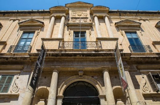
The next was the aviation museum and then a few stops were arts and crafts stops (glass factory, craft village etc.) But then the main attraction of the Northern Route, the town of Mdina. The city was founded as Maleth around the 8th century BC by Phoenician settlers. The history of Mdina traces back more than 4000 years. According to tradition it was here that in 60 A.D. that the Apostle St. Paul is said to have lived after being shipwrecked on the Islands.
The city was the capital of Malta throughout the Middle Ages, until the arrival of the 1530.
Directly outside the gates of Mdina is the town of Rabat, although it was once thought to be within the confines of the city. It is home to some impressive catacombs and archaeological remains not to mention some pretty incredible religious bling.
From here there are a few beach and ruin stops and we hopped off for lunch in Bugibba which is a lively seaside town with bars, restaurants, and hotels. Nothing particularly historic here but a lovely little spot. The next stop was the National Aquarium then another beachside town and it follows up with a scenic drive through a series of very pretty seaside bays on the way back.
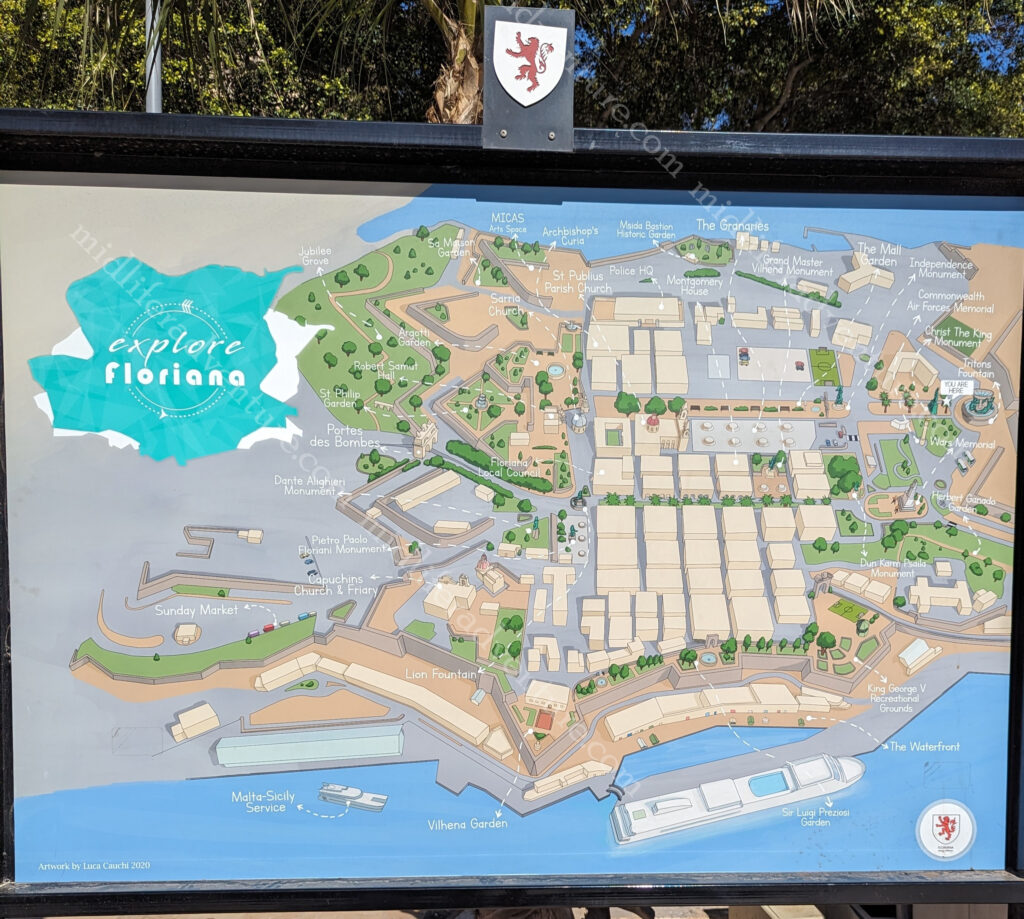
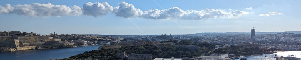
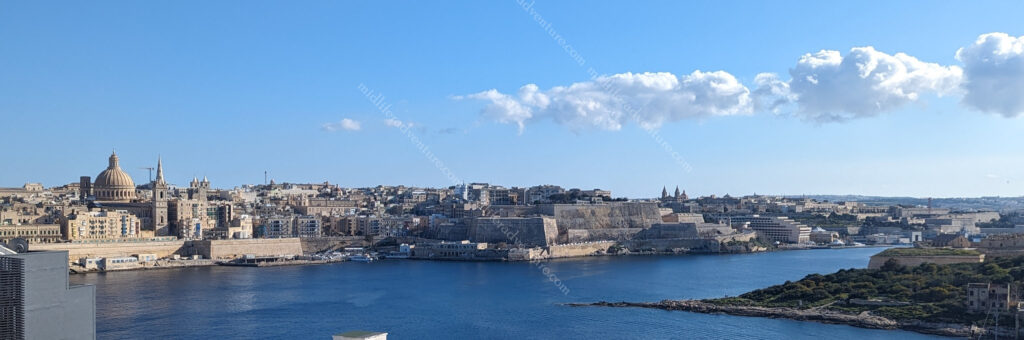
Day three saw us hopping on the HOHO for the southern route. The first stop was of course, the nation’s capital (Valetta), which is less than a square kilometre in size. It occupies the peninsula between Marsamxett Harbour (west) and the Grand Harbour (east) in a suburb known as Floriana. .
It is essentially just an old town CBD, perched on an isthmus. But there is so much in there. UNESCO has described Valetta as ‘one of the most concentrated historic areas in the world‘
When you hop off the bus you find yourself at the Independence monument opposite the Saint Publius Parish Church. The first stone was laid down in 1733 and construction was complete in 1768, when the relic of Saint Publius was brought to the church.
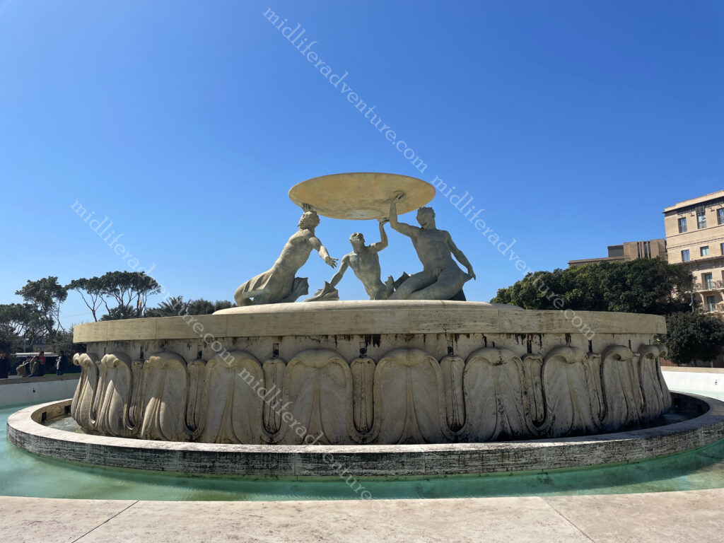
from here a very scenic walk begins towards and through the area that is Valetta. The first thing to signal your arrival is the Triton Fountain.
Triton Fountain consists of three bronze Tritons holding up a large basin. It was built out of concrete and was clad in travertine slabs.
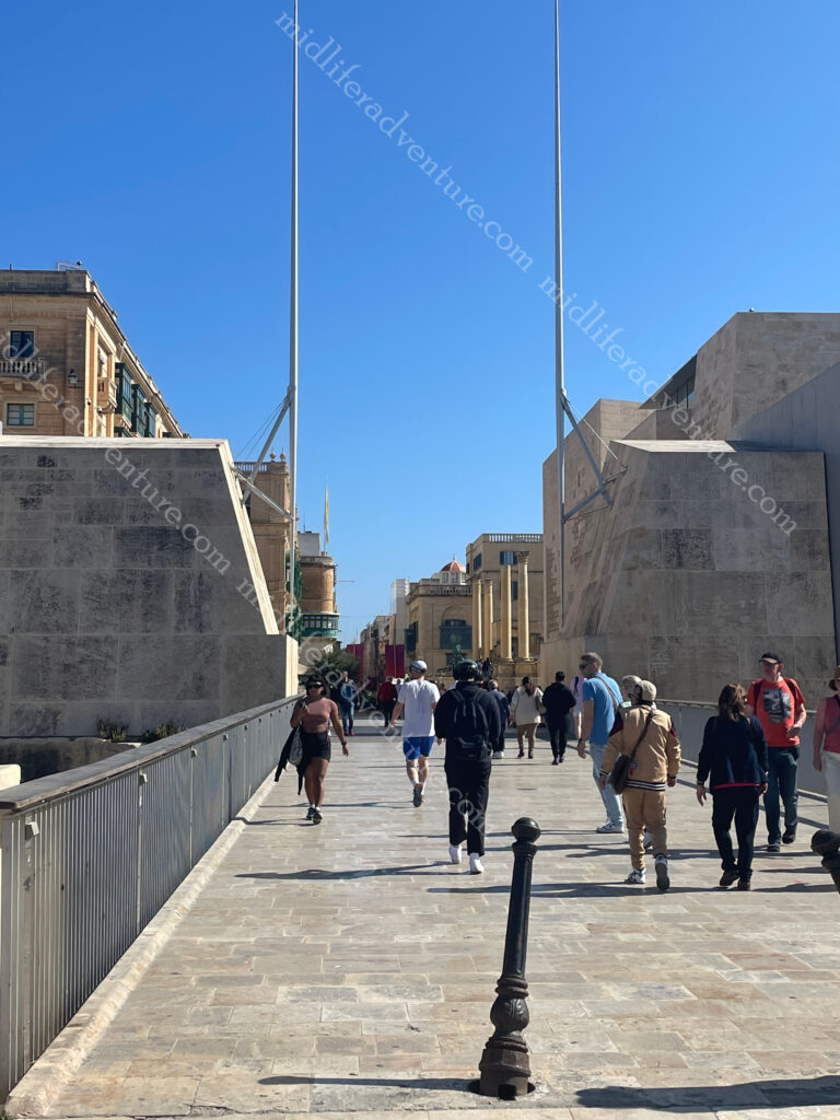
The City Gate was originally built by the Knights of Malta but was destroyed in WWII. It was replaced in the ’60s with a lavish version but people didn’t like it. So there is now a minimalistic bridge.
On either side of the gate is a pole symbolising swords, saluting everyone entering the city.
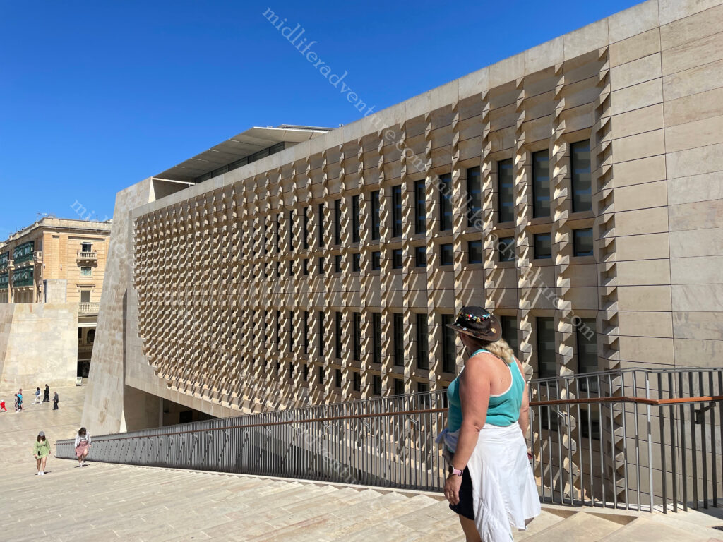
Through the gate on the right you will see the Parliament House of Malta. It was built between 2011 and 2015 on the site of the old railway station .
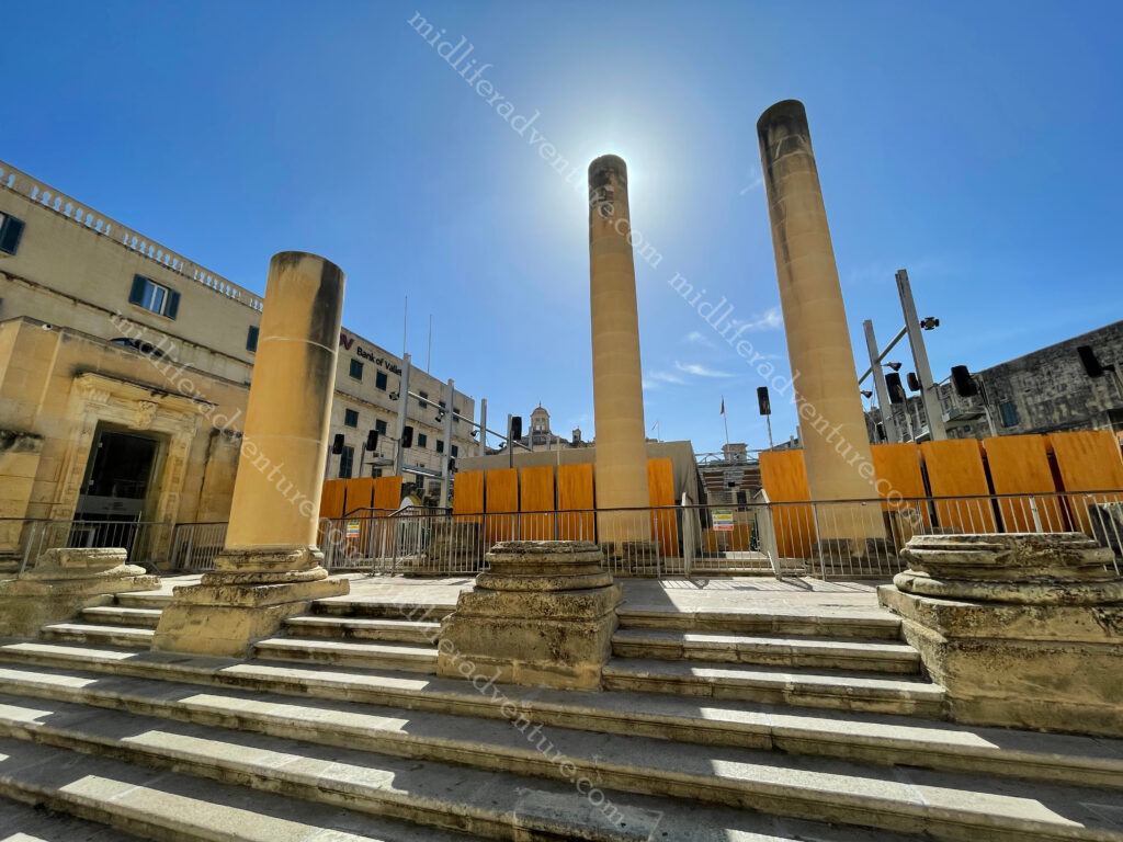
A bit further down and you run into the Opera House. The theatre received a direct hit from aerial bombing in 1942 during WWII.
Down one more block and you are at the National Museum of Archaeology.
One more block and you hit the Saint-John’s Cathedral Museum.
And now you find yourself in St Georges Square which is the central square that is surrounded by a whole heap of stuff. All of this up until this point and all you have had to do was walk in a straight line for 700 meters.
Not least of those to be found in the square is the Grandmaster’s Palace which was Parliament House until the opening of the new one.
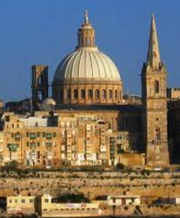
St Pauls Cathedral (Anglican) is the huge spire next to the dome that dominate the skyline of Valetta. Built in the 18th century it occupies prime location in Independence Square.
The dome is the Basilica of Our Lady of Mount Carmel (Roman Catholic). It was originally built in the 16th century but was destroyed in WWII.
Keep walking in a straight line and you hit the end of the isthmus and find yourself at St Elmo Fort. This area also includes a war memorial. A bit further along (coming back to the right) you find another war memorial with the Siege Bell. Then you end up hitting the Upper and Lower Barakka Gardens, these are in essence both more war memorials with plaques and statues celebrating those who paid great service to Malta over the centuries.
The Upper Barrakka Gardens are located on the top of the Valletta bastions, they offer stunning views of the Three Cities. They were built in the 16th century by the Knights of St John as a private gardens for the Grand Master and the Knights of St John.
Across the Grand Harbour from Valetta sits the Three Cities. Each of the cities have two names that are used interchangeably, the original Maltese name and the newer name given to them by the Knights of Malta.
Birgu – Vittoriosa
Isla – Senglea
Bormla – Conspicua
The first two occupy peninsulas jutting into the Grand Harbour while the third sits behind them (but also has a port area). There is another peninsula that doesn’t seem to make the grade in the cities debate (Kalkara) but it has two major defensive forts in place (Fort Ricasoli and Fort Rinella). In total there have been nine separate forts established just to defend the Grand Harbour.
Birgu (Vittoriosa) is the oldest and was built up by the Knights of Malta as their headquarters when they arrived on Malta in 1530. Senglea (Isla) gives more of a local experience with few formal sights, while Bormla (Conspicua) is set back behind these peninsulas. Also jutting into the harbour is the peninsula of Kalkara, which can be seen from across the marina.
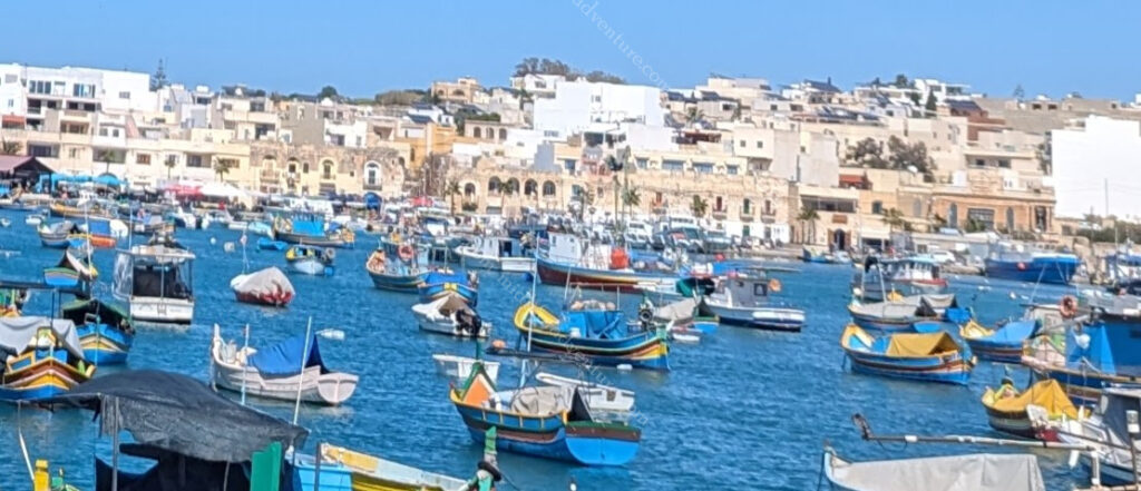
Back on the bus and there was a stop at the Marsaxlokk fishing village which would have been an awesome stop for lunch but we had spent too long exploring Valetta and were pushed for time now.
Next (major) stop was to the Blue Grotto which are a series of sea caverns on the south east coast of Malta. Set against a cliffy terrain near a local fishing harbour the blue grotto and neighboring caves offers spectacular views of rugged coastlines, sea caves opposite a small uninhabited islet (Filfla) which is a bird sanctuary.
Malta has often been called the ‘Fortress Island’ due to the great mass of military architecture that can be seen everywhere. This is a legacy of the islands’ history which saw them being fought over, time and again, due to their strategic location and deep, safe harbours.
So the best way to see these forts built to defend from attacks from the sea, is by boat. Which is exactly what we did. The fortifications that can be seen today come from two distinct periods: those of the Knights and those of the British era. Hopping on at Sliema (our home for the week) we took a 2 hour ride around the harbour takin in most of the 9 forts that were built to defend the harbours.
First on the list was Fort Manoel which sits on its own island between Valetta and Sliema and commands Marsamxett Harbour. The fort is built in the shape of a square, with a pentagonal bastion on each corner, giving it the shape of a star fort. It was built in the 18th century by the Order of Saint John and was named after their Grandmaster of that time. It sits between
The next in line is Valetta itself with Fort St Elmo guarding the approaches to both Grand and Marsamxett Harbours. We had seen it from the ground the previous day and now we got to see just how imposing it would have been to try and attack this place from the water. It was the scene of a heroic defence during the Great Siege of 1565.
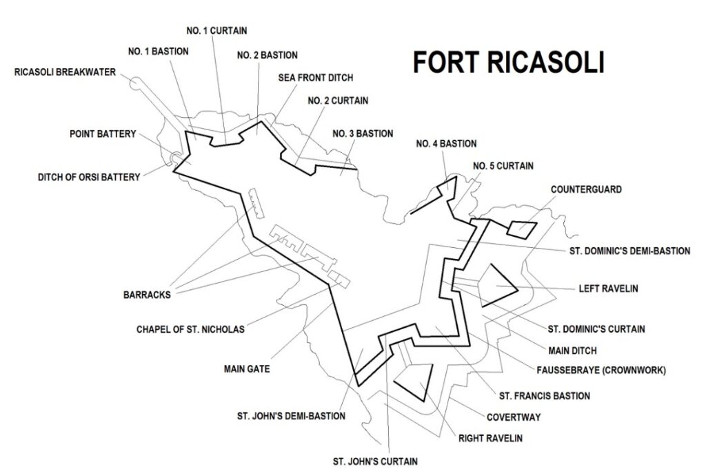
Fort Ricasoli is over 300 years old, being built by the Knights Hospitaller between 1670 and 1698. It is the largest fort in Europe . It was built to protect the Grand Harbour.
But today most of the fort is leased to the Malta Film Commission. As such it has been used extensively as a location for various films and serials.
In recent years, it has been used for the films Gladiator (2000) and Troy (2004) standing in for Rome and Troy respectively. The fort was also used in the filming of Assassin’s Creed (2016). In addition the TV miniseries Julius Caesar (2002) and Helen of Troy (2003) were partially filmed at the fort and in the first season Game of Thrones it was used as the Red Keep.
Fort St. Angelo is located at the centre of the Grand Harbour. It was originally built in the medieval period as a castle called the Castrum Maris.
It was rebuilt by the Order of Saint John as a fort and named Fort Saint Angelo between the 1530s and the 1560s.
Many believe it to be the jewel in the crown of The Maltese Islands’ military heritage.
The Ħal Saflieni Hypogeum is an underground complex of halls and burial chambers dating to around 4000 B.C. It was in use between 4000 BC and 1500 BC and covers an area of around 500 square metres. This one we didn’t get to as time just evaporated on us here in Malta with so much to see and do. Next time I guess.
Maltese food
I am sure that there is a bunch of traditional Maltese dishes that are floating around out there just waiting to be absorbed, but suffice to say that you are on an island close to Italy, Greece, Turkey and northern Africa. There is so much good food to be had here that you literally can not go wrong. We had plates and platters and pizza’s, soups and rolls. We had rabbit, pork, seafood and we had sweets and savouries.
And it was all fantastic, and reasonably priced.
When we were coming here we had little knowledge of what to expect and therefore our expectations were low. But this place has absolutely blown us away. An abundance of things to see and do, coupled with our ignorance of what we would find meant that we have seriously undercooked how much time we needed. We were here for 5 days, thinking that we could just kick back and relax (given that it was so small) but found ourselves at a full sprint almost the whole time and still missed out on seeing things.
I guess that is the beauty of travel, we will just have to come again and spend more time next time around.
Portugal is the westernmost country of continental Europe and includes the island groups of the Azores and Madeira (both autonomous regions in the north Atlantic Ocean.
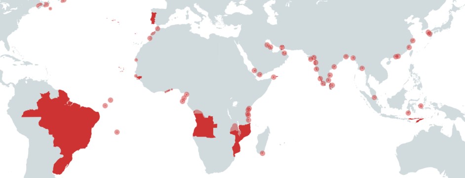
It has existed as a country since the 12th century (originally as a monarchy) but has evidence of civilisation dating back beyond 10,000BC. The nation was integral in the discovery and exploration of Africa and South America.
The Portuguese empire differed from the Spanish empire because the Spanish conquered large areas of land while the Portuguese preferred to control only major trading ports. Throughout the 15th century, Portuguese explorers sailed the coast of Africa, establishing trading posts for commodities, ranging from gold to slavery.
The Portuguese empire created colonies in Africa including Angola, Mozambique, Guinea. Added to this was the islands of the Azores, Madeira, Cape Verde Islands (off the coast of Mauritania-Senegal), and Sao Tome and Principe (islands in the Gulf of Guinea). Then there were the major ports of Cochin, Goa (in India), Colombo (Sri Lanka), Macao (China) and Nagasaki (Japan) in East Asia and of course Brazil.
Lisbon
OK, so we have been to Europe about 6+ times now and this was our first foray into Portugal. How stupid are we? This place is fantastic. We got off the plane and grabbed (a really cheap) Uber to our hotel. The driver was the nicest and most helpful person we had ever met, to the point where we both commented on it. Until the next day when we got our next Uber to the Monastery when the same thing happened, and then again on the way back.
These people are just super friendly and want to ensure that everyone who visits enjoys their time. Add to this that the pricing is more than reasonable for everything and the sights have a nice mix of natural beauty and old world charm how can you go wrong here.
We were not really blessed with the weather here, it rained for two and a half of our three days here. We got the odd glimpses of sunshine (particularly on day one) and in between there were some some pretty soggy days. Our day two was on and off sunny with the skies changing every 10 minutes or so until it finally settled in.
Our hotel was perched high on the hilltop in oldtown, which sadly had been built on the side of a damn mountain. As beautiful as the views were, it meant that everywhere we went was either up, or down, a ridiculously steep hill.
Finding your way around the old town could not be simpler, just follow the tram tracks. Be sure not to be run over by cars, trams, tuk tuks, bicycles, vans etc, that are all competing for the narrow road, but just follow along and you will pass pretty much everything that there is to see.
The tram goes past almost all of the tourist spots in the old town and centres around the main square, Praca do Comercio. This will include the churches, palace, castle, bars, cafes and restaurants. As long as you can see the tracks, you will see the bits.
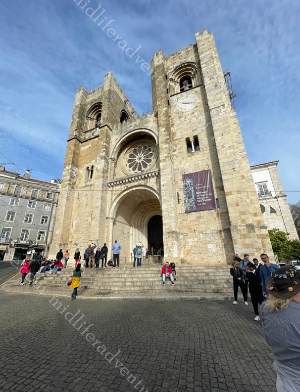
Jammed in the middle of the tracks you will find Sé de Lisbon. This cathedral started being built in 1147 and ended in the first decades of the 13th century.
The tram tracks quite literally split and run either side of the triangular street entrance.
Castelo de S. Jorge Stands on Lisbon’s highest hill and offers panoramic views of the city. The fort dates back to Moorish times (11th century), and has served as military barracks and royal chambers. Currently, it functions as a national monument, museum and archaeological site, with fantastic views and great gardens. And if this is off season, I hate to see the lines in peak times.
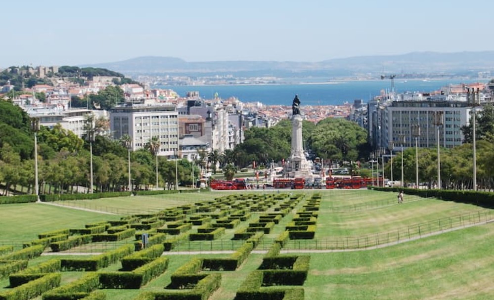
Lisbon’s central park is named Edward VII Park taking up 26 hectares in the middle of town. It was named as a tribute to the British Monarch.
Mosteiro dos Jeronimos (Jerónimos or Hieronymites Monastery) was originally donated to the Order of the Friars of St. Jerome. Construction began in near the launch point of Vasco da Gama’s first journey. Its construction lasted for a hundred years and was funded by a tax on the profits of the yearly Portuguese India Armadas. The day of our visit the weather kept coming and going, alternating between blue skies and torrential downpours.
To say this place is impressive is a massive understatement. Everywhere you look is a different aspect of the place and the intricately carved windows and openings act to frame the next amazing sight.
Portuguese Custard Tarts (Pasteis de nata)
Lets not be silly we have all eaten these. Whether it is the cheap boxed up ones in Costco, or the ones after a Chinese Yum Cha (bearing in mind that Shanghai was one of the Portuguese territories), or just from some dodgy bakery that does them. And they are always good, even the shitty ones are great, with their signature flaky crust and sweet custard filling they are world-famous, and incredibly delicious.
But now we are at their point of origin, and sadly, all others pale by comparison to the original version. It was created by monks at the Jerónimos Monastery and has certified origin. The original recipe is called Pastel de Belém and we found our way to Pasteis de Belem which is right next to the monastery and is recognised as their true home. And in case you were wondering, they were good.
Literally across the road from the Monastery is a park and the Discoveries Monument which serves as a monument to Portugal’s Age of Discovery on both land and sea.
The monument was reconstructed in 1960 to mark 500 years since the death of the Infante Dom Henrique (Henry the Navigator).
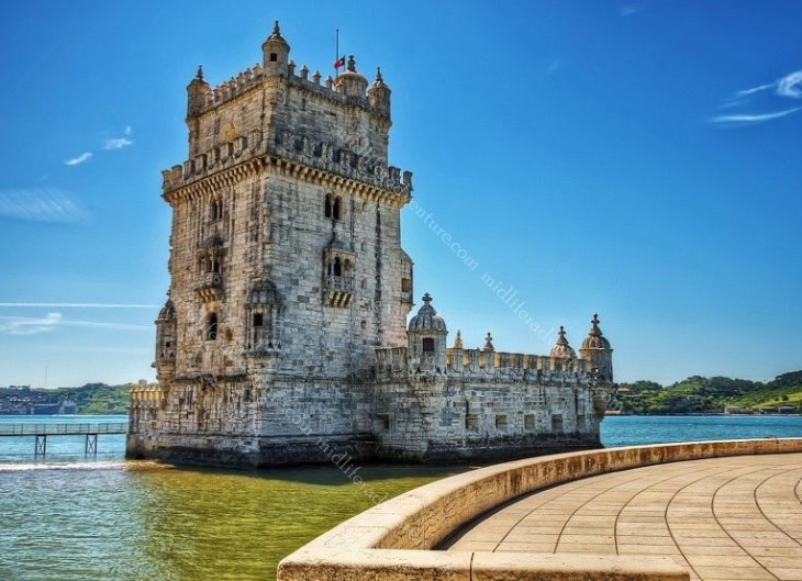
A few hundred meters down the bank of the Tagus River you find yourself at Torre de Belém. This is a 16th-century tower that is a mix between a medieval keep tower and a modern bastion. It was built to guard the river entrance into Lisbon’s harbour.
That evening we found our way down to Praca do Comercio which is one of the biggest squares in Europe, this stylish area in downtown Lisbon often displays beautiful works of art and sculpture and is a great place for a leisurely stroll.
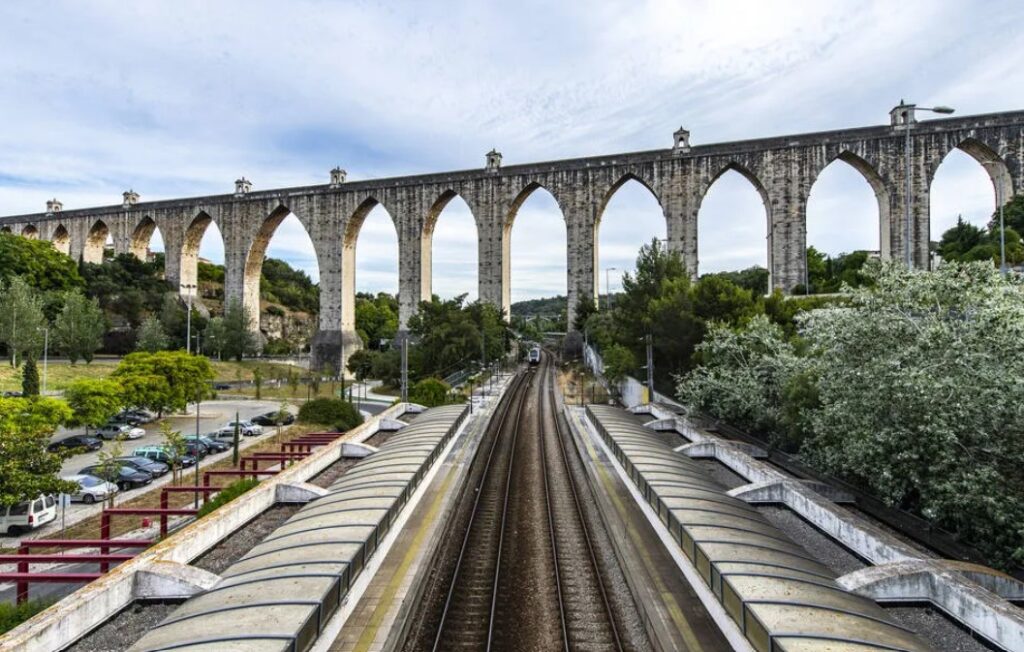
The Aqueduto das Águas was built in the 18th century to supply water to the town. Its construction was funded by special levies on meat, olive oil and wine. It stretches 14 kilometres and can now be visited as a tourist attraction.
The blurb for the Museu Nacional do Azulejo said that it was a must-see for people interested in the history and design of ceramic tiles. Now lets be serious here, that is not a title that I have particularly aspired to. But being in Lisbon, you do get a fair old appreciation of the ceramic tile as almost every building is finished (on the outside) with them. Looking at the photos of the museum, if it is your thing, then this specialty museum does house an impressive collection of decorative tiles dating from the 15th century to now.
The Coaches Museum is one of Lisbon’s most visited attractions, and is a collection of fairytale type carriages that have been used by the royalty and nobility of Europe over the centuries. While most European royal carriages were destroyed over time (especially in Paris after the French Revolution), in Portugal they were preserved. Most of them date to the 17th to 19th centuries, but the oldest example dates back to the late 1500s.
Brazilian BBQ – Portuguese Style
On our third Uber ride, our driver asked us if we liked seafood, which of course we do. He then went on to tell us that in Portugal, they do a similar thing to the Brazilian BBQ but instead of using meat, they do it with seafood. He told us the best place in town and the price came out to about 450 Aussie per head. Well if that is not a done deal then I don’t know what is.
So we headed down to the main square, took our happy snaps of the square and then headed to a little wine bar (as we were early for our reservation. A funky little place called shoes and booze. We had a drink and watched the waitress just dancing around having a great time enjoying her work. When we ordered the second round she asked Jill if she just wanted the bottle as it was 4.50 for a glass or 12 Euros for the whole bottle. The chat continued and we got invited to a private party back at the bar (with live music) the next evening.
Anyway back to the seafood, we made it to the restaurant and ordered the all-you-can-eat thing and it arrived with some interesting fare. The prawns, mussels, crabs and clams were all good and even the crab head mousse was good, but it was the whelks and barnacles that threw us a little. We had to seek guidance on just what part and how to eat the barnacles.
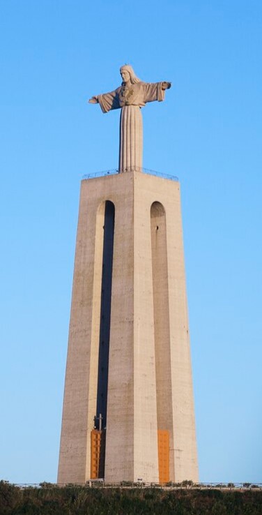
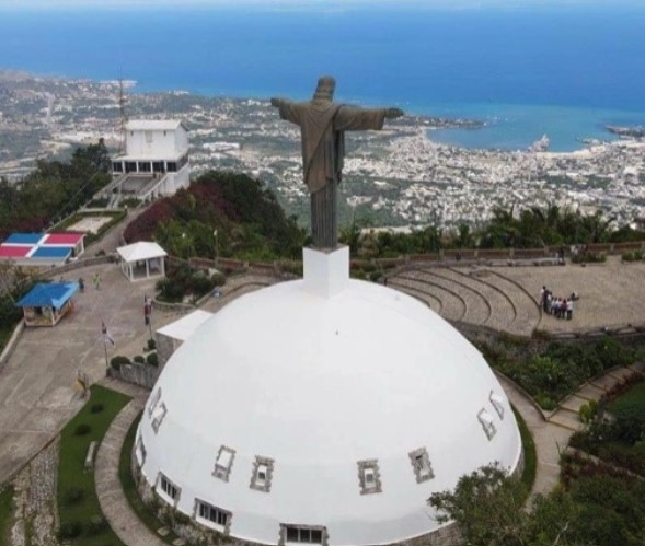
The construction of the Christ the King monument was approved on 20 April 1940, as a plea to God to release Portugal from entering WWII.
The monument consists of a 82 meter pedestal with a 28 meter image of Christ.
Perched on the opposite side of the river the figure of Christ has its arms extended out facing the city of Lisbon, as if to embrace the city.
Long story short, apart from the weather, Lisbon was fantastic and we will need to come back as there is so much more to explore and do. It became very clear that the time that we had allotted was insufficient for the amount to see and do. This was further hampered by the rain that kept us hiding more than exploring.
The prices are more than reasonable and the friendliness of the people was just amazing. And I think that both Jill and I can fit another egg tart or two in, and for the record, even the shitty ones remain good. And there is so much more that missed out on seeing.
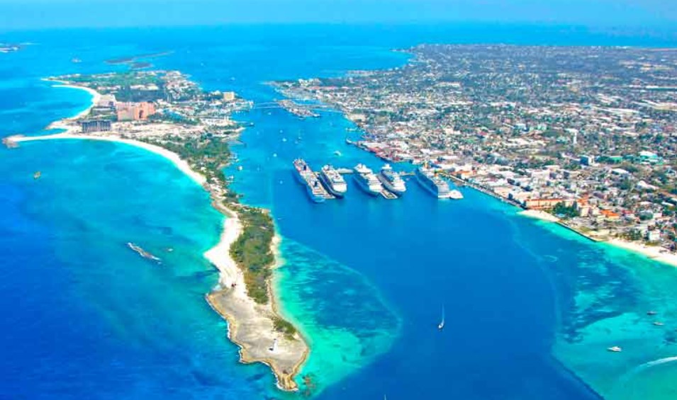
The Bahamas are a chain of more than 3000 islands, cays and islets in the Atlantic Ocean. They are part of the West Indies and sit just north of Cuba.
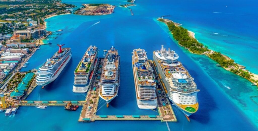
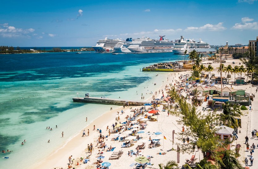
The Bahamas boasts some of the Caribbean’s most beautiful, clear blue water, white and pink sand beaches, warm temperatures and attractions galore. For these reasons, the Bahamas is one of the industry’s leading cruise port destinations, with the capital city of Nassau being one of the world’s busiest ports of call.
According to the Bahamas Ministry of Tourism, in 2024, the Bahamas is expected to host 5.6 million cruise passengers. This figure exceeds the 5.4 million the port hosted in prepandemic 2019. Nassau’s cruise port capacity increased from 20,000 passengers per day to more than 30,000 in May 2023, thanks to a $300 million renovation. The project expanded and revitalized the Prince George Wharf port and added a new berth, allowing it to accommodate six ships per day.
Nassau
Our first foray into the Bahamas was part of our 50th cruise with Jimmy and Claudia, where we set down in the capital Nassau on the island of New Providence. We were just one of several cruise ships to arrive on that day.
Nassau’s history is closely tied to the Caribbean pirate era of the 17th and 18th centuries. The town served as a pirate sanctuary until 1718 when British Governor (Woodes Rogers) expelled the buccaneers. Today, the downtown district offers 20 square blocks featuring architecture and monuments dating to this era, most within walking distance of the cruise pier.
The islands of the Bahamas were mostly deserted between 1513 and 1648 after almost all of the native residents were forcibly removed and enslaved or died from diseases brought from Europe. In 1649, English colonists arrived establishing settlements.
During the day, Nassau is incredibly safe with thousands of tourists, high police presence and hundreds of tour operators. You are safe to walk about uninterrupted and (apart from a few overzealous touts) unmolested. Sadly this situation does not continue once the sun goes down. Gang-on-gang violence has resulted in a high homicide rate primarily amongst the local population. But violent crime (burglaries, armed robberies, and sexual assaults), occurs in both tourist and non-tourist areas.
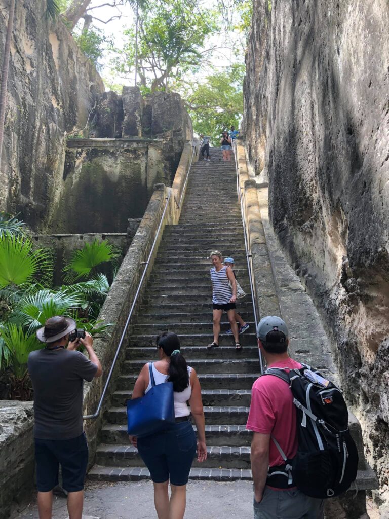
We hit the streets, chased the tourist things, climbed the Queens Staircase up to the fort and then wandered along to the other fort. We even had time to stop and sample some of the local brews.
The Queen’s Staircase, commonly referred to as the 66 steps, is a major landmark that is located in the Fort Fincastle Historic Complex in Nassau.
It was carved out of solid limestone rock by slaves between 1793 and 1794
Fort Fincastle was built in around 1793 and was constructed of cut limestone.
It was placed on Bennet’s Hill to protect the Nassau town and its harbour from pirates.
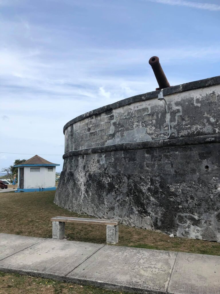
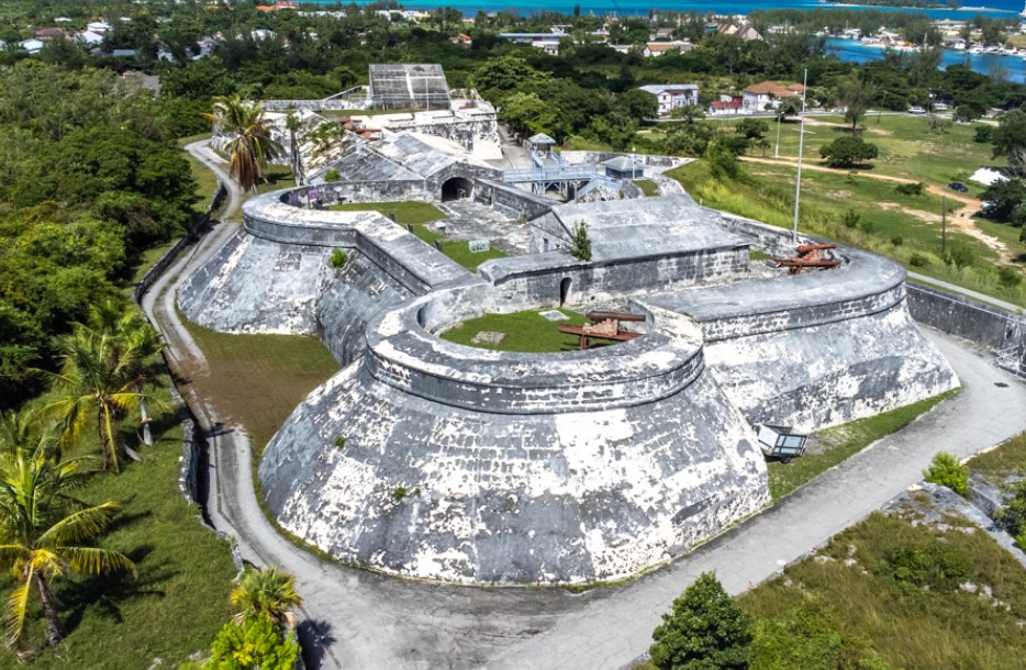
Fort Charlotte is the largest battlement at 100 acres in size. It is so large that within the grounds are three different forts: Fort Charlottein the east, Fort D’Arcy in the west, and Fort Stanley in the center. These massive stone structures feature cannons, moats, bridges, and other elements that make them fascinating to explore.
Fort Charlotte, It sits on a hill overlooking the west end of the harbour a mile west of downtown Nassau. From the fort you get an impressive view of Paradise Island, Nassau, and the harbour.
Fort Charlotte was built in 1788 and was named after the wife of King George III, Queen Saharia Charlotte. The middle bastion, Ft. Stanley and the western portion, Fort D’Arcy were added later. The fort has a moat, dungeons, underground passageways, and 42 cannons, which have never been fired in an act of aggression.
Nassau Mark II
Being a go-to port for the Caribbean, Nassau pops up frequently on many of the itineraries. Once you have done the big blitz (like we did on the first foray) there really isn’t much left to see or do in the main arrival part of town.
That said, beach lovers and travellers who enjoy water sports, diving or snorkelling will find any number of excursions and activities to suit their tastes. These tours can include glass-bottom and jet boat excursions, catamaran sailings, reef snorkelling, deep-sea fishing, scuba diving, encounters with sea lions, dolphins, stingrays and even swimming pigs. And of course, exclusive beach days with private cabanas.
Our second foray saw us arriving after the (Prince George Wharf) port redevelopment. $300 million had been invested into 11 acres of waterfront land reimagining the waterfront. This meant that the once dingy port had been significantly upgraded.
Guests to the new port are now welcomed by a modern arrivals plaza, theatre, entertainment venues, a museum, art gallery and new green spaces. Importantly there is an organised ground transportation area, and state-of-the-art security. Oh and don’t forget the retail, food and beverage outlets.
Junkanoo Beach is the closest walk (about a 15-minutes) from the cruise port and
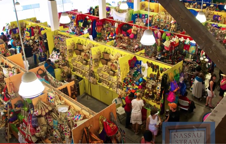
The Nassau Straw Market was once an authentic market selling plaited, braided, and woven items synonymous with the subsistence lifestyle. Now it is a tourist trap selling straw craft souvenirs(hats, bags, mats, dolls etc) along with conch shell jewellery, and wood carvings.
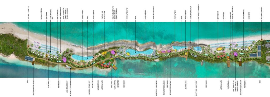
Coco Cay
This time around we found ourselves being delivered at a place called Coco Cay. It is an entirely manufactured island that is owned and operated by the Royal Caribbean company solely for the use of their ships. It is advertised as Perfect Day at Coco Cay, and surprise surprise, that is the first thing that you see.
Looking back from the pier we saw our ship next to one of the newest and biggest ships of the Royal Caribbean fleet. The difference was incredible, especially when you think that our (little) one is 13 floors high. But the new one is about twice the width too.
From here you enter into the world of waterparks, theme parks, shopping and beach walks where the tourist is king. Everything on the island has been put there to amuse, entertain or fleece the clientele from a cruise ship.
Being a company island, the food and drinks kick in on the company coin. So unless you are after something extra, everything else is free. There are some individual, over the water, cabanas for rent at a price of around $2000 USD per day. But a beach chair ranged from free to $20 depending on where it was. The trinket shops were extra but the food and drink (mostly) went on your cruise card.
The calm side of the island had a kid’s paddle beach sheltered on all sides. In the centre lives the largest pool in the Caribbean. This has the obligatory swim up bar and places to sit. But the private DJ playing tunes was the bit that did us in. Our beach time is preferred quiet and not with somebody else’s choice of music doing our heads in.
Coco Cay was a nice touch and a very clever commercial decision by the company. They have found a way to build a whole tourism network that purely feeds funds into the corporate machine. They feed the machine with at least one cruise ship arriving every day and more often than not two.
Not something that you would want every day, but as a change it was quite nice.
Royal Beach Club Paradise Island
Cleverly, our most recent foray into Nassau revealed that the company (Royal Caribbean) had also bought the (17 acres) strip of land (on Paradise Island) opposite the port.
The intent is to develop the ultimate beach day – The Royal Beach Club Paradise Island. Like Coco Cay, the area will offer private beaches taking in the turquoise-blue waters and white sand beaches, cabanas, pools, activities, live music, and local artisans.
Martinique is an overseas territorial island of France. It is part of the Lesser Antilles and is 35km from Dominica, 26km to Saint Lucia and about 75km to Guadeloupe.
Martinique is about 80 km long and 35 km at the widest part. This makes it one of the smallest of the French overseas territories, but it has one of the highest population densities. The climate is remarkably constant with the average temperature being about 26° with minimums of 20–22 and maximums up to 34 °.
According to the blurb the original population disappeared after Europeans arrived, as a result of either disease or being wiped out by the invading French. In 1658 there were 5000 French settlers on the island. From here a lot of slaves were brought from Africa which added a new ethnic component. Today people of mixed European and African ancestry account for more than 90% of the population.
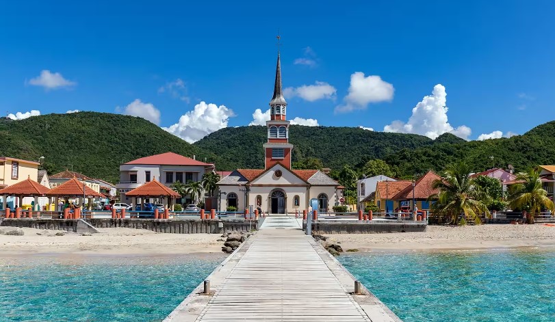
Fort-de-France
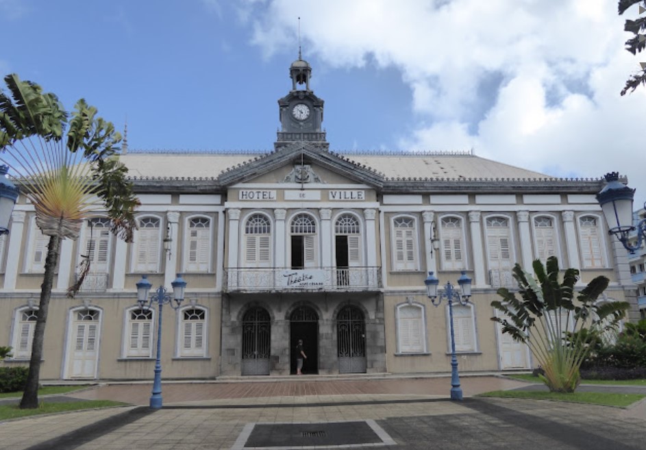
Fort de France is the main city of the overseas territory and was our landing point on the island. Interestingly as Martinique is only a territory, it does not officially have a capital. While the city lacks the palm trees and beaches of the rest of the island it does have the restaurants, shops, bars, and places showcasing the island’s history. Many of these venues sit in colonial-era buildings.
Fort Saint Louis was built to protect the city against enemy attacks. The fort was soon destroyed, and rebuilt in 1669 under Louis XIV as Fort Royal. It changed to Fort-de-France sometime in the 19th century and is the enduring name of the fort and the surrounding town.
St. Louis Cathedral is the main church in town and is probably the highlight of a town with not that much going for it.
Old town hall is one of the more impressive buildings in a town that is broadly underwhelming.
The covered market was the next on the trek through town. It provided the mix between a normal fruit and veggie market, some trinkets and souvenirs and some traditional food stalls. But in essence, it was a tin shed with some veggies in it. I don’t mean to sound down on Martinique, there really was nothing wrong with it at all. The people were friendly, the prices were good, there just was not too much to see or do.
Jardin de Balata is the local botanic gardens that is a short cab ride from town, if you are of a mind to do the hike be warned it is a fair walk and it is all uphill.
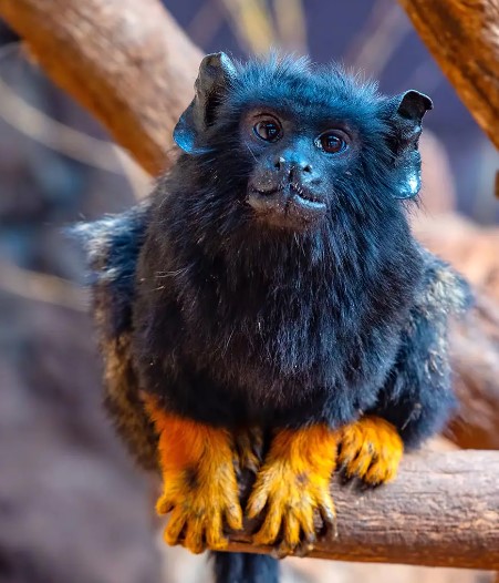
There is a zoo here, we didn’t go to it, but the promo picture shows this little critter. I have no idea what it is, but it looks pretty interesting.
Anyway, that is something else you could have done.
If you had more time in Martinique the recommendations are to stop and visit some of the smaller towns. The top on this list is Les Anses d’Arlet. The area is mostly jungle-covered mountains but there are also 3 coves for the nature lovers.
Other towns suggested were Big Cove (Grande Anse) and Arlet Cove (Anses d’Arlet) in both have restaurants and accommodation right on the sandy beach while Small Cove (Petite Anse) has a rocky shoreline.
Puerto Rico, despite being well and truly its own entity, sadly only counts as a territory of the United States and does not add to my country tally.
Although Puerto Rico is an American territory, it competes as its own individual country in both the Miss Universe contests and in the Olympics. Yet another reason I think that it should count.
But wow. If this little dip of the toe into the water of visiting Puerto Rico is any sort of glimpse, the place is amazing. It is the smallest island of the Greater Antilles in the Caribbean and sits a bit east of the Dominican Republic. The temperature permanently sits in the 20’s and 30’s all year round. There are around 3.2 million people in Puerto Rico, and close to 5 million Puerto Ricans living in the U.S.
The Island has almost 300 miles of coastline and nearly the same number of beaches. And being ostensibly American, it has the largest shopping centre in the Caribbean.
San Juan
Our entrance to Puerto Rico was on a cruise ship (along with 2 others on the same day) which saw us coming into the port of San Juan. A really lovely (not so) little town that saw us cranking up the step count for the day considerably.
A predominately walled city there is a huge level of fortification (especially to the sea) with all of the gates and things that you would expect from such a town.
Castillo San Felipe del Morro is better known locally as El Morro. It is one of the largest fortifications built by the Spaniards in the Caribbean during the 16th century. It is made up by six staggered levels that integrate barracks, dungeons, and storerooms. It was designed to protect the city and still has some of the original cannons facing the ocean. According to the blurb in its history, El Morro was never defeated by the enemy.
The fort is massive and is set far out on the point with large green areas surrounding it. It was originally designed to protect the city from attacks from the sea.
Castillo San Cristóbal is the other fort that stands and was meant to defend from enemies approaching by land. Covering over 27 acres, this fortification is the largest one made by the Spaniards in the New World. This castle holds the famous Garita del Diablo, center to many military tales and stories in the Island.
The Capilla del Cristo is a small sanctuary at the top of the walls of the city. Legend has it that two men were racing their horses down the street and one of them fell over the cliff and survived. This inspired the construction of a sanctuary dedicated to the saints of health. Its altar is made of embossed silver and the room is decorated with two José Campeche paintings.
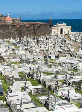
Between the two forts, you can see the Santa María Magdalena de Pazzis Cemetery. This was established in the 19th century and was built outside the city walls because of their strong fear of the afterlife. Its oceanfront location derives from a superstitious belief that the deceased started a journey over to “the great beyond” and being close to the sea symbolised the beginning of eternity.
This cemetery is the final resting place of Puerto Rico’s most prominent natives and residents. A nice touch that we found was some mosaics of each town that have been laid into the footpaths along the way.
As usual, the Cathedral de San Juan takes up a prominent place in the heart of town. This one is an example of medieval architecture during the time when the Spanish ruled the New World. The Cathedral de San Juan is the second oldest church in the Americas, after the one built in the Dominican Republic.
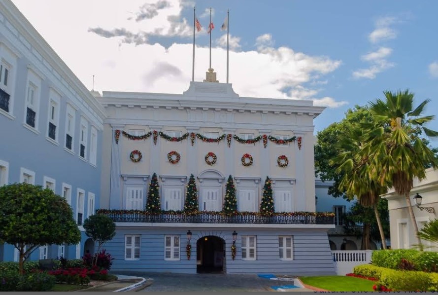
La Fortaleza (officially El Palacio de Santa Catalina de Alejandría) is the oldest state residence of the New World still in use.
It was originally built in the mid 1500’s and has served as a fortress, a prison, and an arsenal, and is now the official residence of the Governor of Puerto Rico. This executive palace conserves traditions (such as candlelit-only dining rooms) and has original Spanish objects from the colonial era.
Calle Fortaleza (more commonly known as Umbrella Street) extends from the Governors mansion and is Instagrammers heaven. When we arrived there were hordes of them striking all the poses under the sun (never looking at the camera).
The surrounding streets are full of the funkiest restaurants in town.
When chatting with our local barman on the boat we were told that San Juan was the original birthplace of the Piña Colada. Being the butch and manly type that I am, I am partial to a Piña Colada. To find its origin we had to hunt down the restaurant called Barrachina. Which we did, only to find that 2023 was the 60th anniversary of its invention.
Casa Blanca is the oldest residence in Old San Juan. It was once the home of the first governor and has since been converted into a museum.
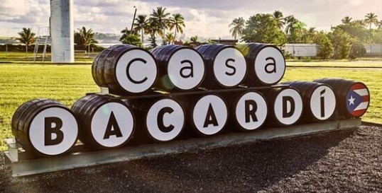
In Cataño, Puerto Rico, you will find the the largest premium rum distillery (Bacardi) in the world.
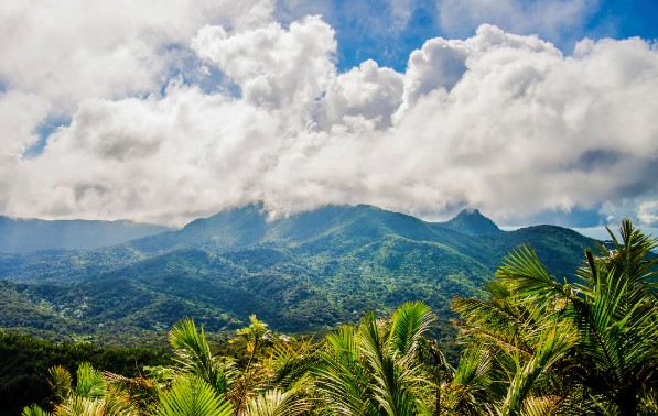
Puerto Rico is also home to the only rainforest in the American National park system (El Yunque).
If friendliness counts for anything, then this place is amazing. The smiles and happiness that you are greeted with here is something to behold. I am very happy to come back here again and explore more of the isalnd.
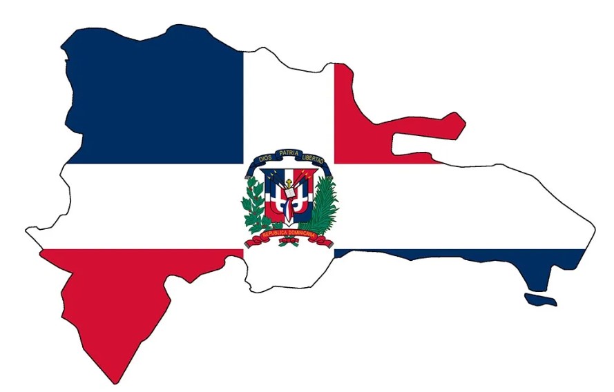
The Dominican Republic shares the island of Hispaniola with Haiti. It is the second largest (after Cuba) country in the Caribbean) and third largest in population.
The capital (Santo Domingo) was the first permanent European settlement in the Americas and was the home of Spanish rule in the New World. After more than three hundred years the Dominican people declared independence in November 1821.
Puerto Plata
Puerto Plata is the birthplace of tourism in the Dominican Republic and is as fake as all get out. But in a really good way. When you get off the boat you are immediately thrown into a development known as Taino Bay. This is an entirely manufactured waterfront that houses every type of tourist attraction that you would want from a tropical island.
For about a 3 square kilometre area you are in a tourist wonderland of beaches, pools, shops, bars, restaurants and attractions. If you didn’t choose to keep going, it would be entirely possible to miss the actual town and community completely. But if you did, you would have still had a great day lazing by the beach and soaking up those Caribbean vibes.
But of course, we kept going. past the tourist mess (as lovely as it was) and got into the actual township of Puerto Plata, more specifically the old colonial-era centre. Here we wandered through the old colonial (Victorian) era buildings and just soaked up the town. And of course, found the umbrella-donned street known as Calle de Las Sombrillas.
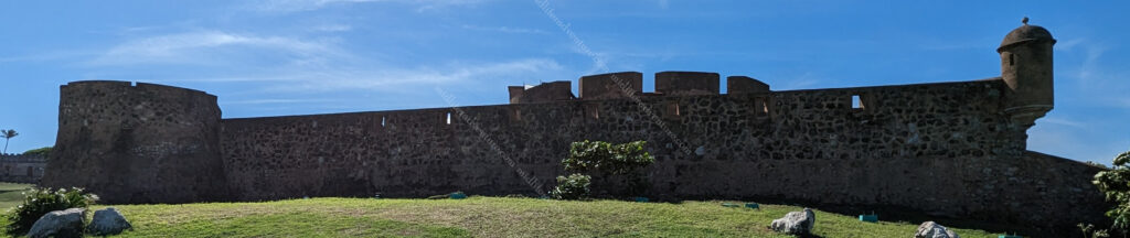
As you keep wandering you come across one of the first colonial-period fortresses – the Fortaleza San Felipe. This historic military fort dates back to 1577 and was built to protect the coast from the Dutch, French, and British. In the 19th century, it served as a prison. Today it is a museum.
As is Jill’s thing, she did the street art photography blitz that she normally does when she finds it. It really is a nice way of discouraging graffiti, encouraging the arts, and brightening up otherwise boring walls throughout the city.
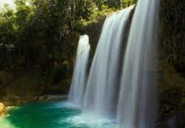
The 27 Waterfalls of Damajagua is a tourist attraction that is really only 12 waterfalls and some rock pools. But if you want to hike and swim, then this might be for you.
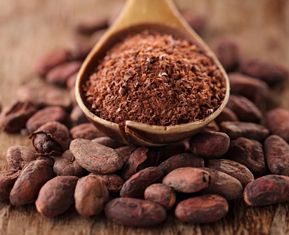
The Dominican Republic has a history of cacao production with about 150,000 hectares and 40,000 farms producing it. I was totally oblivious to this until I kept running across all of these artisanal chocolate shops trying to sell me their wares.
On further examination, it has been turned into both a crop for export and a tourism seller with various tours and cocoa camps. In the town of Altamira near Puerto Plata is the Chocolala, a cacao farm run entirely by women. There is also a place called Chocolate Mountain, a farm and camping site! Both obviously offer tours and products for purchase.
The mountain of Pico Isabel de Torres sits overlooking the town of Puerto Plata. The summit is 793 meters high and offers a spectacular view of the city. Importantly, there is a cable car that will take you to the top for $10. Once up the top there is also a botanic garden.
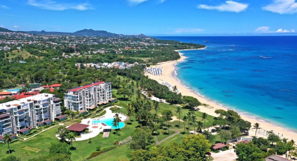
Playa Dorada is a few kilometres outside the city centre and is the first of the resort-style developments that found its way to the Dominican Republic. It is exactly what you imagine it to be.
The island is spectacular with sprawling landscapes, the sea, mountains, valleys, rivers, and a multitude of beaches. Our dip the toe in the water was just a teaser suggesting that we probably need to come back here and explore it a bit more fully.
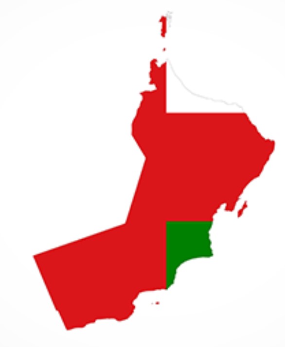
Oman (officially the Sultanate of Oman) sits at the mouth of the Persian Gulf. It shares land borders with Saudi Arabia and the UAE (west) and Yemen (southwest), while sharing maritime borders with Iran and Pakistan.
It has a population of a bit under 5.5 million.
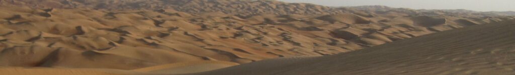
The Rub’ al Khali or the Empty Quarter is the desert portion of Oman but also encompasses parts of the UAE, Yemen and Saudi Arabia. It is 1,000 kilometres long, and 500 kilometres wide and has sand dunes with heights of up to 250 metres
Our early research had us a little more excited about Oman as at first glance there seemed to be plenty to see and do. We were a little terrified coming into it as our Aussie dollar exchange rate came in at 25 cents. This meant that one of their real was worth $4 for us. Jill put us right in the heart of tourist land.
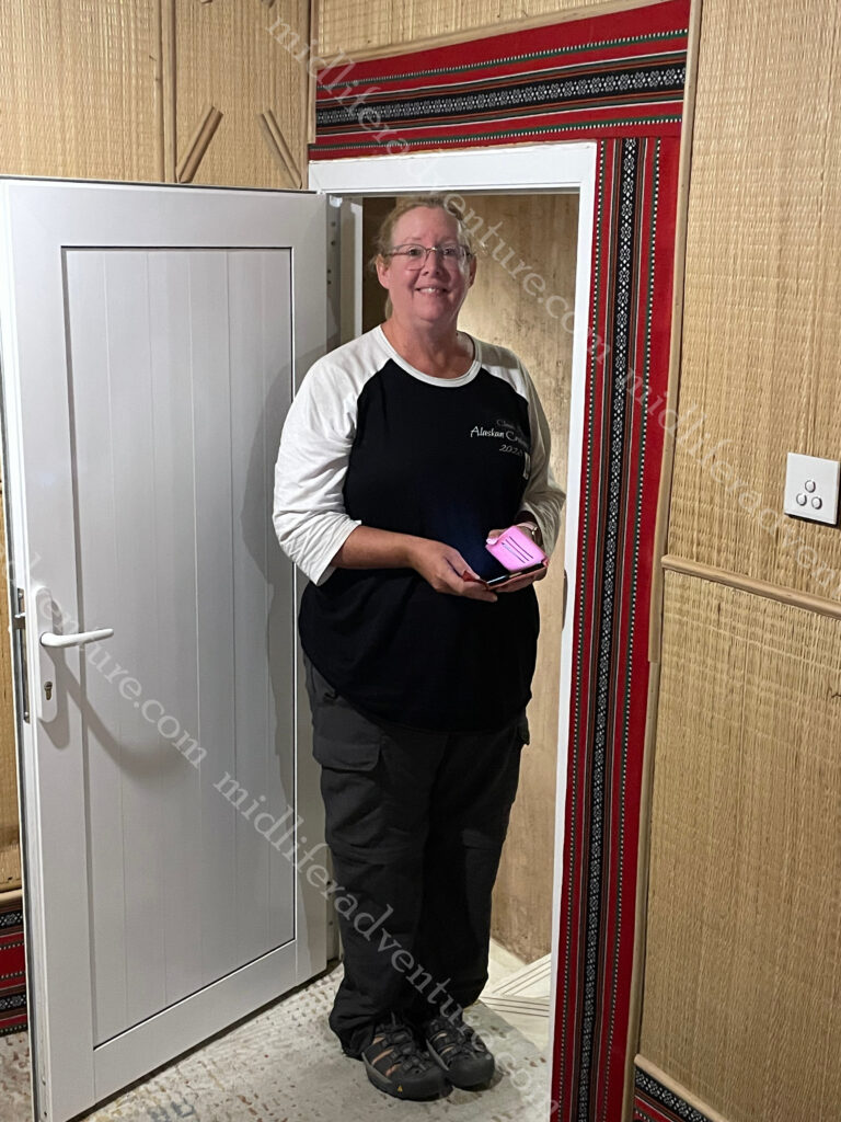
Our hotel room was not a shadow on our one from Abu Dhabi. It was the width of a bed and this was the door.
As I am a touch taller than Jill, I sconned myself on this door (and others around the hotel) on several occasions.
One of these has given me a gash to the head, concussion and likely brain damage.
The seaside area of Mutrah was to be our home for the next few days. Sadly the room paled in comparison with the luxury that we had in Abu Dhabi but the location was fantastic. Looking straight out of our window we had direct views of (and about a 300 m walk to) the Mutrah Fort.
At the bottom of our hill (250m), we were on the Mutrah Corniche. This is a 3km long promenade along the waterfront, which of course is lined with cafes, restaurants, and markets. You have views of the Oman Port and harbour (including the Sultans Yacht) and the Hajar Mountains with its Portuguese watchtowers on the other side.
Our first task was getting up at 6 am and walking along the Corniche to the fish market and dhow harbour before breakfast. Even the dodgy, smelly fish market was impressive. Stainless steel troughs. mosaic tiled walls and of course the freshest of fish that you could find.
As finding food in the Middle East had proven a touch challenging at times we have taken to getting breakfast included in our hotel. And so far, Oman is winning.
After our breakfast, we climbed the hill, paid our admission and hit the fort. Now this was a first. There was nobody there. We had the entire fort to ourselves for about 30 minutes. We roamed and explored and took our photographs with absolutely nobody else to contend with. When we were finished and were walking out the door, we passed the baton to two German guys who then also had it to themselves. Hitting the bottom though a group of about 10 arrived, so their solitude would have been short lived.
Having finished at the fort we hopped the local bus for a 4-5km ride to the National Museum of Oman.
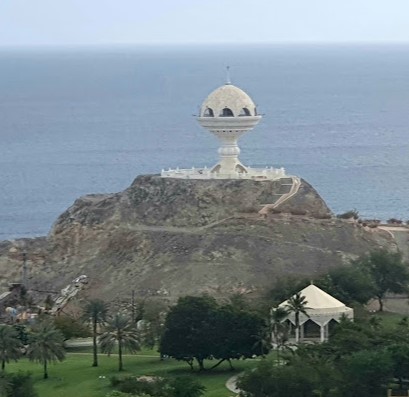
Along the way you see a bizarre space ship looking thing on the right.
Apparently to celebrate the 20th National Day of Oman in 1990 this monumental incense burner was built on top of a prominent hill at Riyam Park.
Getting off the bus was a bit of a catch all as within a short walk of where the bus drops you off, you have the Museum, the Al Alam Palace (the official palace of the sultan), two Portuguese forts of Al Jalali and Al Mirani and some major government buildings.
But the Museum was first.
The palace was the next obvious place to head as it was only a few hundred meters away in a straight line. But it was also in full sun with no shade and no respite.
The next was the forts, which were basically each side of the palace. Unlike the Mutrah Fort, these were unable to be entered and climbed upon. But they were kind of big enough and obvious enough to get some nice photos.
At this point we had melted. While the actual temperature of Oman is lower than places like Saudi Arabi, the humidity raises the “feels like” factor considerably. While walking around at 1:30 in the afternoon we got our own personal record when we hit the “feels like” temperature of 52 degrees centigrade. We were cooked.
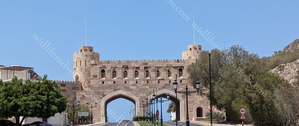
The last stop before running away to hide from the heat was the Muscat Gate Museum.
Having got our gate photos we grabbed drinks (melting) and were waiting the 5 minutes for the bus to arrive. At this point a taxi pulled up and beeped (a common thing-touting for business). But this guy already had a customer. He was already being paid and was going past the Souk (our get off point) and took us for free – just to save us waiting in the sun. Now that was a first.
So after hiding through the afternoon (after showers and attempts to wash the sweat from clothing) we waited for early evening and made our way down the hill to the Mutrah Souk. This is one of the oldest markets in Oman and was right on our doorstep. We had briefly wandered through during the afternoon but it is the evening when the Souk really takes off.
The next day, another amazing breakfast and on a bus back towards town to see the things we had passed on our way in. Stop number one, the Sultan Qaboos Grand Mosque. It was officially opened in 2001 and has become Oman’s most important spiritual site. It was closed on the Sunday that we tried to visit. While we did not get to enter the mosque we still had access to wander the grounds outside and get some happy snaps. The mosque was built to hold 20,000 worshippers and is home to the world’s biggest 1-piece handmade Iranian carpet and the second-largest chandelier in the world.
Directly opposite the grand mosque is the Omani Parliament building. It was built in 2013 and sits on more than 100,000 square metres. It has more than 5 km of facade and the centrepiece is a 64 m clock tower (the highest in Oman) with each of the clocks having a 4.8 metre diameter. The building is known locally as the Majlis Oman.
According to the blurb the Parliament building has been equipped with a range of well-paced spotlights, with modern LED technology and underground lighting fixtures. This means that at night the whole 38-metre high wall is illuminated with a controlled washing effect over almost all of the surface.
The Royal Opera House area which is an event in itself. The building is imposing and our first glimpse of it was in the taxi on the way in (mosque and parliament too), which prompted us to get back here a few days later. It isn’t just the opera house but more of an entire precinct for the arts and cultural pursuits. It is regularly used and has the capacity for 1,000-seat concert and opera theatre. But with 15,000+ square metres, over six levels with three basement floors, it can easily change its configuration to cater to most events.
So Oman is our favourite so far. It is authentic. It has actively resisted the current trend (looking at you UAE) of advancement at all costs and has maintained those things that make it special. There are tons of forts all over the country and deserts and oases worthy of exploring.
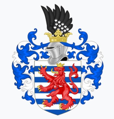
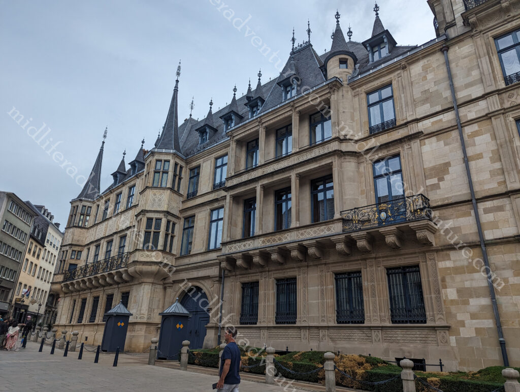
Luxembourg, officially the Grand Duchy of Luxembourg, is a tiny landlocked country of around 2500 square km and a population of under 650,000.
This makes it both one of the smallest and least populated countries in Europe.
It borders Belgium (west and north), Germany (east) and France (south).
Luxembourg’s recorded history dates back to Roman times but the modern day version is considered to begin in 963. The House of Luxembourg was a royal family that ruled in and around the region for centuries.
There is evidence of primitive inhabitants dating back to the Paleolithic or Old Stone Age over 35,000 years ago. The first real evidence of civilisation is from the Neolithic or 5th millennium BC, from which evidence of houses has been found.
Originally, the City of Luxembourg was originally built in the mid 10th century as a small fort (the castle). It was built on a steep rocky outcrop at the junction of the Alzette and Pétrusse Rivers. Due to it’s strategic position it has been occupied and controlled by the Italian, Spanish, Belgian, French, Austrian, Dutch and Prussian. With each iteration and rule various engineers contributed to the fortifications stronghold. The fortress was so strong that at one point it earned the title of “Gibraltar of the North.”
Luxembourg was one of Europe’s greatest fortified sites between the 16th century until 1867, when its walls were dismantled. The fortifications and the old town have been classified as world heritage sites by UNESCO since 1994.
The Grand Duchy of Luxembourg became a founding member of the United Nations in 1945 and in 1949 it also became a founding member of NATO.
This is a catch up as I published this one out of order, we were actually in Luxembourg, before Switzerland but I got the two L’s (Luxembourg and Lichtenstein) mixed up in my head and only just realised (3 countries later) that I had missed this one.
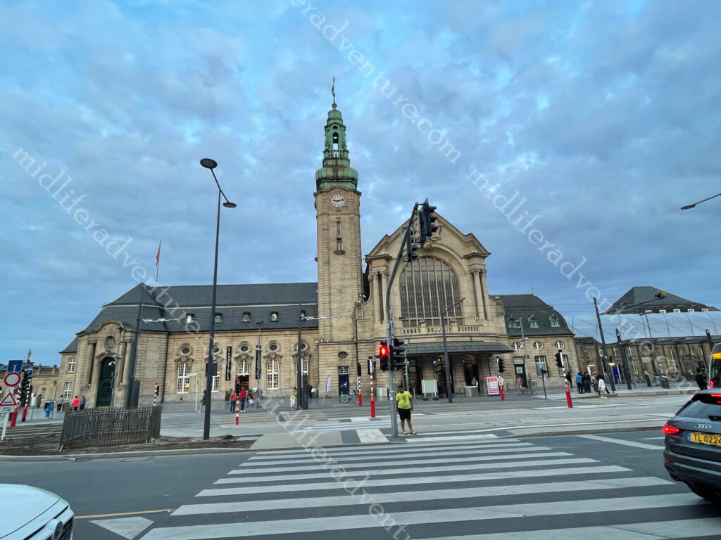
Luxembourg City is modern and the capital of Luxembourg it has done an excellent job of blending history and modern progress. The modern city is a highly efficient and functioning centre of commerce (particularly banking) while the Old Town area has kept the history and beauty of the city alive.
The first thing to know about Luxembourg is that all public transportation is free.
From our hotel (in the red light district near the train Station) we did the tourist walk towards the Old City to check out what Luxembourg had to offer.
The first thing that we aimed for was the Pont Adolphe Bridge. Originally built between 1900 and 1903 during the rule of Grand Duke Adolphe, the bridge had the biggest stone arch in the world at the time. The big double arch spans more than 85 metres across the Pétrusse valley at a height of 42 metres, and a total length of 153 metres.
Crossing the bridge you come to the Monument of Remembrance, officially known as Gëlle Fra. It is a war memorial dedicated to fallen Luxembourg soldiers.
At the top of the obelisk is a golden statue of the Greek goddess of victory, Nike. She is holding a wreath and looking down on a fallen soldier laying at the base of the pillar.
Constitution Square, or Place De La Constitution is next.
This is a lovely garden built on the site of a former bastion or fortress wall.
At the center of the square the Luxembourg flag waves, towering over the green space.
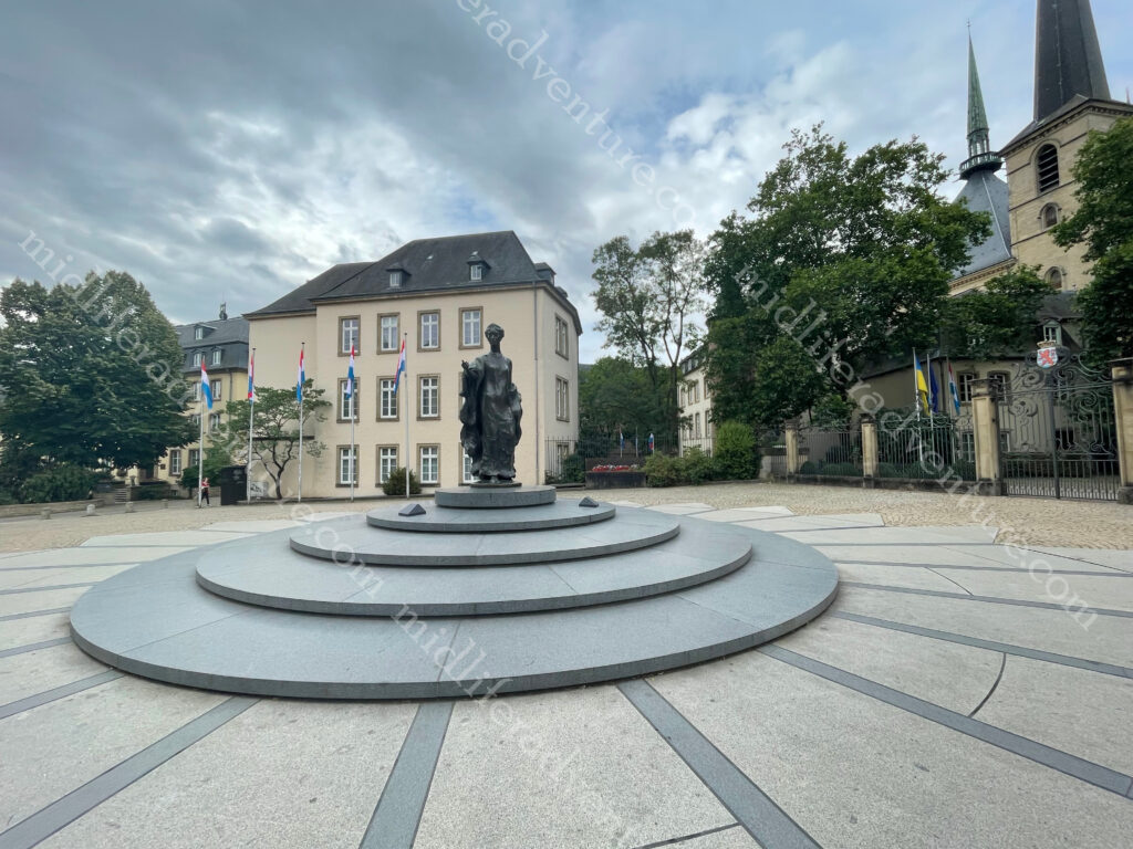
Across the road is the Notre Dame Cathedral. It took more than 300 years to construct and is free to enter. Looking nothing like the more famous Cathedral with the same name, this one has three towers, stained glass windows, intricately carved pillars, and a vaulted nave.
Place Guillaume and Place d’Armes are the two main squares in Luxembourg City.
Place Guillaume is home to the Luxembourg City Hall. A statue of the former Grand Duke William II riding a horse dominates the eastern half of the square.
Place Guillaume and Place d’Armes are the two main squares in Luxembourg City. Place Guillaume is home to the Luxembourg City Hall. A statue of the former Grand Duke William II riding a horse dominates the eastern half of the square.
Place d’Armes is in the heart of the pedestrian zone of Luxembourg City. It is lined with cafes, restaurants, and shops. During the holidays, the square hosts a Christmas market and every other Saturday there is a flea market in this central square.
Grand Ducal Palace was originally Luxembourg City’s first town hall that was built in 1418.
It is the official residence of the grand ducal family.
During the summer months, the Luxembourg City Tourist Office runs exclusive guided tours of the Palace. These 75-minute tours are booked out months in advance. They allow visitors to take a look behind the scenes, including the Grand Duke’s office, the dining room and the “Salon des Rois”.
The money raised from ticket sales is used to support a foundation that supports humanitarian and solidarity initiatives to assist vulnerable people and those in distress, both in the Grand Duchy and in developing countries.
Luxembourg is lovely, there is plenty to see and do but in real terms, you can do the lap within half a day, perhaps a little longer if you do the palace tour. I feel this may be the case for many of the smaller European countries. The train in and out is a breeze, and the free transportation around town makes this place a dream for a quick pop-in and look around.
Luxembourg food
Luxembourg is a very international country, as over the years people have moved here from all areas of the world. Their food is a mix of French, German, and Belgian cuisines, but other countries also feature strongly in restaurants across the country.
This actually blew us away, Luxembourg has delivered the best food that we have eaten all trip. Strangely enough we did not eat traditional but rather we had Syrian and Italian and both were exceptional. We did not eat in flash hotels or restaurants, we picked the local small joints (as we usually do) and were totally blown away with the quality, taste and service that was on offer.
Traditional Luxembourgish cuisine however is deeply rooted in local farming and seasonal produce that include meats, sausages, cheeses, potatoes, cabbage, and beans. Wine, honey, and mustard are also traditionally made throughout the country.
The traditional stuff is a bit more basic and includes things like:
Bouneschlupp and Gromperenzopp (Green Bean and Potato Soup),
Gromperekichelcher (Potato Pancakes),
Bouchée à la Reine (vol-au-vent),
Letzeburger Kniddlelen (Luxembourg Dumplings),
Wäinzoossiss mat Moschterzooss (Sausage with Mustard and Wine Sauce)
Given that the local stuff was a bit stodgy, I had not planned to do a food section here. But the stuff we ate and the service that they gave was phenomenal. Having come out of North America where you are expected to pay a minimum of 18% extra for service as a tip, not one lot of service (that we paid for) came close to what we got here in Luxembourg as part of the experience.
There is real pride taken in both the service and the products that are brought to your table. In fact, even at our dodgy neighbourhood Italian joint, we were served with a porcini mushroom mousse as a free appetiser while we considered the menu. If there are any foodies reading along, put Luxembourg on your list.
We have been to Malaysia a lot – we regularly transit through Kuala Lumpur and Penang is one of my favourite places on the planet. We have hit the west coast and Borneo extensively but had never made it south or to the east coast. So this trip we are.
After a nice easy transit through Kuala Lumpur (again) – I should talk about our KL transits as we do them so often. We have found a little hotel right in the midst of KLIA2 (the airport) that gives us access to an air conditioned room, a shower and a bed (for about $60 a night). It is a short walk from the terminal (about 600-800 meters) and is set up especially for those in transit. There is a 24 hour reception and the buffet breakfast starts at 4am to accommodate the early flights. We have stayed here many times and probably will again.
So after a shower, a meal (including beer) and a sleep we hopped on a bus from the airport and headed south to Melaka (Malacca). Oh and by the way – the spelling of the name of this place changes regularly and inconsistently.
Probably worth mentioning the busses here. These are things that I typically have avoided at all costs as they are slow, cumbersome and uncomfortable. In addition they really are not built for people over 6 foot tall. Add to this Jill’s amusement by booking us on (what has come to be known as) chicken busses. We have travelled on some truly atrocious local bus transports.
But I am very happy to say that in Malaysia, this is definitely not the case. Bus transport in Malaysia (at least the long haul stuff) is clean, comfortable and a highly pleasant experience. There are 3 seats across rather than the usual 4, and the seats are spaced reasonably apart so that there is ample leg room. There is, in fact, a hell of a lot more comfort to be found on a Malaysian bus than there is on any economy airline seat anywhere in the world.
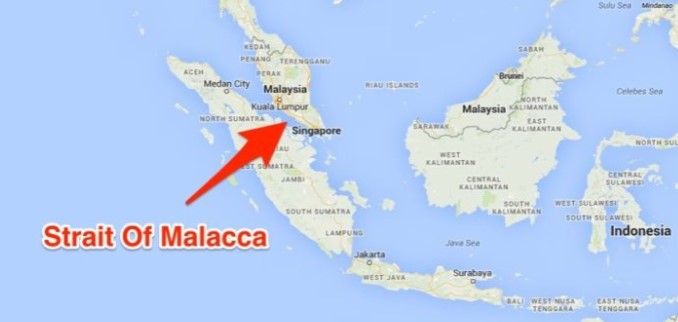
We had long heard of the importance of the Malacca Straits (the vital trade route that keeps Asian and global trade flourishing) but had not made it down here until now.
Virtually all shipping between the Far East and the Mediterranean / Middle East has to pass through this channel and has done so for hundreds of years (since around 1400). Because of this it has been a critical global port (along with places like Singapore and Shang-Hai) for many centuries.
Every year, around 90,000 ships pass through the sea lane of the Malacca Strait, which links the Indian Ocean to the Pacific. The cargo lanes make up an estimated 40 % of global trade. In addition, along the seabed is a dense array of internet cables that keep the world online. It is one of the most vital arteries of the global economy and a well-known global choke point.
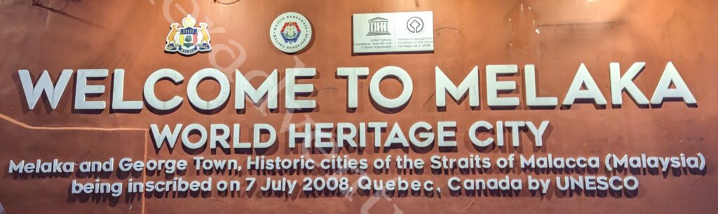
Melaka was the location of one of the earliest Malay sultanates but this all went away when the Portuguese conquered it in 1511. The Dutch then had a turn from 1641 to 1798, who then ceded to the British in 1824. Even Japan had a turn during WWII (1942–1945). Until finally on 31 August 1957, Malaya became an independent nation.
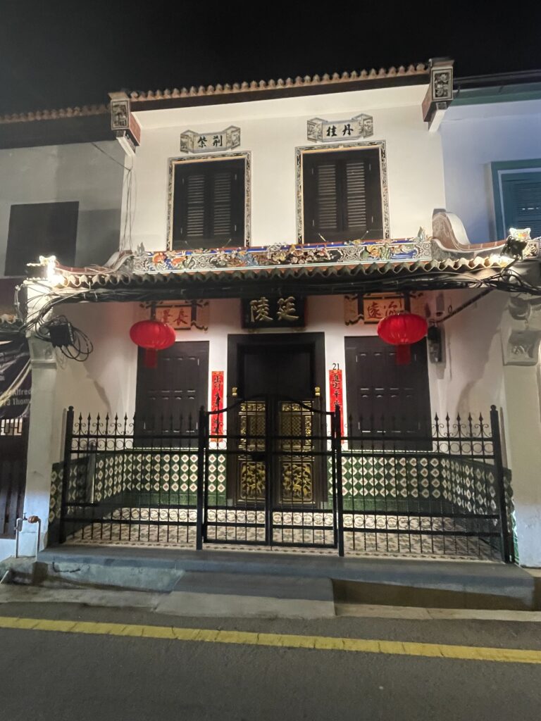
Melaka has it all, from old Chinese churches to Portuguese forts, palaces to heritage museums, mosques, sanctuaries to cultural parks. For the most part they are relics of the colonisation by the Dutch, Portuguese and the British But there is plenty to see and do (as long as you can abide the heat and humidity).
Most of the activity in town centres around Red Square or the Stadhuys (that were once the offices of the Dutch Governor) and across the bridge into Oldtown and Jonker St (the Chinatown area). This includes the overly packed weekend night market (especially on Saturday night). With the influx of the incredibly blingy pedal tuk tuks.
I usually don’t talk about where we stay, as most people that we know would never stay at such meagre offerings. We are more 2 star than 4 star and while we love the character of many of these places they would draw the scorn of most of our family and friends. It is the price we pay for travelling for long periods.
That said, there are still some basic rules that we abide by. Our hotels and rooms must:
be a private room (no dorms)
have a private ensuite (no shared bathrooms)
have decent WIFI (as far as possible)
be close to lots of food options
be walking distance to the cool stuff
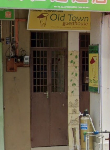
Here in Melaka we stayed at a place that was just fantastic. It was more akin to a B&B than a hotel. Run by Choa and his wife Maria their spiel is “We’re a budget guesthouse with charm and we are one of the cheapest options because we don’t have staff – we do everything ourselves. Our home is your home – come sit back, relax, and join us for a cup of coffee”.
Granted it doesn’t look like much from the outside but you cannot find nicer or more accommodating hosts. Once you get in the walls are covered in murals of all of the sights to see in and around Malaka. Nothing is too much trouble and they even give you a recommended itinerary to make the most out of your stay.
And it is right in the middle of some fantastic (an cheap) restaurants.
Maria is a master baker (maybe not officially but certainly in our eyes) who bakes up a storm every day. Biscuits, cakes, slices you name it. And on our last day she even made up a care package for Jill to leave with to get us through our bus ride – that included several types of biscuits a fresh mango and some banana cake.
If we come back to Melaka we would stay here again just to experience the hospitality again.
There is also a Little India that caters to the mainly Tamil population, who first came to work on the rubber plantation. It is fairly small but the restaurants are pretty good and most importantly they have been culturally welcomed. There is even a Chitty Village for the minority Chitty population.
The most striking part for us (other than the food) was the waterfront. the river makes its way through the heart of the city and virtually every step along the way there is something to see. Sadly many of the funky little cafes and restaurants (away from the main blocks) are no longer open (right now) but hopefully they will come back in time. But the river is really nice and is well used with tourist cruises and bars and restaurants lining the strip.
As nice as the riverfront is at night, if you are willing to brave the heat of the day, you get exposed to a whole new world during the daylight hours. Walls plastered with street art (becoming a favourite of ours it seems) funky bridges crossing backwards and forwards along the river, even a Ferris wheel. There really is a lot to keep yourself amused with.
Who knew I would be writing about this…Gan Boon Leong was born in 1937 and was Malaysia’s most successful bodybuilder (and later politician) – having won countless bodybuilding prizes, including Mr. Asia and Mr. Universe. He is known as the ‘Father of Bodybuilding in Malaysia’. To honor everything he did for Melaka, the city erected several golden statues of him, which are now just as much photographed as Melaka’s more traditional tourist sights.
The Malacca Straits Mosque was built in 2006 on a man-made island and looks like it is floating when the water level is high. It has two archways lead to the main entrance with stained glass covering the space between the arches. The mosque has a 30-metre tall minaret that doubles as a lighthouse.
Food
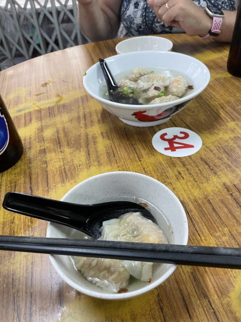
With Melaka’s long held importance as a trade route, comes a food maturity that exists in few places. People have been brining their food influences into Melaka for hundreds of years and the result is spectacular. Penang and Singapore are my two favourite food destinations and having been to Melaka, I have found my third. The laksa is sensational (but be warned is seriously spicy) and no trip to Malaysia is complete without a Roti Canai (pronounced Chanai).
Every meal we had in Melaka was a win. Whether Indian, Chinese, Malay. In fact even the western food attempts were credible (a rare thing throughout Asia). Melaka may be my second favourite Malaysian spot (behind Penang).
Travelling the world in a pre and post COVID state