Tag Archives: cathedral

Rio de Janeiro

Well this has been a long time coming and let me say right up front it was worth the wait. Rio de Janeiro couldn’t have been settled in a more beautiful landscape, nestled between the hills and the ocean. They made a definite point of saying that they were hills as they were not tall enough to classify as mountains.

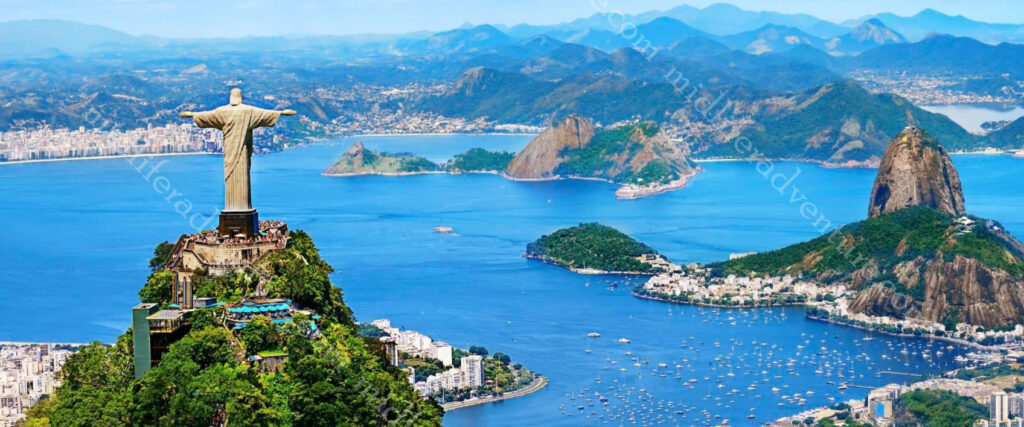
The skyline is dominated by two main peaks that rise from Guanabara Bay. The first is sugarloaf mountain (not a mountain at 396 meters but hey) and the other is Corcovado (still not a mountain at 710 meters) which is the site of Christ the Redeemer.

Our day was mostly grey and overcast, but on occasion the sun peaked out from behind the clouds but then quickly disappeared again.
Getting around in Rio de Janeiro proved to be really simple. Our movement was dominated by our tour bus, but a clean and efficient metro system, cheap Ubers and yellow taxis make Rio pretty straightforward to navigate. During daylight hours the streets are safe to walk around on and the beaches have hire bikes that link in with a local mobile app (about $7 for 2 days).
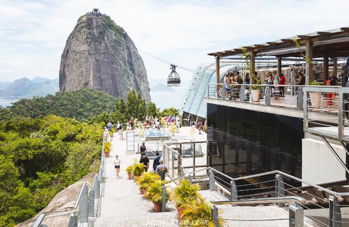
Sugarloaf Mountain (known as Pao de Acucar) is one of the most iconic and sought-after landmarks and top attractions of Rio de Janeiro.

The peak is known worldwide for its cable car, the panoramic views of the city and the infamous Rio beaches (more about these later). It is a huge lump of granite and quartz rising straight out of the water and offers 360 degree views of Rio. It is also a UNESCO World Heritage site.

You have the option of hiking (yeah right) or taking the modern cable car all the way to the top. The hike takes you half way with another cable car taking you the rest of the way.

The obvious next place was to climb the Corcovado mountain to see the Christ the Redeemer statue.

This is possibly one of the most famous views on the planet. You’ve probably seen the picture million times – a giant white concrete statue of Christ the Redeemer overlooking the city of Rio de Janeiro.

The sight is impressive in photos, but the reality is even better. The statue was first conceived in 1920, after World War I, when representatives of the Brazilian republic felt that the country needed a symbol to strengthen their faith again.

To get here we got a bus to the foot of the hill, where you meet up with the funicular railway, which takes you by cog tram, through the forest to the foot of the statue. The tram/train leaves every 30 minutes, and the ride up takes 20 minutes.

The statue is 30 meters tall, standing on an 8 meter pedestal and weighs in at 635 tons and was finished in 1931. The arms of Christ the Redeemer stretch 28 meters wide and the surrounding area has been designated as the Tijuca Forest National Park.

Lets be serious here. You will be but one of thousands visiting here. At any time of day. The place is packed. If your photo editing skills are good or if your framing is perfect or you are super lucky, you may get a nice photo. Otherwise expect there to be a ton of other people. We gave up on the getting to the Sugarloaf lookout from the Corcovado as the number of people was just mind boggling.
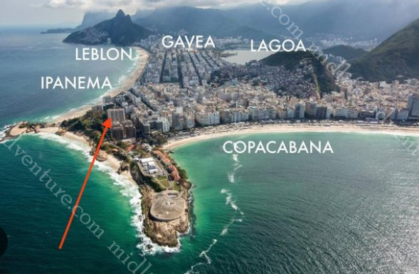
Coming down the mountain (hill) we did the beach loop. Rio de Janeiro is home to some of the most famous beaches on the planet. The main ones are Copacabana, Ipanema, and Leblon (broken up only by Arpoador rock..

Copacabana is one of the most famous beaches in the world. The boulevard was designed by Brazilian architect Roberto Burle Marx and is depicted in postcards – mainly due to the beautiful wide beach and striking patterned pavement. As we were in town on New Year’s Eve, the beaches were more packed than usual and the local authorities were setting up for the New Year’s Celebration. The sheer volume of portaloos being set up was a sight to behold.

Ipanema beach is the next most famous of the Rio beaches popularised by the famous 1960’s bossa nova song the ‘Girl from Ipanema’. If you think that you can visit this beach without hearing this song in either English or Portuguese then you are kidding yourself. The song was written about a real person (Helô Pinheiro) who at the age of 17 inspired the songwriters (Antônio Carlos Jobim and Vinicius de Moraes) by simply walking to the beach.

Leblon Beach flows directly on from Ipanema Beach separated only by a canal and park known as Jardim de Alá or thew garden of Allah. The Canal links the lagoon to the Atlantic Ocean.

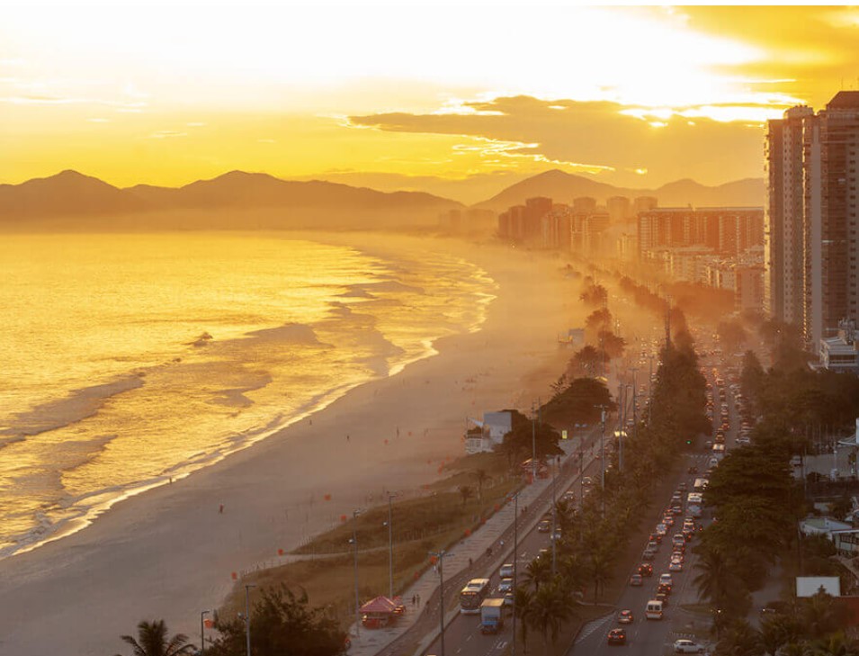
Barra da Tijuca is a bit more off the beaten path but is a suburban beach. It is more American in style with condo’s and shopping malls everywhere you look and was the site of many events during the 2016 Olympics.

Since the Portuguese colonised Brazil in the 16th century, it has been overwhelmingly Catholic. Today Brazil has more Roman Catholics than any other country in the world with an estimated 123 million of them. This translates to a ton of fairly impressive churches dotting the city.

The first and main one is the Metropolitan Cathedral of Saint Sebastian.

The church of São Francisco da Penitência was built in 1726 and is a Baroque colonial church in the center of the city.  
Rio also has four major football (soccer) teams and if you think you can go anywhere in town without somebody mentioning one or more of these then you are also kidding yourself. The teams are Flamengo, Fluminense, Botafogo and Vasco.

Rio is probably equally as famous for its Carnival. Usually in February, it begins on the Friday preceding lent and ends on Ash Wednesday, but the Winners’ Parade happens on the Saturday after carnival ends. Up until the mid 1980s, the Samba Parades of Rio Carnival were held along the main street of Avenida Presidente Vargas.

But 1984 saw the building of the permanent structure and stands that have come to be known as the Sambadrome Marquês de Sapucaí. This is a purpose-built stadium, designed specifically to host the annual parade and able to accommodate about 75,000 people.

The focus of Carnival is for the local Samba Schools to compete. The blurb says that the parades are an amalgamation of dance, fashion, music, narrative, spectacle, and competition in which thousands of performers process in the early morning hours through the Sambadrome.

Coming through in December we got to see the Sambadrome but obviously missed out on the February celebrations. The other thing that has tended to become a thing of ours is the taking in of local street art.

Due to the fact that it was New Year’s Eve and it was a cruise ship full of older people, the decision was made that the night would be more safely spent on the ship, rather than on the beaches of Brazil. So we all got ourselves back to the ship before dark and moved around to park in front of Copacabana Beach where we waited for the midnight fireworks show.

Everywhere we went in Brazil we constantly read about the safety situation. Even the Australian smart traveller website suggests that you exercise a high degree of caution in Brazil due to the threat of violent crime. This has not been our experience, everywhere we have been has been friendly and welcoming and has felt safe (granted we were not out and about in the evenings).

Brazil has been fun, friendly, incredibly well priced and will absolutely be somewhere that we will return to.

Fortaleza, Brazil

Fortaleza (or fortress) is Brazil’s 4th largest city (with about 4 million people) that sits in the Northeast of the country. The main claim to fame of Fortaleza is as a major domestic tourist destination hub. At this stage, it does not draw large numbers of international tourists but is a Mecca for the locals.

Hopping off the boat we got sick of the idea of haggling with the overpriced taxis that infested the port. The taxis were trying to charge $20-30USD (96-144 Brazilian real) to get a lift to town. So we did our usual and walked out of the port area to get an Uber.

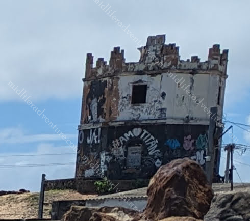
Jill’s map showed that there was a lighthouse just outside the gate so we aimed for that.

At this point, we were met with a police blockade telling us that the nearby neighbourhood was too dangerous to walk through and that they would only let us leave in a vehicle.

We met another couple who wanted to walk along the nearby beach but they were also discouraged due to the perceived danger. We also met a Canadian couple who were equally as eager to explore but equally oblivious as to where to go.

So we perched on the side of the road and ordered our Uber. Having no idea where to go we aimed for the Cathedral, figuring it would be pretty central and we could roam about from there. So a 37 real ($7.70) Uber ride and we were delivered direct to St. Joseph’s Cathedral.

This is the main Cathedral in town and can fit up to 5000 inside. The main towers reach 75 meters. Perched on the top of the hill it is a mere block or so from the circular Fortaleza Central Market (Mercado Central de Fortaleza). Originally a meat and fish market, it has now been converted to a crafts market with about 500 shops.

The streets around the markets were full of pop-up market stalls with virtually anything you could imagine on offer.

But the main thing about Fortaleza is the foreshore. To the north of the city is a long, scenic and highly accessible Atlantic Ocean. Leaving the Central market I led the way and marched down the road, around the corner and through some pretty dodgy areas until we eventually turned left and found ourselves at the suspect end of the Avenida Beira Mar.

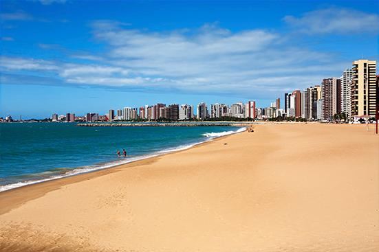
The Avenida Beira Mar is a wide beachfront promenade that runs along the oceanfront. Our entry point was closest to town which was pretty sketchy at best. While the beaches offer emerald green seas, the neighbourhoods were not quite as salubrious. Not quite favelas , but certainly not very tourist friendly.

But the more we walked, the nicer it got. The dodginess eased and the tourist staples started to appear. The Avenida Beira-Mar sidewalk kicked in revealing the expected cafe’s, restaurants, Japanese garden, beach volleyball courts and the rest of the tourist elements. In fact, the range of shoreline activities are almost unending.

We (including the Canadian couple that we met) found ourselves at a funky little beachside cafe that offered good (if tough to understand and communicate with) and cheap service. Really nice, cold, big beers, by the beach and surrounded by cheeky bikinis made for a tough afternoon. Even more so when the bill came back at under $10 for 4 really large beers. Add to this the random lobster and prawn salesman who was offering 3 for $10.

Futuro Beach is one of the most famous beaches in Fortaleza. Stretching for 8km along the city foreshore it is a great beach and the local touts offer fresh lobster, shrimp, crab and fish.

As we walked away from town the beach kept getting better and better. They were obviously setting up for the upcoming New Year’s celebrations and stages, generators and makeshift toilets were all finding their way to the foreshore. We were due back to the boat before 5pm which sadly saw us having to leave the area early.

I got the sense that the area that we were in would be absolutely amazing for sundowner drinks and into the early evening. I would probably stick more to the tourist end rather than the town end but the beach promenade would certainly be the place to be.

The Uber back to the ship was even cheaper and we ended up getting transport in both directions and 4 big beers for less than the cab drivers were charging for a one way fare.

Martinique

Martinique is an overseas territorial island of France. It is part of the Lesser Antilles and is 35km from Dominica, 26km to Saint Lucia and about 75km to Guadeloupe.

Martinique is about 80 km long and 35 km at the widest part. This makes it one of the smallest of the French overseas territories, but it has one of the highest population densities. The climate is remarkably constant with the average temperature being about 26° with minimums of 20–22 and maximums up to 34 °.

According to the blurb the original population disappeared after Europeans arrived, as a result of either disease or being wiped out by the invading French. In 1658 there were 5000 French settlers on the island. From here a lot of slaves were brought from Africa which added a new ethnic component. Today people of mixed European and African ancestry account for more than 90% of the population.

Fort-de-France

Fort de France is the main city of the overseas territory and was our landing point on the island. Interestingly as Martinique is only a territory, it does not officially have a capital. While the city lacks the palm trees and beaches of the rest of the island it does have the restaurants, shops, bars, and places showcasing the island’s history. Many of these venues sit in colonial-era buildings.

Fort Saint Louis was built to protect the city against enemy attacks. The fort was soon destroyed, and rebuilt in 1669 under Louis XIV as Fort Royal. It changed to Fort-de-France sometime in the 19th century and is the enduring name of the fort and the surrounding town.

St. Louis Cathedral is the main church in town and is probably the highlight of a town with not that much going for it.

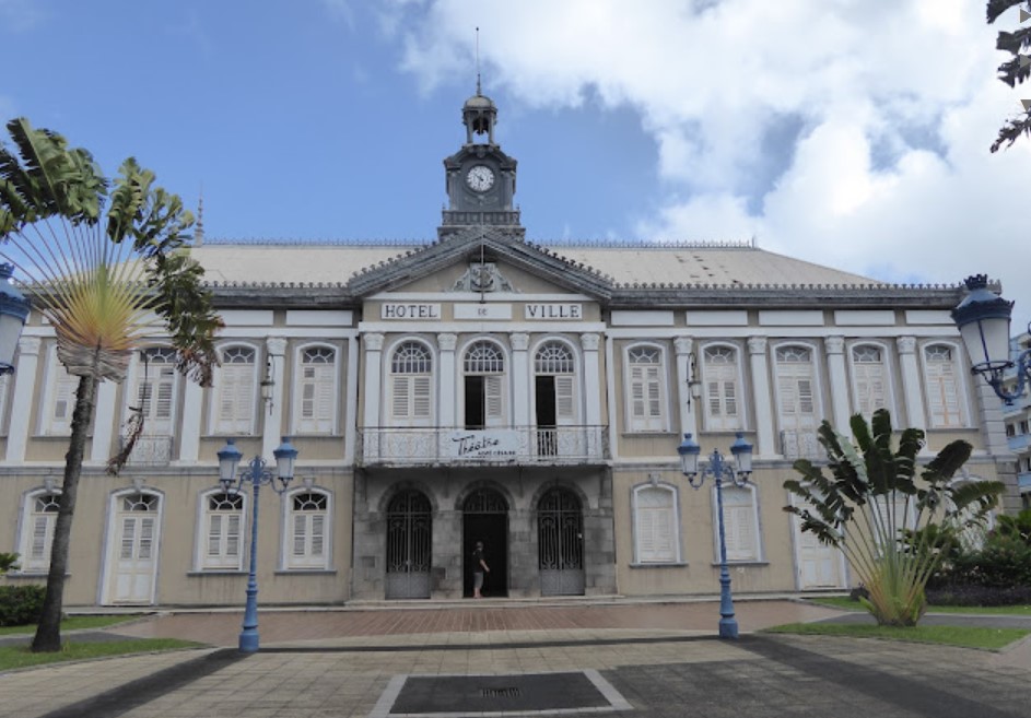
Old town hall is one of the more impressive buildings in a town that is broadly underwhelming.

The covered market was the next on the trek through town. It provided the mix between a normal fruit and veggie market, some trinkets and souvenirs and some traditional food stalls. But in essence, it was a tin shed with some veggies in it. I don’t mean to sound down on Martinique, there really was nothing wrong with it at all. The people were friendly, the prices were good, there just was not too much to see or do.

Jardin de Balata is the local botanic gardens that is a short cab ride from town, if you are of a mind to do the hike be warned it is a fair walk and it is all uphill.

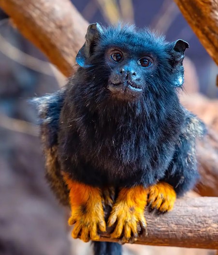
There is a zoo here, we didn’t go to it, but the promo picture shows this little critter. I have no idea what it is, but it looks pretty interesting.

Anyway, that is something else you could have done.

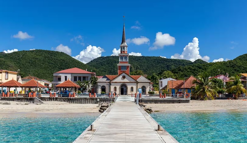
If you had more time in Martinique the recommendations are to stop and visit some of the smaller towns. The top on this list is Les Anses d’Arlet. The area is mostly jungle-covered mountains but there are also 3 coves for the nature lovers.

Other towns suggested were Big Cove (Grande Anse) and Arlet Cove (Anses d’Arlet) in both have restaurants and accommodation right on the sandy beach while Small Cove (Petite Anse) has a rocky shoreline.

St Kitts and Nevis

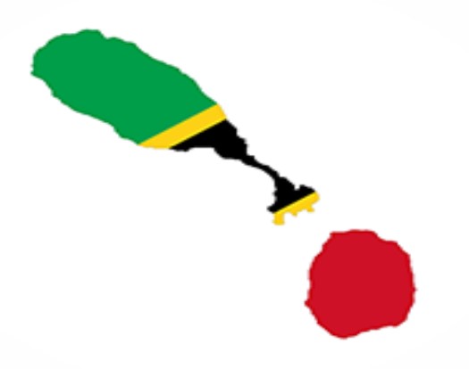
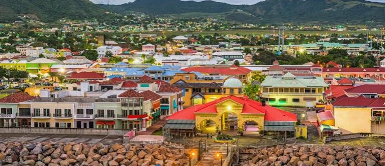
Saint Kitts and Nevis is an island country and microstate in the Caribbean and our first official foray into the West Indies (or the Lesser Antilles). With only 261 square kilometres and about 50,000 residents it is one of the top 10 smallest countries in the world.

The capital city is Basseterre and is where we found ourselves landing.

Basseterre is on the larger island of Saint Kitts and is the main port for passengers and goods. The smaller island of Nevis is about 3 km southeast of the main island across a shallow channel called the narrows.

Much like the Dominican Republic, the immediate port arrival is full of all of the tourist things that you would expect (but without the beaches and pools). There were touts aplenty, t-shirt and trinket shops, duty frees, and the general assembly of bars, cafes and restaurants.

Getting around is pretty easy as the streets are typically named after the things that are on the street. So there is Bank St, College Street, Fort Street and so on. There are two main churches in town, the biggest is StGeorge’s Anglican Church which sits up the hill past all of the initial tourist mess.

The other is the Cathedral of Immaculate Conception which sits closer to the port and opposite the Independence Square park.

As it would happen our wanderings took us up the hill, where we found ourselves at Warner Park, the local cricket ground and home of the local Caribbean Premier League Team. Being a cricket tragic, I had to wander in, on and around a West Indian Cricket Ground. Such a pity there was not a game on, but I will take what I can get.

Saint Kitts and Nevis were one of the first of the islands in the Caribbean to be colonised by Europeans and housed the first British and French colonies. It is also the most recent British territory in the Caribbean to seek and gain independence, gaining it in 1983.

The Brimstone Hill Fortress is a national park, and one of the most popular tourist attractions on St. Kitts. As one of the one of the most well-preserved British polygonal-style fortifications in the Western Hemisphere.

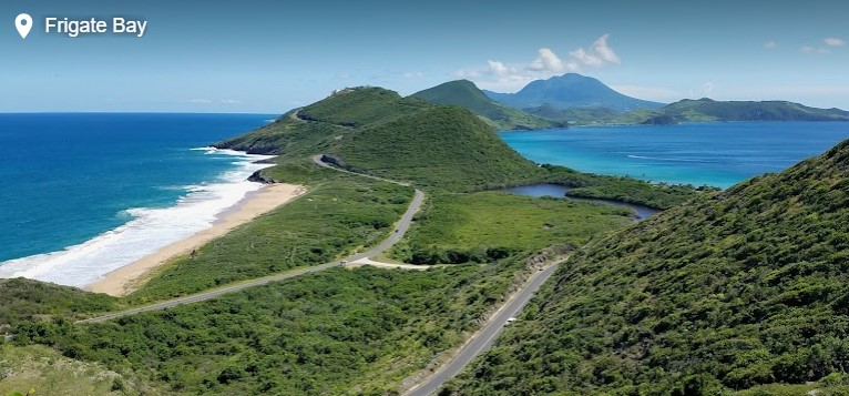
Frigate Bay lies just southeast of the capital and is the home of the tourists who choose to hang out a bit longer than our mere day trip.

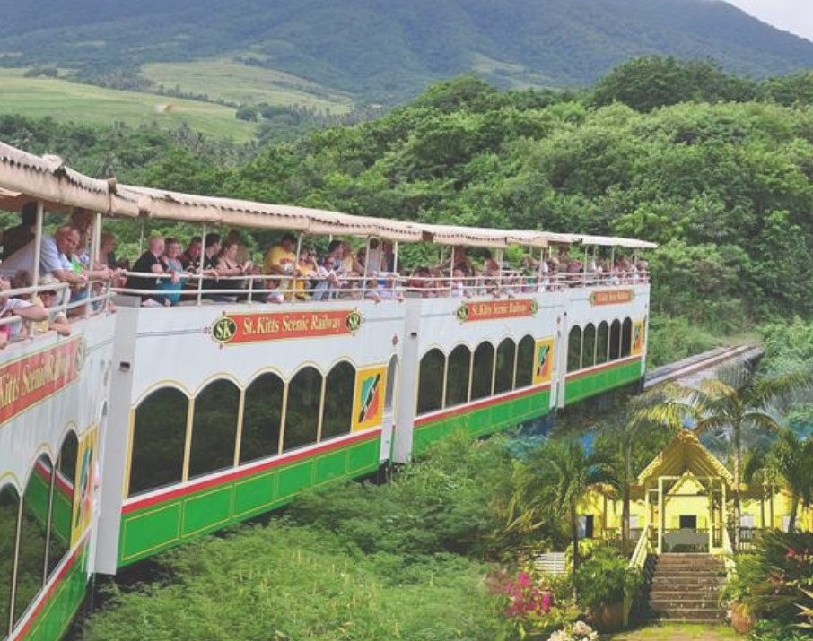
The St. Kitts Scenic Railway is a 3-hour ride that circles the island by both narrow gauge train and 12 miles on buses. It was built as a sugar cane railroad and now goes past the island’s sugar plantations and sugar factory.

Now let’s call this one straight. This place is seriously humid. Sweating in hot temperatures is normal for me, but here even Jill was dripping in sweat as we walked around. The thing that does need to be mentioned is the food. Everywhere we went we passed the most amazing smelling restaurants we had ever encountered. As we had come off a cruise ship, we were stuffed but if we ever come back, the food journey will be high on the list.

We did manage to sample the local beers ($2 each) and dipped our toe in the water with a Johnny Cake. The Johnnycake is something that I had heard of but never tried. I asked the lady what it was and got a relatively indecipherable answer so figured the best way wax to just order it and play lucky dip on what arrived. I do tend to do this a lot. The beers were great, but the fried doughy bread thing stuffed with (jerk) chicken and salad could probably have been avoided.

St Kitts was lovely and with a bit more time it would be nice to explore it a little more fully. Reading into what we missed revealed rainforests, sandy and volcanic beaches and given the relatively small size of the place, they are all quite easily accessible with the hiring of a vehicle. And for future reference, August is when the cricket is on and pumping with the Caribbean Premier League.

Puerto Rico

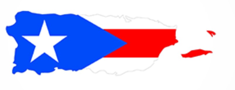
Puerto Rico, despite being well and truly its own entity, sadly only counts as a territory of the United States and does not add to my country tally.

Although Puerto Rico is an American territory, it competes as its own individual country in both the Miss Universe contests and in the Olympics. Yet another reason I think that it should count.

But wow. If this little dip of the toe into the water of visiting Puerto Rico is any sort of glimpse, the place is amazing. It is the smallest island of the Greater Antilles in the Caribbean and sits a bit east of the Dominican Republic. The temperature permanently sits in the 20’s and 30’s all year round. There are around 3.2 million people in Puerto Rico, and close to 5 million Puerto Ricans living in the U.S.

The Island has almost 300 miles of coastline and nearly the same number of beaches. And being ostensibly American, it has the largest shopping centre in the Caribbean.

San Juan

Our entrance to Puerto Rico was on a cruise ship (along with 2 others on the same day) which saw us coming into the port of San Juan. A really lovely (not so) little town that saw us cranking up the step count for the day considerably.

A predominately walled city there is a huge level of fortification (especially to the sea) with all of the gates and things that you would expect from such a town.

Castillo San Felipe del Morro is better known locally as El Morro. It is one of the largest fortifications built by the Spaniards in the Caribbean during the 16th century. It is made up by six staggered levels that integrate barracks, dungeons, and storerooms. It was designed to protect the city and still has some of the original cannons facing the ocean. According to the blurb in its history, El Morro was never defeated by the enemy.

The fort is massive and is set far out on the point with large green areas surrounding it. It was originally designed to protect the city from attacks from the sea.

Castillo San Cristóbal is the other fort that stands and was meant to defend from enemies approaching by land. Covering over 27 acres, this fortification is the largest one made by the Spaniards in the New World. This castle holds the famous Garita del Diablo, center to many military tales and stories in the Island.

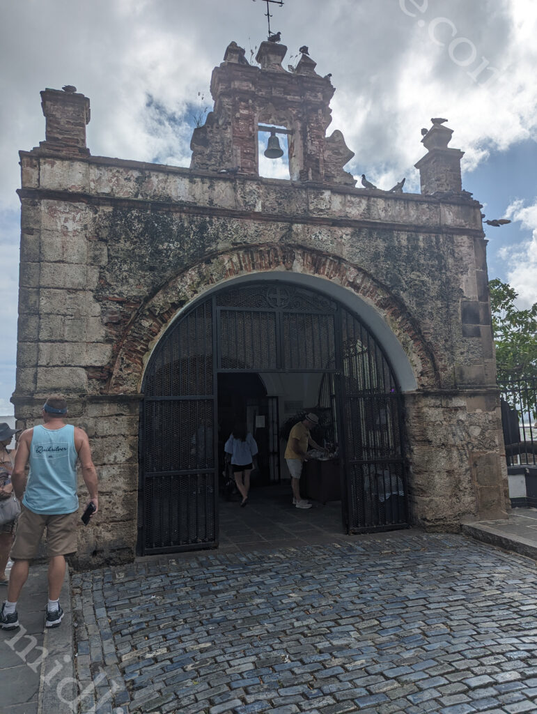
The Capilla del Cristo is a small sanctuary at the top of the walls of the city. Legend has it that two men were racing their horses down the street and one of them fell over the cliff and survived. This inspired the construction of a sanctuary dedicated to the saints of health. Its altar is made of embossed silver and the room is decorated with two José Campeche paintings.

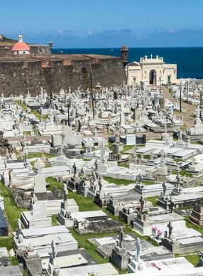
Between the two forts, you can see the Santa María Magdalena de Pazzis Cemetery. This was established in the 19th century and was built outside the city walls because of their strong fear of the afterlife. Its oceanfront location derives from a superstitious belief that the deceased started a journey over to “the great beyond” and being close to the sea symbolised the beginning of eternity.

This cemetery is the final resting place of Puerto Rico’s most prominent natives and residents. A nice touch that we found was some mosaics of each town that have been laid into the footpaths along the way.

As usual, the Cathedral de San Juan takes up a prominent place in the heart of town. This one is an example of medieval architecture during the time when the Spanish ruled the New World. The Cathedral de San Juan is the second oldest church in the Americas, after the one built in the Dominican Republic.

La Fortaleza (officially El Palacio de Santa Catalina de Alejandría) is the oldest state residence of the New World still in use.

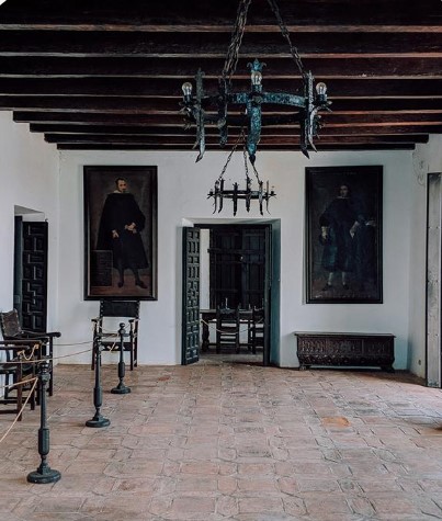
It was originally built in the mid 1500’s and has served as a fortress, a prison, and an arsenal, and is now the official residence of the Governor of Puerto Rico. This executive palace conserves traditions (such as candlelit-only dining rooms) and has original Spanish objects from the colonial era.

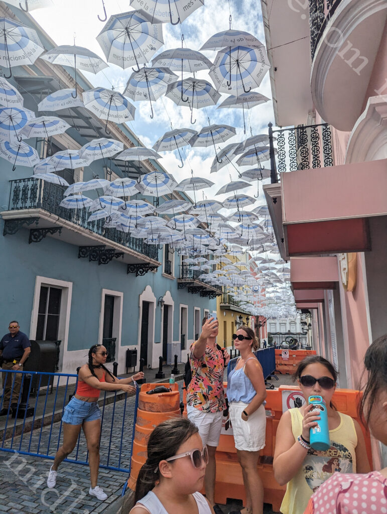
Calle Fortaleza (more commonly known as Umbrella Street) extends from the Governors mansion and is Instagrammers heaven. When we arrived there were hordes of them striking all the poses under the sun (never looking at the camera).

The surrounding streets are full of the funkiest restaurants in town.

When chatting with our local barman on the boat we were told that San Juan was the original birthplace of the Piña Colada. Being the butch and manly type that I am, I am partial to a Piña Colada. To find its origin we had to hunt down the restaurant called Barrachina. Which we did, only to find that 2023 was the 60th anniversary of its invention.

Casa Blanca is the oldest residence in Old San Juan. It was once the home of the first governor and has since been converted into a museum. 

 In Cataño, Puerto Rico, you will find the the largest premium rum distillery (Bacardi) in the world.

Puerto Rico is also home to the only rainforest in the American National park system (El Yunque).

If friendliness counts for anything, then this place is amazing. The smiles and happiness that you are greeted with here is something to behold. I am very happy to come back here again and explore more of the isalnd.

Kossovo

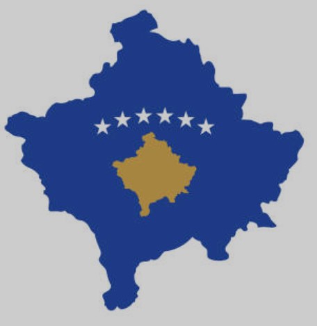
Kosovo lies landlocked in the centre of the Balkans, With a population under 2 million. It is bordered by Serbia (north and east), North Macedonia (southeast), Albania (southwest), and Montenegro to the west.

Its capital and largest city is Pristina.

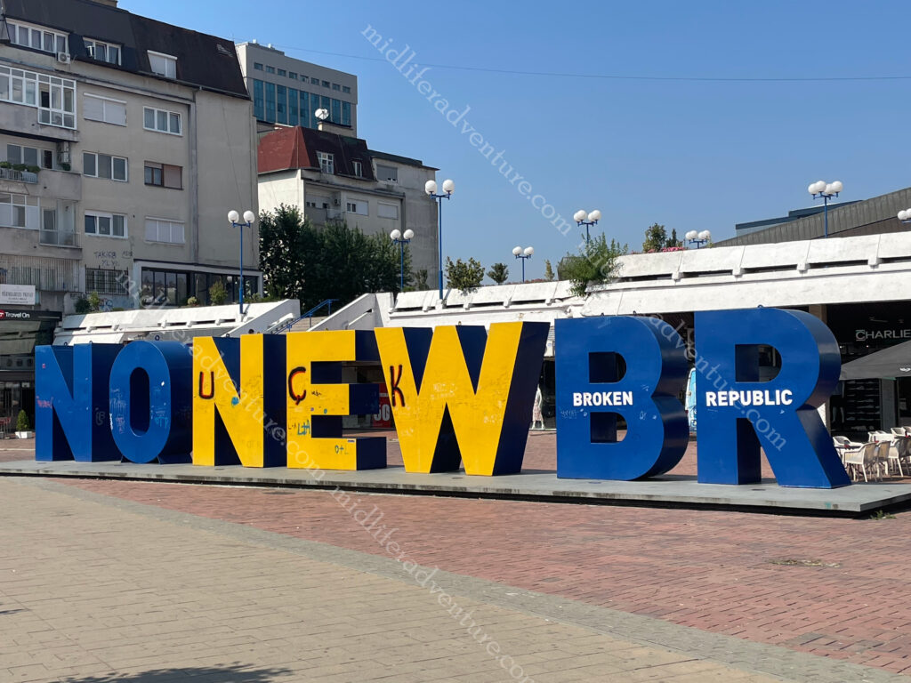
In about 1950 the Serbian/Albanian population mix in Kosovo was about 50/50, today it is 5/95. Kosovo is the newest country, having declared its independence from Serbia in 2008. The day of that declaration it unveiled the newborn monument. At the unveiling the monument was signed by the President and Prime Minister of Kosovo, followed by 150,000 citizens celebrating their independence.

By the time we had arrived the shine and gloss may have worn off the idea of being a sovereign nation for some. Somebody had come in late at night and moved the letters around so that it now read No New BR with the words broken republic printed an the letters.

The earliest historians can trace back evidence of settlement in Kosovo to the stone age. There are indications that cave dwellings might have existed, such as Radivojce Cave (Drin River), Grnčar Cave (near Viti) municipality and the Dema and Karamakaz Caves near Peja.

The strategic position of the nation coupled with the abundant natural resources has made the area favorable for the development of human settlements throughout history. There are hundreds of archaeological sites identified throughout Kosovo.

Pristina

Pristina is the capital and it is a safe and easy place to travel in and around. There are not a lot of attractions and activities to see and enjoy but the ones they have are ok. The public transportation is frequent, cheap and reliable with majority of buses air conditioned.

As we came in fairly late in the afternoon and there was not too much to see and do in town we decided to cool off in our hotel before heading out to dinner. We picked a local Italian joint nearby. This was our first introduction to just how cheap this place was. I ordered a pasta and a small (22cm) pepperoni pizza while Jill just had a Margarita pizza. And these were washed down by two beers each. Total bill was 13.80 euros which is $23.17 aussie. $23 for two pizzas, 4 beers and a pasta. That is just crazy.

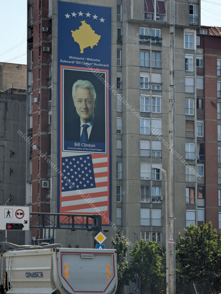
The next morning we were up, breakfasted and on the bus to town to see the sights. The bus fare was 50 cents for a one way or 80 cents for a 24 hour ticket for as many trips as you wanted. We rode the bus getting off on Bill Clinton Boulevard near the statue of Bill Clinton. This was done to thank former U.S. President for his help during their struggle with the government of Yugoslavia.

From here we wandered up the hill towards the Cathedral of Saint Mother Teresa. It was opened in 2010 on the anniversary of her death. This is about the 4th country in a row that is claiming a great affinity to Mother Teresa. She was born in Skopje (hence their claim) of Kosovar/Albanian descent (that’s them covered) but she took off at 18 and was never seen again in this part of the world. So the attempts to claim her throughout the Balkans seems a bit of mystery.

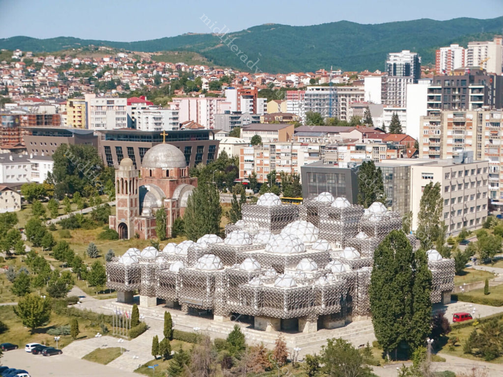
From here, the road was blocked off for a festival leading its way down to the park and the incredibly odd and controversial National Library of Pristina. The current building began in 1982 and consists of a total 99 domes of different sizes and is entirely covered in a metal fishing net. It has been described by many as the ugliest building in the world.

After this you find yourself at a long pedestrian mall, full of the usual shops, businesses, statues, restaurants and cafes. Nothing really to see and tourism hasn’t really kicked in yet. But it is neat and attractive and a pleasant place to stroll.

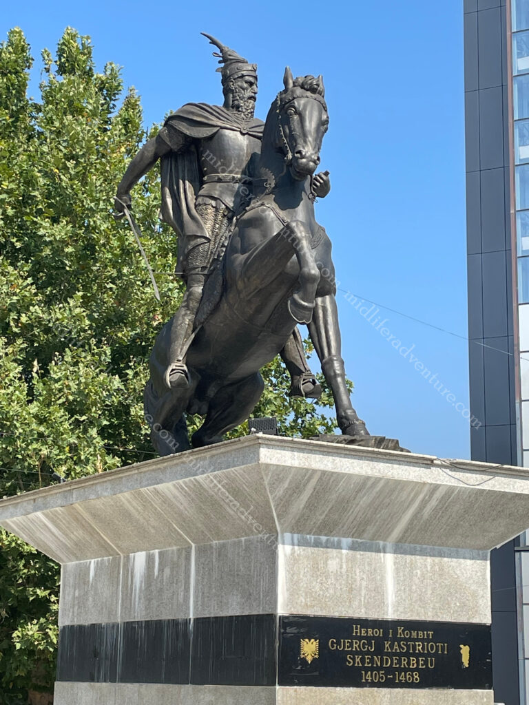
Following the end of the Kosovo conflict in 1999 and no longer under Serbian rule, Kosovo Albanians in 2001 erected a monument within the centre of Pristina to Skanderbeg. He was a medieval Albanian who fought against Ottoman forces in the 1400’s.

HEROINAT is a statue opposite the Newborn statue that depicts the face of a typical Albanian woman using 20,000 pins.

Each pin represents a woman raped during the Kosovo War from 1998 to 1999. The pins are at different heights, creating a portrait in relief.

That pretty much did it for Pristina. There were a few mosques around the traps, the odd statue and a church. We did find one local beer and managed to sample another couple of new ones but they were from elsewhere.

Bulgaria

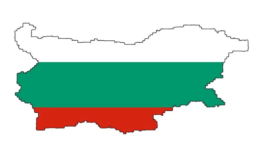
Bulgaria is a southern Balkan country bordered by Romania (north), Serbia and North Macedonia (west), Greece and Turkey to the south.

Bulgaria is renowned for its diverse terrain that includes the Black Sea coastline, a mountainous interior and rivers, including the Danube. Based near the European crossroads it has long been a cultural melting pot with Greek, Slavic, Ottoman, and Persian influences.

Before I get into the exploring, I need to talk about first impressions. This place is fantastic. We got off the plane and onto the Metro for a run into town for our hotel. A slight mishap with the ticket scanning saw me through the barrier and Jill stuck on the other side. Seeing the dilemma some random woman came up and swiped her card, letting Jill through and just wearing the cost.

We then got to our hotel and were met by the friendliest and most helpful dude that we have come across thus far (and that bar has been set pretty high). This friendliness was genuine and extended the entire time through our stay. So much so that on the morning that we were due to leave he even offered to wait around for us (after his overnight shift) and drive us to the bus station, so that we didn’t have to lug our heavy bags.

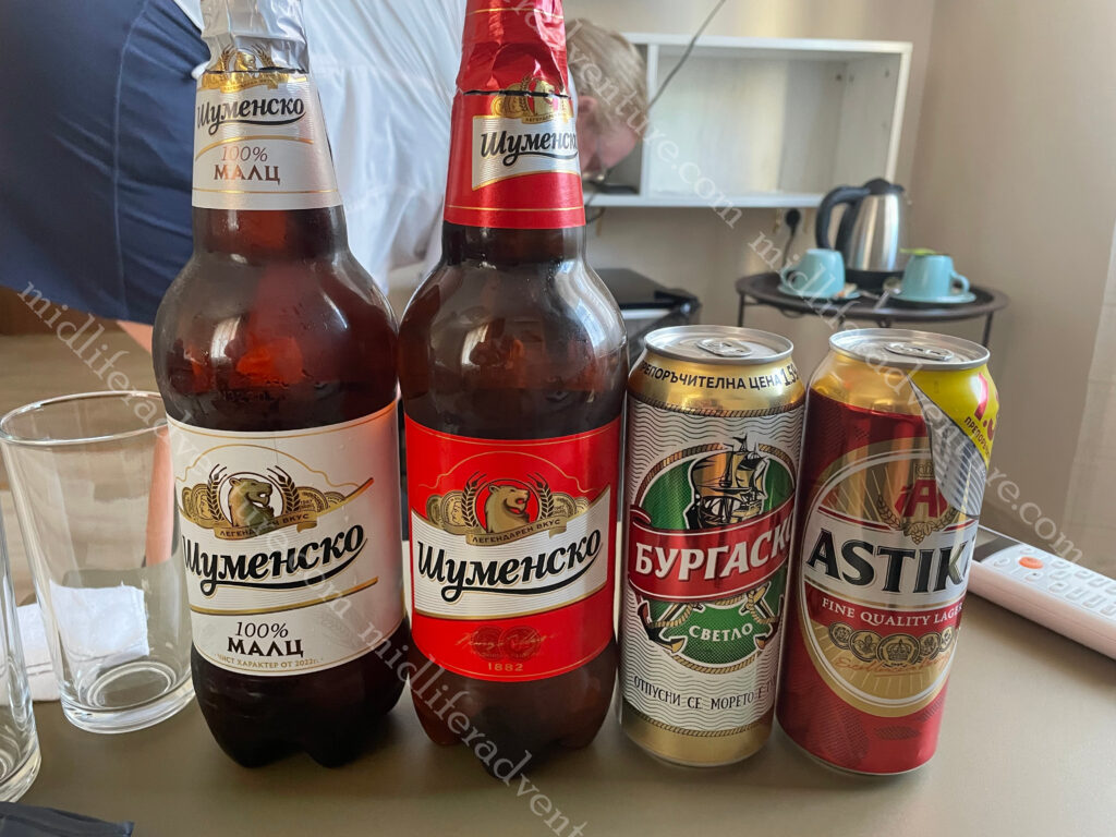
Our room had a fridge so we popped out to the shop on the corner and bought 4 large beers (2x500ml and 2×1 litre) and a soft drink each and got change from $12 Aussie for the lot.

I’m really gonna like this place.

Sofia

Sofia is the capital of the Balkan nation of Bulgaria. It’s in the west of the country, below Vitosha Mountain. The city’s landmarks reflect more than 2,000 years of history, including Greek, Roman, Ottoman and Soviet occupation. When doing our early research it looked a bit light on, but on arrival we were happy to see that there was much more on offer than the tourist blurbs suggest.

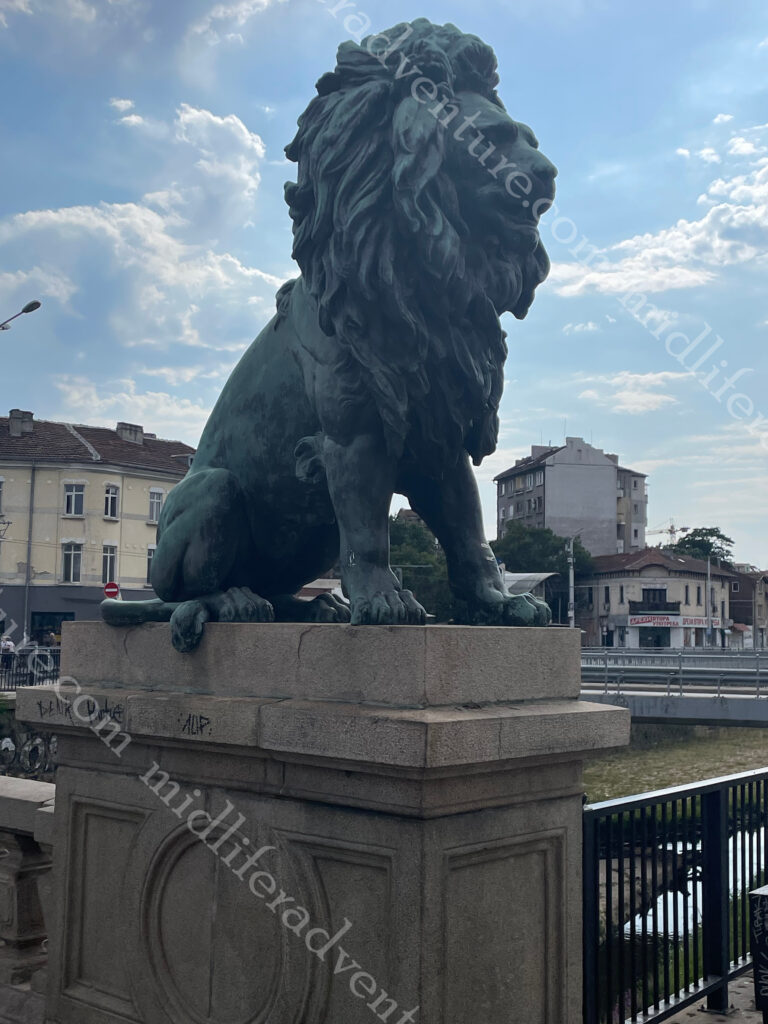
Hopping off the Metro we landed right on top of one of the listed landmarks, the Lions Bridge.

Well that was easy.

It is a bridge over the Vladaya River that was built 1889–1891 and connects the Central Railway Station with the city centre.

It has 4 very large lion statues on it.

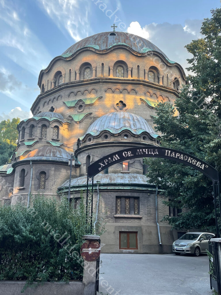
Just around the corner from our hotel, we randomly happened upon the Church of St Paraskeva which is the third largest church in Sofia.

It is a Bulgarian Orthodox church dedicated to Saint Paraskeva,

We were aiming for something else but sure enough this popped up and was pretty cool.

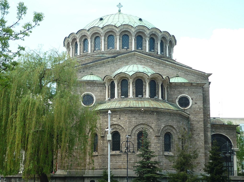
StAlexander Nevsky Cathedral was what we were actually aiming for. It is one of the 50 largest Christian churches in the world taking up an area of 3,170 square metres and being able to hold 5,000 people inside. Construction started in 1882 but most of it was built between 1904 and 1912. The cathedral was created in honour of the Russian soldiers who died during the Russo-Turkish War of 1877–1878 when Bulgaria was liberated from Ottoman rule.

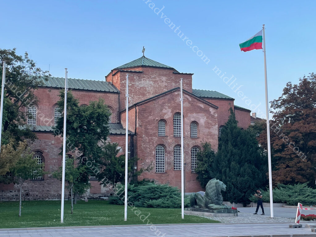
Virtually across the road, you find the Saint Sofia Church which is the oldest church in Sofia. The floor of the church is covered with Early Christian flora and fauna-themed mosaics. 

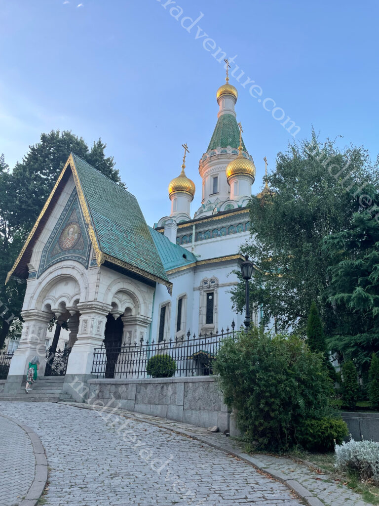
Just down the hill a bit and you come across Saint Nikolas Russian Church (Tsurkva Sveta Nikolai).

It was built in 1882 on the site of the Saray Mosque, which was destroyed during the Russian liberation of Bulgaria from the Ottoman Empire.

Having ticked those boxes we hunted for dinner but were rejected from the first place (Armenian) as I was dressed like a grotty backpacker. They claimed that they were full but really they didn’t want the likes of us in there. So we went somewhere else, got online and made a reservation for the next night, where we dressed similarly. Having done all of that, their snootiness did not translate into good enough food to justify the price (it was OK) and as a protest, they made sure that their service sucked.

A later check of reviews from other people found many similar experiences.

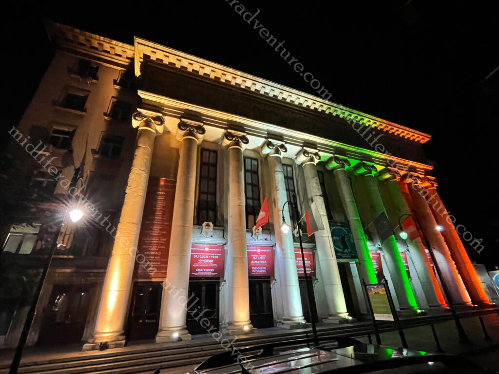
On our walk back from dinner (the first night) we stumbled upon the Opera House that we had walked right past and completely missed on the way up the hill (it was tucked around a corner).

Also on the walk home, we came across roving packs of teens and 20 somethings in the park looking for things to do. Some were drinking, but for the most part, they were just hanging out and discussing the issues of the day. Not protests as such, just exchanges of ideas.

National Museum of History is Bulgaria’s largest museum and was founded in 1973. Set at the end of a very nice park with some lovely fountains it was worth the short journey to get here.

St. Nedelya Church is an Eastern Orthodox cathedral dating back to the 10th century. It has been destroyed and reconstructed many times through the ages. 

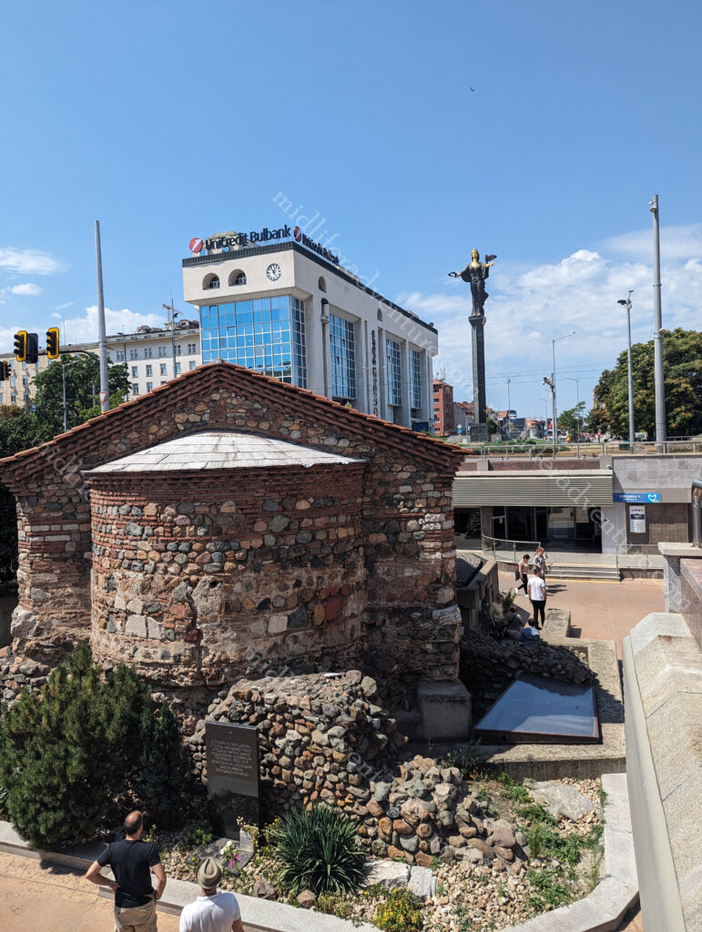
The Rotunda Church of Saint George is buried in a courtyard behind other buildings. It dates back to the late 3rd and early 4th centuries.

It was originally built as Roman baths. It is the oldest surviving building in Sofia.

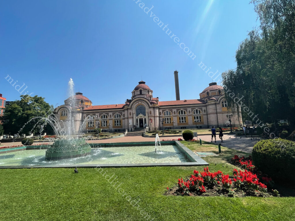
The Regional History Museum is another landmark in the centre of Sofia, the capital of Bulgaria. It was built in the early 20th century near the former Turkish bath and was used as the city’s public baths until 1986.

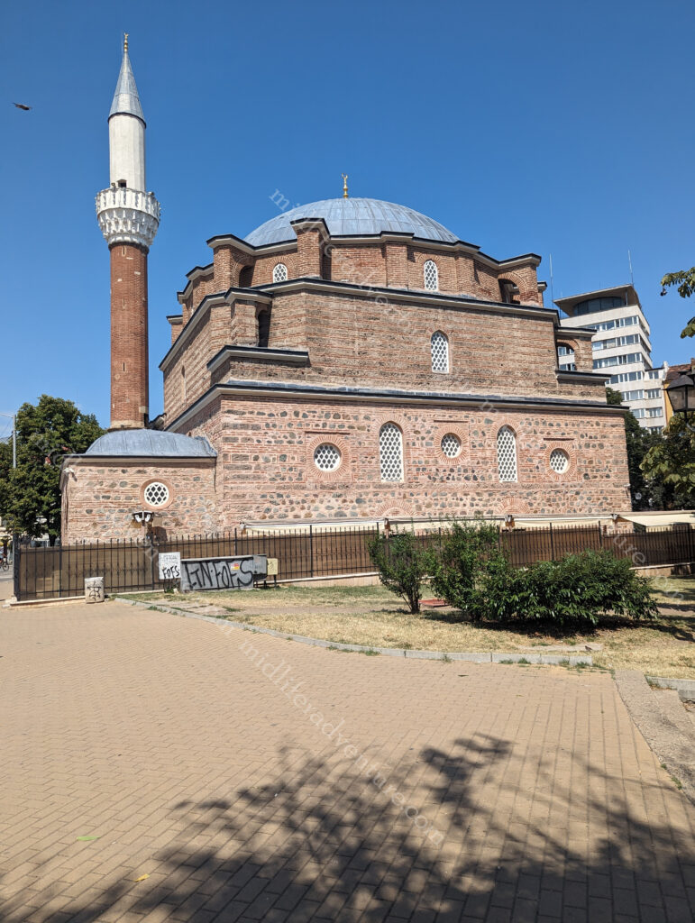
Almost across the road you will find the Banya Bashi Mosque. This was built in 1566, during Ottoman control of the city. It was built over natural thermal spas and at times you can see the steam rising from vents in the ground near the mosque walls.

The mosque has a 15m diameter large dome and prominent minaret.

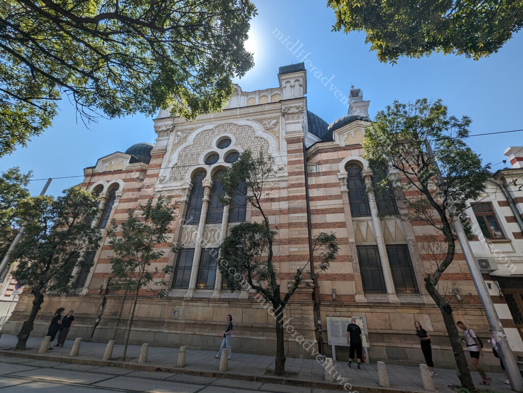
The Sofia Synagogue opened in 1909 in the presence of King Ferdinand I of Bulgaria.  Buried away in a backstreet it is tough to get a good camera angle for better photos, sorry.

And just down the road and around the corner you will find the Gypsy Markets. The description that we got from our hotel dude was it was a bunch of gypsies selling the things they had stolen or found in the trash that day. He also suggested not eating there as the meat was likely to be cat or dog.

We were here on a Saturday and Sunday and for the most part, the place was closed. Shops and restaurants worked normal hours, none of this I must be open the whole time. It was an interesting throwback to when people had lives.

A little inconvenient at times but hey.

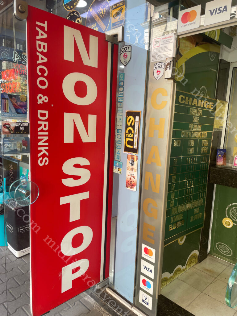
The only places that were always open were the alcohol and tobacco shops.

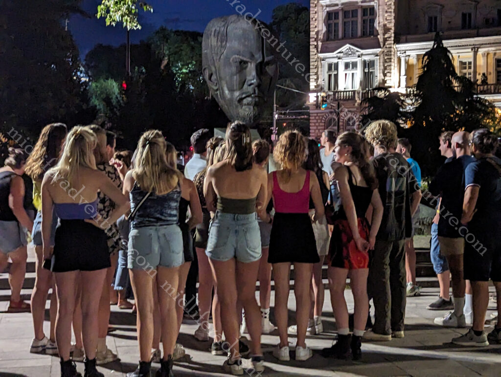
As with everywhere, the place had a bunch of statues dotted all over the place. But these ones seemed funkier and edgier than the usual ones that typically haunt big cities.

This is the Eastern Europe that we had been hoping for all along. The place is fantastic, cheap and friendly. The food is good and the sights are worth seeing without being mind-blowing. But mostly it is about the atmosphere. The place feels right. You could happily settle in and spend a month here just soaking up the culture and getting a sense of the place, and importantly you can do so without destroying the budget.

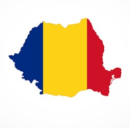
Romania

Romania is a country located at the crossroads of Central, Eastern, and Southeastern Europe. It borders Bulgaria (south), Ukraine (north), Hungary (west), Serbia (southwest), Moldova (east), and the Black Sea (southeast).

Romania is particularly known for the forested region of Transylvania, long associated with the Dracula legend. It is ringed by the Carpathian Mountains and has many well preserved medieval towns and fortified churches and castles.

Human remains found in Romania have been dated back to 40,000 years ago, making them the oldest known homo sapiens in Europe.

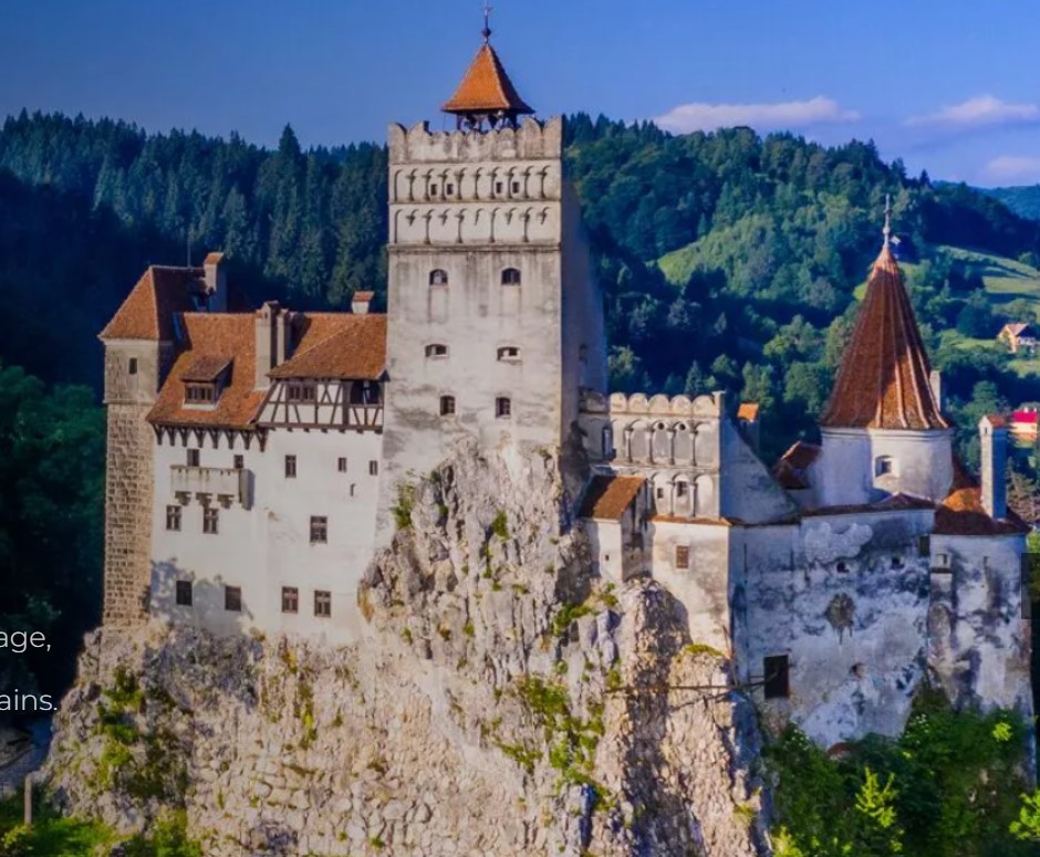
Castle Dracula

We did not get near this one, but I thought that I should at least mention it and provide a few stolen tourist brochure shots. More rightly known as Bran Castle it was built in 1377 and attracts over 700,000 visitors a year.

Bram Stoker’s character, Dracula, is a Transylvanian Count with a castle located high above a valley perched on a rock with a flowing river below in the Principality of Transylvania.

Bran Castle is the only castle in all of Transylvania that fits Bram Stoker’s description.

The Bram castle website offers the opportunity to get in touch with the creatures of the night through an exhibition entitled ‘A history of dreads in Transylvania’. This provides a history of local myths and fears (their symbols and significance) and the way they were reflected in the historiography of the 15th century. And how they were then discovered and used by Bram Stoker in the 19th century for the creation of Count Dracula.

Bucharest

My relationship with Bucharest is a mixed one. I have both loved and hated it at the same time. My first introduction was magnificent, we hopped off the plane and straight onto a local transfer bus that delivered us (close enough) to our hotel – seamless. Our hotel was one of the best we had seen thus far and was clean and efficient. The room was luxurious with a fully functioning air conditioning unit (it was about 37 degrees) which pleased me nicely.

Bucharest is a big capital city (2.2 million), and it doesn’t really have much to make it stand out apart from the main two or three tourist attractions. While certain aspects of the place are stunning and photogenic, the majority are in a terrible state of disrepair. Billions have been spent on the presidential palace and constitution square etc. but the rest of the place is being left to crumble down upon itself.

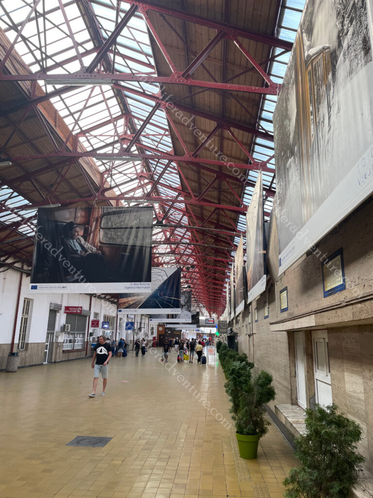
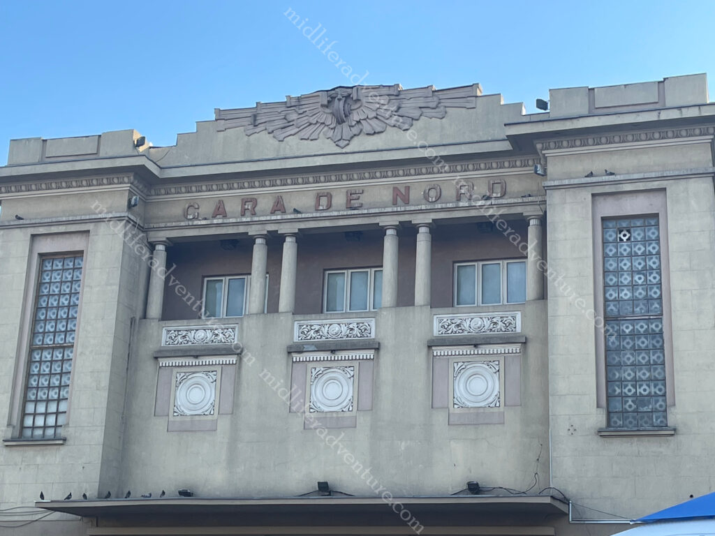
Having relaxed and cooled off, we had to find our way to the Bucharest Nord train station to pick up our physical tickets (to Moldova) for the next evening. On the map, it seemed like a simple enough task but this is where the wheels started to fall off.

There are two stations at the Nord, one is for the longer trains while another is for the local trains. We landed at the local one one first of all and it was a dump. Having been redirected to the main one (about 800m away) we walked along the urine soaked, rusting, vandalised and generally dilapidated path that at one time connected the two stations together. Travellators had been smashed and destroyed and at some point had became shelter to the homeless population leaving a very overt stench of urine. These have now been barred off to keep the homeless out.

We eventually got to the main station and after some consternation was able to locate and find our tickets (mainly due to the magnificent website the man in seat 61).

This is actually worth mentioning (www.seat61.com) is a privately run website by a guy called Mark Smith who started it as a hobby.

If you are ever looking to get on a train you need to check this website out. It gives you answers virtually any question that you may have almost everywhere in the world.

Having gotten our tickets (and sweltered in the heat) we (at considerable urging from me) opted to catch the Metro to Old Town. Disappointment number two. Old town Bucharest is almost entirely dilapidated or under repair. The buildings are falling down or are covered in scaffolding (at least they are trying to bring it back to its former glory). Those that are open are nightclubs, strip clubs, brothels, rub-and-tugs and really loud (overpriced) lager-lout bars.

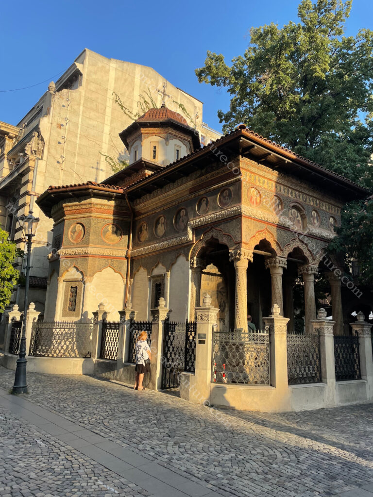
Stavropoleos Monastery is a monastery for nuns and was about the only thing in Old Town still worth looking at.

The building which dates back nearly 300 years has been heavily affected by earthquakes. Only the church still stands from its original state. 

Feeling very disillusioned, we caught the bus back to our hotel and had a nice meal in pleasant surroundings… tomorrow would be another day.

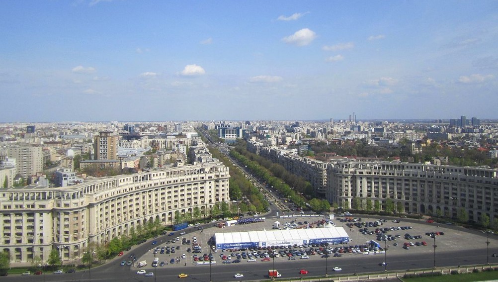
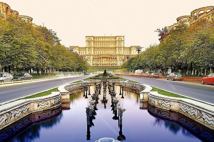
Its main draw is the Palace of Parliament is the heaviest building in the world coming in at just over 4 billion kilograms. This place is huge it is 84m tall with a floor area of 365,000 sqm. It was ordered by Nicolae Ceausescu the president of communist Romania and took 13 years to build. Uranus Hill was levelled, and the Uranus-Izvor neighbourhood was destroyed so the building could be erected. It was finished in 1997.

We came at it from the side (through the park) and were impressed by what we saw, but once you make your way around to the front things go up another level. The palace houses the two branches of the Parliament of Romania, three museums (contemporary art, communist totalitarianism and palace) and an international conference centre. The building has eight underground levels, the deepest housing a nuclear bunker, linked to main state institutions by 20 km (12.4 mi) of tunnels. From the palace, you look out onto Constitution Square.

Bulevardul Unirii (Union Boulevard) the Palace and Constitution Square were designed at the same time as an architectural unit.

It connects the Palace with  Alba Iulia Square (Piața Alba Iulia), running through Union Square.

The Romanian Athenaeum is the main concert hall in town and has been since it opened back in 1888. As we arrived almost the entire symphony orchestra was chain smoking at the side door in full tuxedos, not sure what was playing that day, but they were clearly on a break.

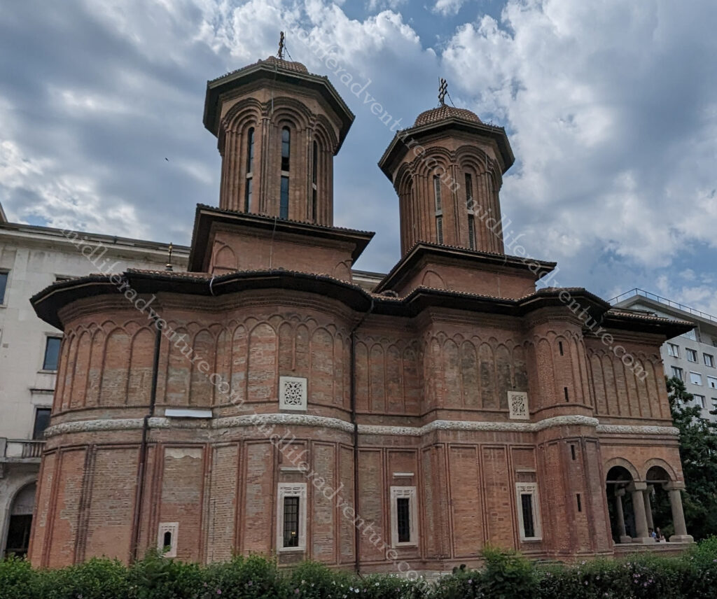
Kretzulescu Church is an Eastern Orthodox Church located in one of the corners of Revolution Square. 

Arcul de Triumf is a triumphal arch located in the northern part of Bucharest, Romania, on the Kiseleff Road. It was originally hurriedly built of wood in 1878 so that the victorious troops could march under it after Romania gained its independence. The current version was built in 1921–22, renovated in 1935–36, and renovated again starting in 2014. And of course, it is now the home to Instagrammers (who apparently now bring their own chairs with them for their photoshoots).

Having done the long tourist hike, we found ourselves back in the Old Town area again and thought we would give it one more try. Sadly, the CEC Palace, George Enescu Museum, peoples Salvation Cathedral, Coral Jewish Temple and many of the things we came to see were covered in scaffolding and were unable to be seen. The central part still sucked, but if you hunt hard on the fringes you can get glimpses of what it may once have looked like and hopefully what it may once again be.

There isn’t a lot of nature in Bucharest outside a few parks. It is a major city, and like most major cities it doesn’t have tons and tons of green space. However, Romania more broadly is known for its incredible scenery and nature. It is a bit of a shame that you don’t get a taste of that in Bucharest.

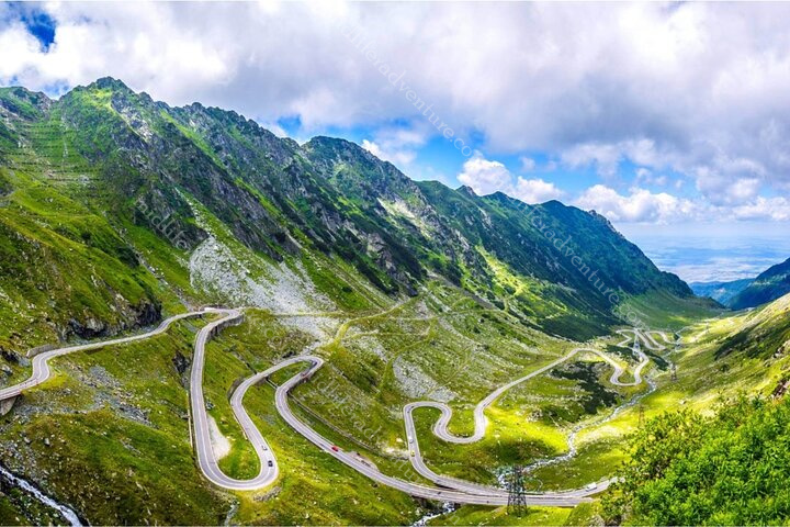
Other things that we missed but would like to come back and see include the Transfagarasan Highway this 80+ kilometer highway runs from Wallachia to Transylvania.

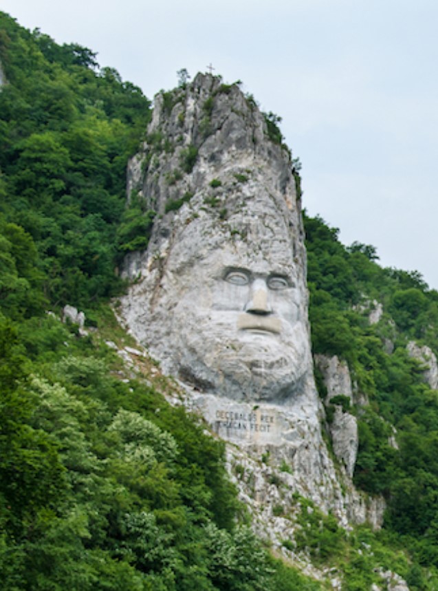
Also, the Statue of King Decebalus which is carved into the rock as you sail through the Iron Gates on the Danube River.

This 141-foot-high face of Decebalus honors this last king, who fought for the country’s independence against the Roman emperors Domitian and Trajan.

And beyond Brand Castle there are another 309 castles dotted throughout Romania that would be nice to see. They were mostly created between the 14th and 18th centuries and have served as fortresses for armies to defend the country against its many intruders.

Leaving Bucharest we once again headed to the Bucharest Nord train station for our overnight train to Moldova. Having learned our lesson we went straight to the main entrance and managed to avoid the urine soaked mess that we were met with on the first day.

A few days later, we found ourselves back in Romania on our way back from Moldova. Nothing really to report other than the highway robbery that was taking place at the train station and airport. Coffee usually ran to $2 but at the railway station it was $7 and at the airport, it was just over $10. We were going to get some food but even the Hungry Jacks at Bucharest airport was charging $25 Aussie for a small whopper meal. We chose to go without.

As I said up front, my relationship with Bucharest is a mixed one. The bad here is very bad and the normal is only barely passable. But the good is exceptional. On the whole, it was ok and eventually, it probably won me over. I would however like to come back to Romania to see some of the sights that exist a little further outside the capital.

Serbia

Serbia is a landlocked country in the Balkans. It shares land borders with Hungary (north), Romania (northeast), Bulgaria (southeast), North Macedonia (south), Croatia and Bosnia and Herzegovina (west), and Montenegro (southwest), and Kosovo.

Serbia has about 6.6 million people.

Having loved our (240 km and 8 hour) bus ride into Bosnia and Herzegovina we decided to fly out for a 40 minute puddle jump into Serbia, more specifically Belgrade.

Belgrade

Belgrade is the capital and largest city of Serbia. It is located at the junction of the Sava and Danube rivers with a population of around 1.6 million. Belgrade is one of the oldest continually inhabited cities in the world with the first dated records of habitation going back to the the 3rd century BC.

Our accommodation saw us perched between the old and new town directly opposite the old main railway station and associated park.

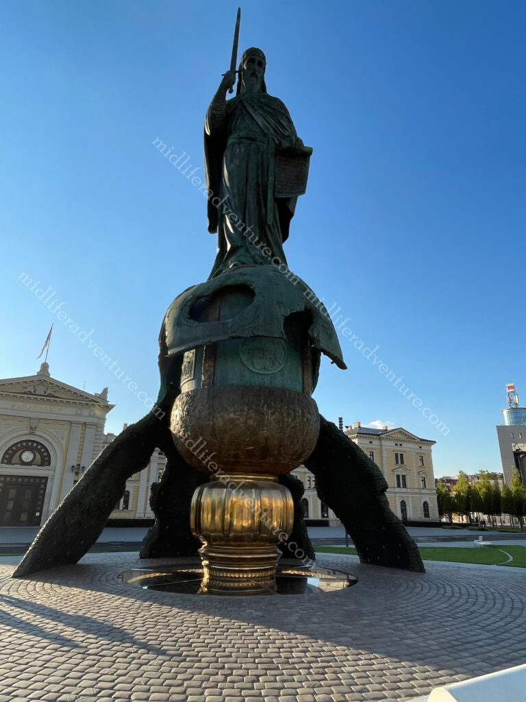
The park is amazing with an incredibly impressive monument to Stefan Nemanja (over 20m high).

He was a medieval Serbian nobleman who together with his son Sava (who the big church is named after) are considered the fathers of the Serbian Orthodox Church).

As it was early enough we dropped off our gear and headed out on a walk to see the sights. We chose to hit the ones that were away from old town, where we would be spending most of our time the following day. So we turned the corner from our hotel and started our way up the hill aiming towards St Sava Temple.

But within two blocks we had already landed upon the railway museum, which was incredibly impressive in its own right.

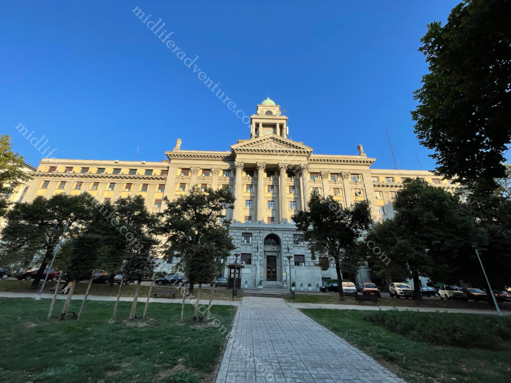
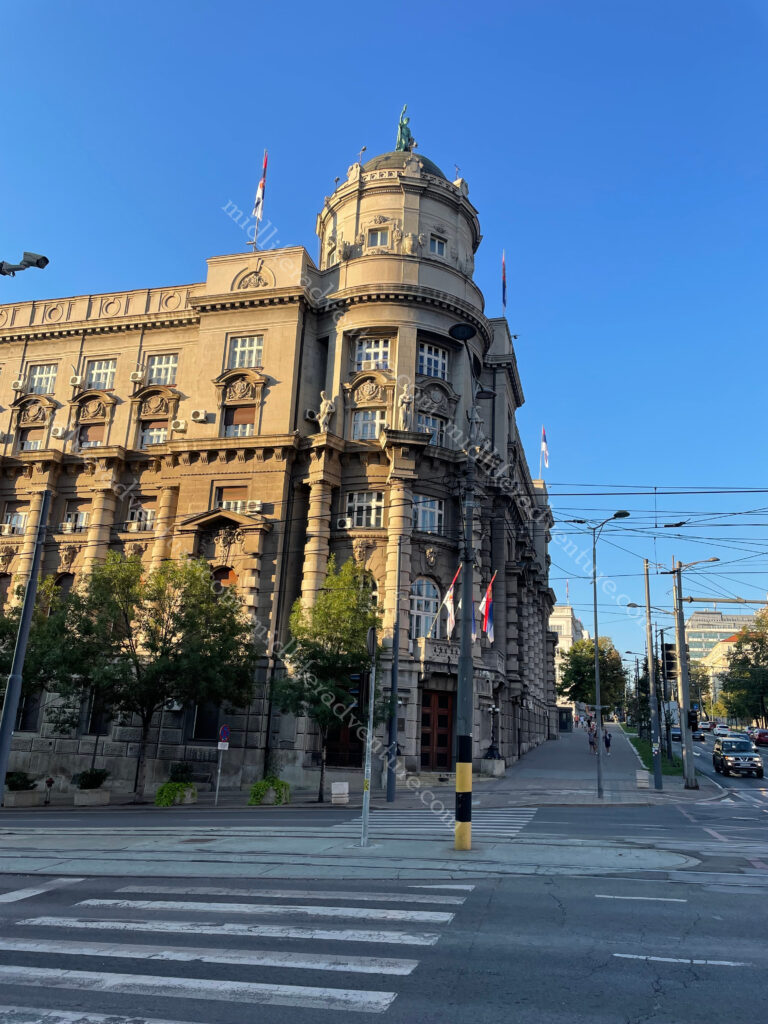
Half a block up and across the street we came upon the Government of the Republic of Serbia building.

This was built in the 1920s and was the first public building built in Belgrade for the purposes of the public administration of the newly formed Kingdom of Serbs, Croats and Slovenes.

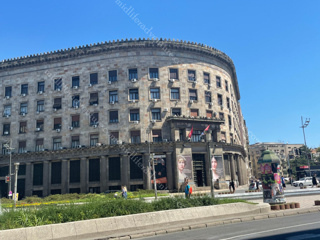
Next came the Department of Defence, the Ministry of Foreign Affairs, the Belgrade city museum, public health department. And they were all housed in amazing soviet era architecturally designed buildings that were incredibly impressive.

Anyway, we did eventually make it to St Sava Temple which again, blew our socks off. The church is dedicated to Saint Sava (son of the dude with the big statue opposite our hotel), the founder of the Serbian Orthodox Church and an important figure in medieval Serbia. It was built on the location of St. Sava’s grave.

The next morning we were up and off to the 160 acre Belgrade Fortress. For many centuries the entire town existed within the walls of the fortress. It sits at the meeting of the Sava and Danube rivers.

As with all of Europe, the warring tribes saw this piece of land change hands many times over the millennia. The romans had their turn and according to wiki “in the period between 378 AD and 441 the Roman camp was repeatedly destroyed in the invasions by the Goths and the Huns. Legend says that Attila’s grave lies at the confluence of the Sava and the Danube (under the fortress)”. In the following centuries the fortress suffered continuous destruction under the Avar sieges. 

The name Belgrade was first mentioned in AD 878 by Bulgarians. The fortress kept changing its master as Bulgaria had it then the Byzantines and then Bulgaria again, in the 11th century it was given to the new Serbian state as a wedding gift. In the 15th century it was conquered by the Turks (with short periods of Austrian and Serbian occupation), but it remained under Ottoman Empire rule until 1867, when the Turks withdrew from Belgrade and Serbia. 

From the fortress you got a fair view of the Gardoš Tower or Millennium Tower.

It was built and opened in 1896 to celebrate a thousand years of Hungarian settlement in the region.

Within the walls is St Petka’s Chapel which was built in 1417 and was allegedly erected over a sacred spring. At one time it held the holy relics of St Petka. With all of the destruction of the fortress over the years, the exact location of this chapel is not known so a replacement was built on the grounds in the 1930s.

The amazing thing for us was that to visit and walk through the fortress and associated grounds was 100% free.

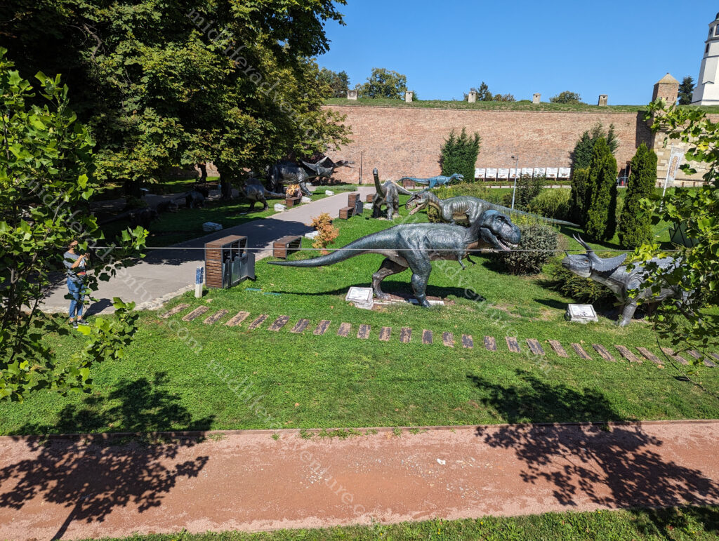
There was one odd children’s playground area with dinosaurs in it that had a small fee.

But as we did not want to play on the playground, we avoided that cost.

From the fortress, you spill out into the remainder of old town and the main tourist and shopping district of Belgrade. This part of town is full of funky old buildings with tons of character.

As you wander through you come upon the Cathedral Church of St. Michael the Archangel or simply St Michael’s Cathedral. This is a Serbian Orthodox church in the centre of the old part of Belgrade. It was built around 1840, on the site of an older church dedicated to Archangel Michael.

The Historical Museum of Serbia is currently in this building but it has been granted the building opposite our hotel (the old main railway station) as its permanent home and will be moving soon.

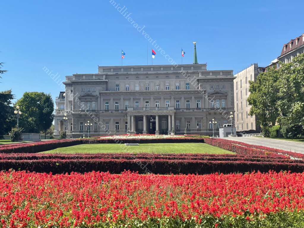
The Stari Dvor or old palace was the royal residence of the Obrenović dynasty (1800’s).

Today it houses the City Assembly of Belgrade. 

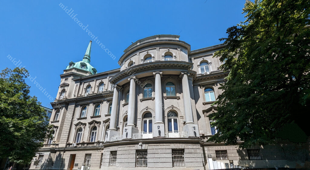
Novi Dvor or new palace was was a royal residence of the Karađorđević dynasty (late 1700 & 1800’s)

Today it is the seat of the President of Serbia. 

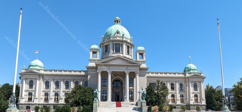
House of the National Assembly was built in 1936 and has served as the seat of parliament for the Parliaments of Yugoslavia, Serbia and Montenegro and since 2006, Serbia.

For the most part, Serbia has been great. The food is good (if not exactly heart smart), the prices are reasonable, the beer is well-priced, and there is plenty to see and do (mostly without charge). I would certainly not hesitate in coming back.

The Golubac Fortress is somewhere that looked amazing but sadly (at about 120km from Belgrade) we could not get to. It was a medieval (fortified) town on the Danube 4 km downstream from the current town of Golubac. The fortress was built during the 14th century and has ten towers. Most of these started square but evolved to get many-sided reinforcements to accommodate modern firearms.

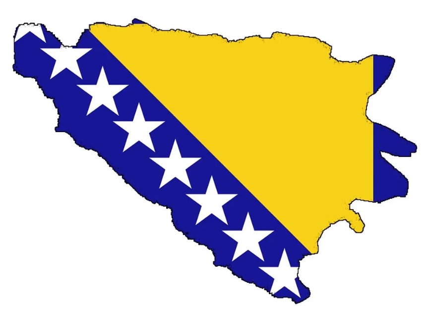
Bosnia and Herzegovina

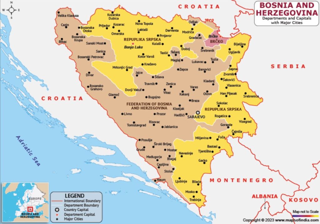
Bosnia and Herzegovina is a Balkan country bordered by Serbia (east) Montenegro (southeast) and Croatia (north and southwest).

It has a small coastline on the Adriatic Sea around the town of Neum.

The 1990s saw the breakdown of the former country of the Yugoslavia into several smaller territories. But the separation wasn’t peaceful and the Bosnian War raged between 1992 and 1995, leaving this beautiful country in ruins.

Well getting here was quite the experience. We were leaving the EU (by bus) and entering eastern Europe proper. Up until now the borders have been open and easy but leaving Dubrovnik and entering Bosnia and Herzegovina made for some interesting transits.

Our bus ride was 240km and took us well over 8 hours to complete. Leaving Dubrovnik in the morning we headed north and found ourselves at a land border crossing. So we all got out of the bus and were individually processed at the border just outside the town of Neum. What we did not know was that Bosnia and Herzegovina has a 20km stretch of coastline on the Adriatic.

So this meant that after a quick stop in Neum, we reached another border about 25 minutes later and had to all get individually processed out of Bosnia and Herzegovina.

Another hour or so on the bus and (guess what) another border to get us back into Bosnia and Herzegovina. Everybody out of the bus, queue up and be individually processed back in. Drive a little further and then it was lunchtime for the driver, so we stopped again.

Jablanica

At least at this stop we had some entertainment. We stopped at the town of Jablanica which sits on the banks of the Neretva river and Jablanica Lake. But most importantly it is a common meal stop for those driving. Which means that it caters for large numbers of transiting passengers.

And it seriously caters to large numbers. Our first hint was when we passed a roadside stall that was spit roasting 3 whole sheep. About 100m down the road was another, with about 10 sheep on the spit. And restaurant after restaurant we passed all with 5-10 sheep rotating over fires and embers.

Sarajevo is the capital and largest city (under 300,000) of Bosnia and Herzegovina and is on the Miljacka river. Sarajevo is well-known because it is where Archduke Franz Ferdinand was assassinated thereby pushing the entire world into conflict (WWI). The Latin Bridge is the site where the murder happened and therefore became a must-see.

Baščaršija is the historic center and old town of Sarajevo. This part of the city was built in the 15th century, and it quickly expanded.

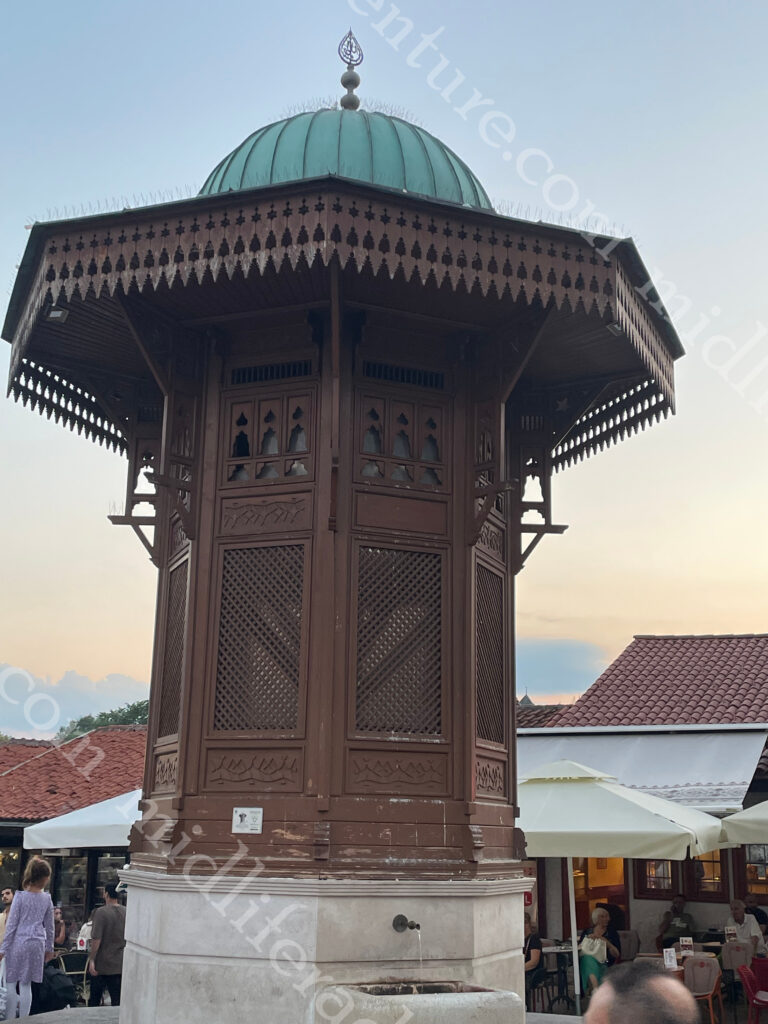
Sebilj, the symbol of Sarajevo, is at the very heart of Baščaršija.

It is a wooden water fountain dating back to the Ottoman era.

There were hundreds of these fountains all over Sarajevo. However, only one remains to this day.

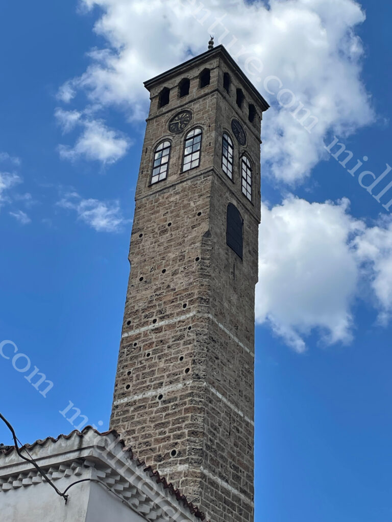
Towering over the city is the Sarajevo Clock Tower. It sits next to the Gazi Husrev-beg Mosque. It is estimated that Sarajevo Clock Tower was built in the 16th century.

It is the only public clock that shows lunar time and is set manually. There used to be more than 20 similar clock towers all around Bosnia and Herzegovina during in the Ottoman Empire.

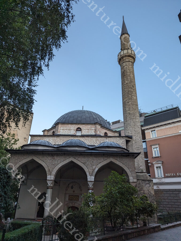
Gazi Husrev-bey mosque is the main mosque in Sarajevo.

Built in 1531, this mosque is the perfect example of the Early Istanbul Style. It is the largest historical mosque in Bosnia and Herzegovina and one of the best representative Ottoman structures in the Balkans.

Bezistan is a covered market that was quite common in the Ottoman Empire. Sarajevo has a well-preserved Bezistan, just a short walk away from the Clock Tower. Gazi Husrev Bey built the marketplace in 1540 while he was the governor of Sanjak of Bosnia.

Baščaršija Square is the main area within old town and gives you ready access to the wide array of mosques, bazaars, Jewish temples, cathedrals, cafes, restaurants and bars.

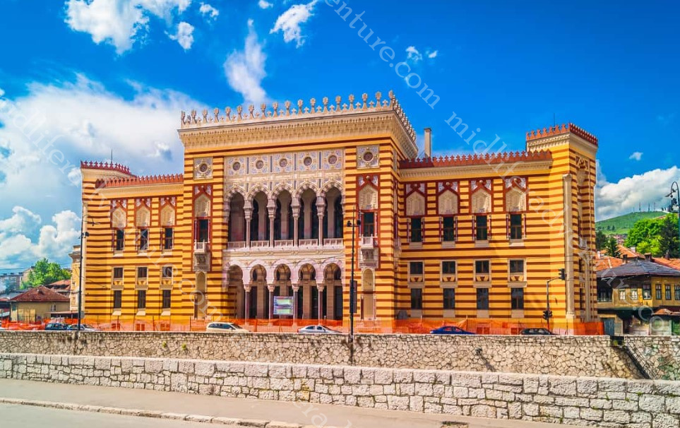
Sarajevo City Hall known as Vijećnica, is in the heart of Baščaršija. Designed in 1891 it was the largest and most representative building of the Austro-Hungarian period in Sarajevo.

One bit that I was not expecting was the heavy Muslim and Turkish influence on everything. This mostly has to do with my lack of knowledge about this part of the world as this is my first time visiting the Balkans (and Eastern Europe more generally). The country is more than half Islamic and the coffee is more along the Turkish lines, strong, rich and with the telltale sludge on the bottom.

Sacred Heart Cathedral is the big catholic church in town. It was built in 1887 in honour of the Sacred Heart of Jesus. The two bell towers are 43.2 m high. Above the portal is an octagonal rosette and a statue of the Sacred Heart.

The prices were good and the food was fantastic. We were very pleased to see that the regional love of lamb had also translated to the city. This meant we were able to get beautifully cooked lamb and veal and have eaten more slabs of meat than we had done in almost a year.

The central part of Sarajevo is very nice. But the drive into town reveals a country still trying to rebuild after war and conflict. It is clear that rebuilding efforts are well underway (the tram tracks were ripped up and being fixed all over town when we were here). But there is still much to be done. Almost every building (outside of the tourist heart) looks like it is either being built up or falling down.

I would happily come back to Bosnia and Herzegovina and spend more time here exploring. The countryside that we drove through was magnificent and there is enough to keep you amused.