Cruising the Caribbean

Well, a cruise of the Caribbean is a hell of a thing to contemplate. There are tons of companies going to any number of destinations. Some of these are countries, some are independent nations, some are foreign territories of other countries and some are private islands owned and operated by one or other of the cruise companies.

The sheer range of itineraries available is staggering.

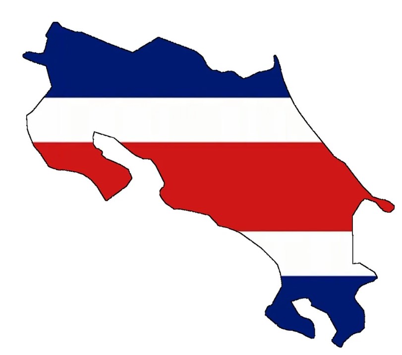
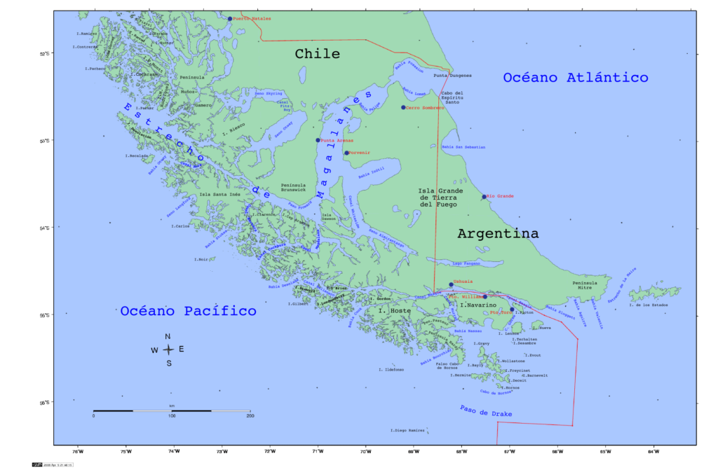
Let’s start with what is meant by the Caribbean and what areas are included. The Caribbean is a catchall phrase that includes the more than 700 islands, islets, reefs, and cays within the Caribbean Sea. But it also includes some mainland countries that border the Caribbean Sea and the North Atlantic Ocean add to this the nearby coastal areas on the mainland (including the Gulf of Mexico, North American mainland, eastern parts of Central America, and the northern sections of South America).

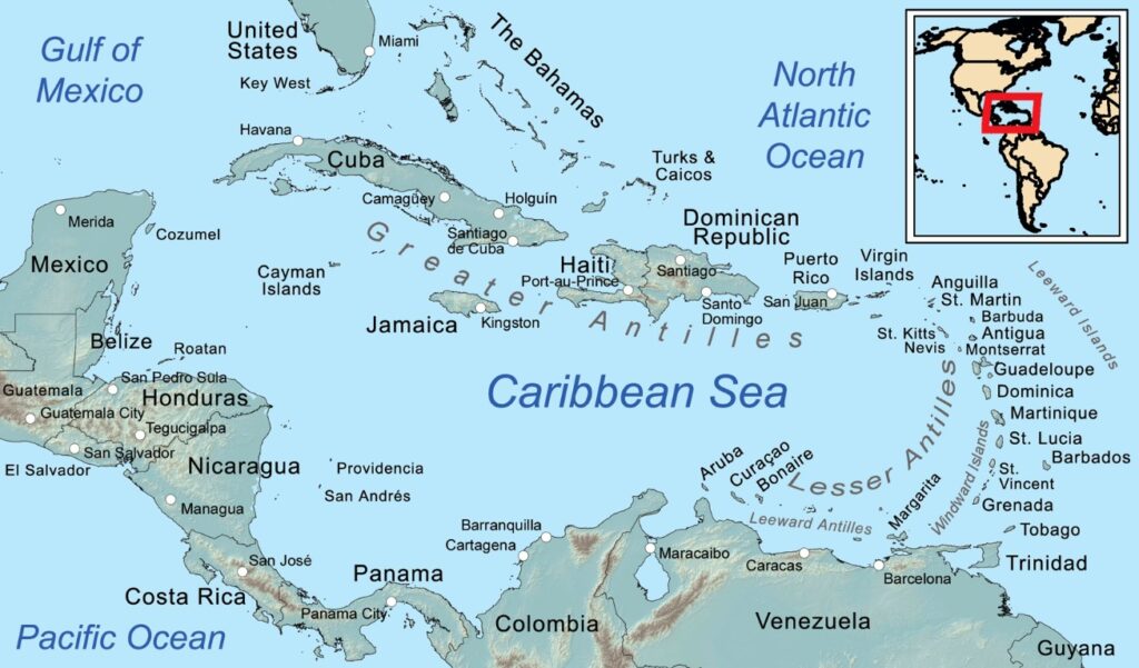
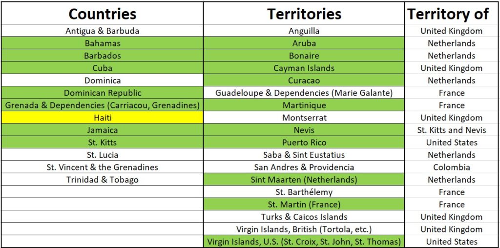
In total there are 31 individual countries or territories that make up the Caribbean (excluding the mainland nations that border it). So far, we have had the opportunity to visit 17 of the 31 countries or territories, with plans already in place to get to Haiti.

Getting About

To start with, there is no real ferry system in operation to allow you to bounce from island to island and airfares between islands can be quite expensive. So if you want to see a fair bit of the area, a cruise ship is your only real option (unless you have an amazing budget).

Cruise ship itineraries go to most of the islands (although due to some suspect security situations, crime and variable political stabilities some of the islands get missed). Add to this that some of the islands do not have deep enough seas/ports to allow access for the big cruise ships. That said, the majority do and accept the passengers and you just need to hunt the websites for the itinerary and line that suits you.
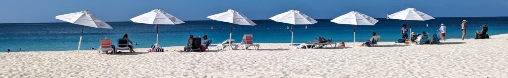
The Beaches

Almost all of the Caribbean islands offer excellent beaches, some are close (within walking distance) to towns and cities while others involve a (relatively cheap) taxi ride. Some of them have been flogged by tourists and are basically just sand and water (still pretty nice) while with a (very little) bit of effort, you can find snorkelling and wildlife amongst the many shallow reefs.

Many of the beaches will be private. This will mean a resort fee to access that area of the beach. This will typically buy you a lounger and that’s about it. Umbrellas and cabanas will be there, but they will (typically) be extra. Drinks (watery cocktails) and food (junky burgers and chips) will be available at highly inflated prices. When I say the beach will be private, I mean privately owned. You will still share it with 2-500 of your favourite strangers.

But it is not all bad, the beaches are nice, the scenery stunning and the views and sunsets will be amazing. And if you are ok with a weak cocktail in the sun then a good time will be had.

The food

The Caribbean is an exotic holiday destination known for its beaches, nature and the friendliness of (most) of its people. It is not by any means a food lover’s destination, and is unlikely to be so anytime soon. Traditional Caribbean food emerged several hundred years ago and has influences from African, Indian, Asian, Cajun, and European cultures.

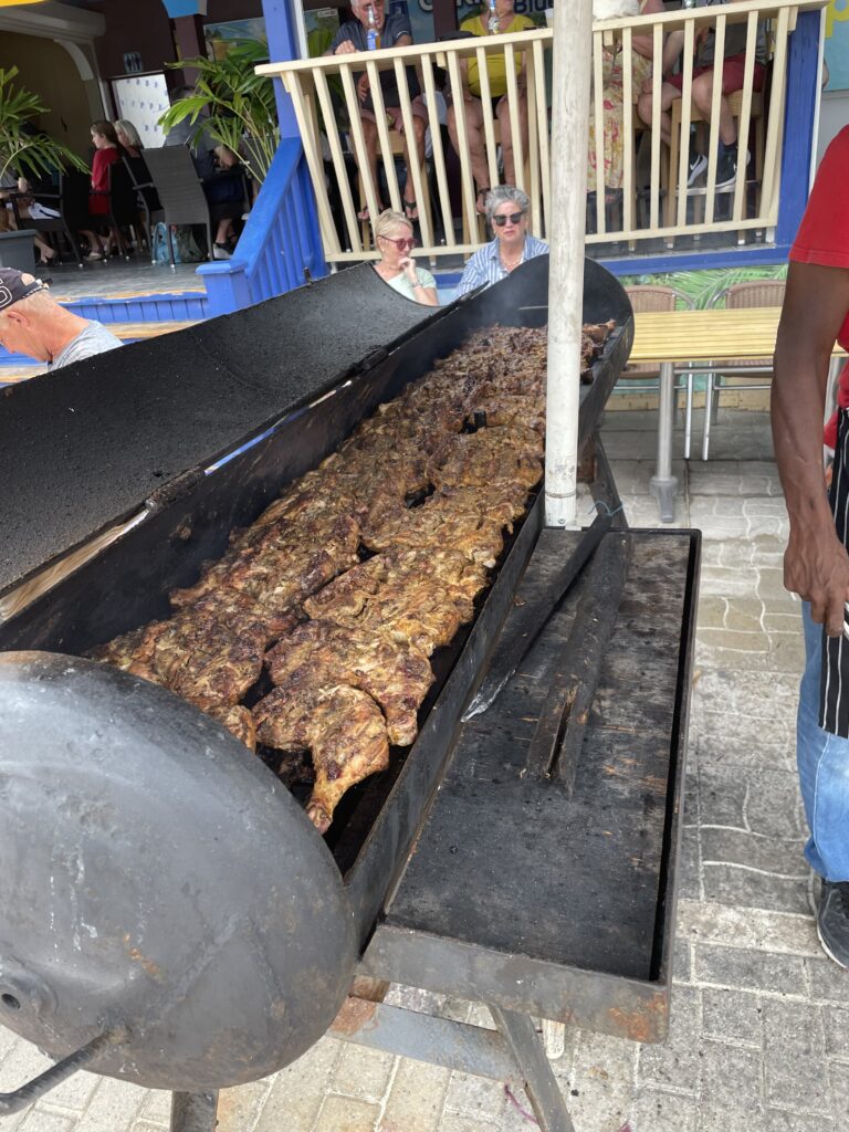
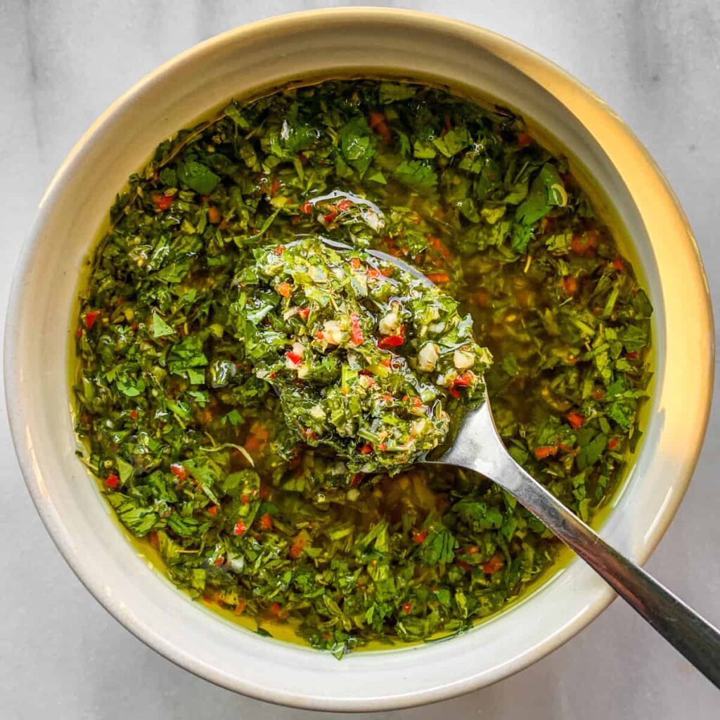
Jerk chicken is the staple. It’s is basically just chicken doused in spices and hot chillies, slow-cooked over pimento wood branches. But as you would expect, everyone has their own ‘unique’ recipe for the exact spice blend that goes into the mix.

It is nice enough, but good luck avoiding it if you felt like anything else.

If you get really lucky, you may find a pork chop (with the same sort of Jerk spice mix) but at least it’s something different. Unsurprisingly the burger patties come with BBQ Jerk sauce but every now and then if you are lucky, you may find one with a mango salsa.

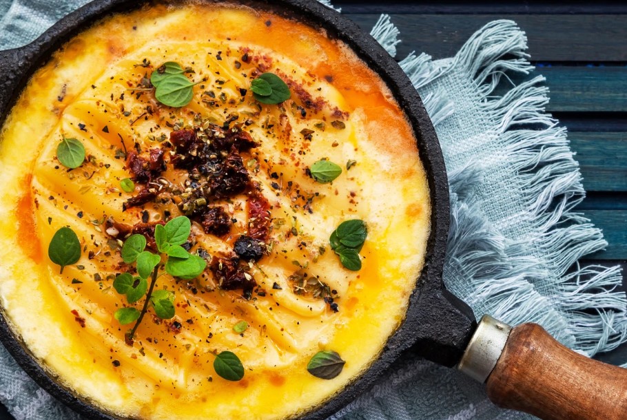
Ackee and saltfish (salted cod) is Jamaica’s national dish and is eaten morning, noon, and night. Ackee is a fruit with a savory, almost nutty flavor.

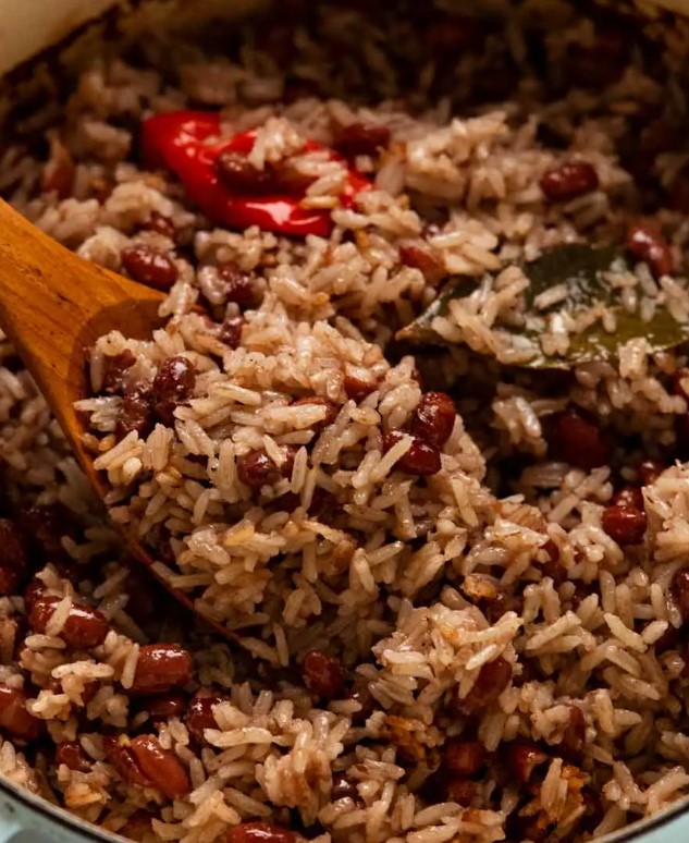
The ubiquitous side is rice and beans although is referred to widely as ‘rice ‘n’ pigeon peas’.

It is made by simmering the rice and beans in a coconut broth seasoned with spice, garlic, onion, and sweet capsicum.

It is also ok. But it is on every plate.

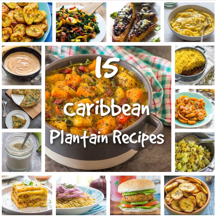
Plantain (a really starchy banana) is the next thing that will be tough to avoid. It is prepared in a variety of ways and can be quite tasty.

Sweet and savoury options abound and it will almost always be one of your sides (along with the rice).

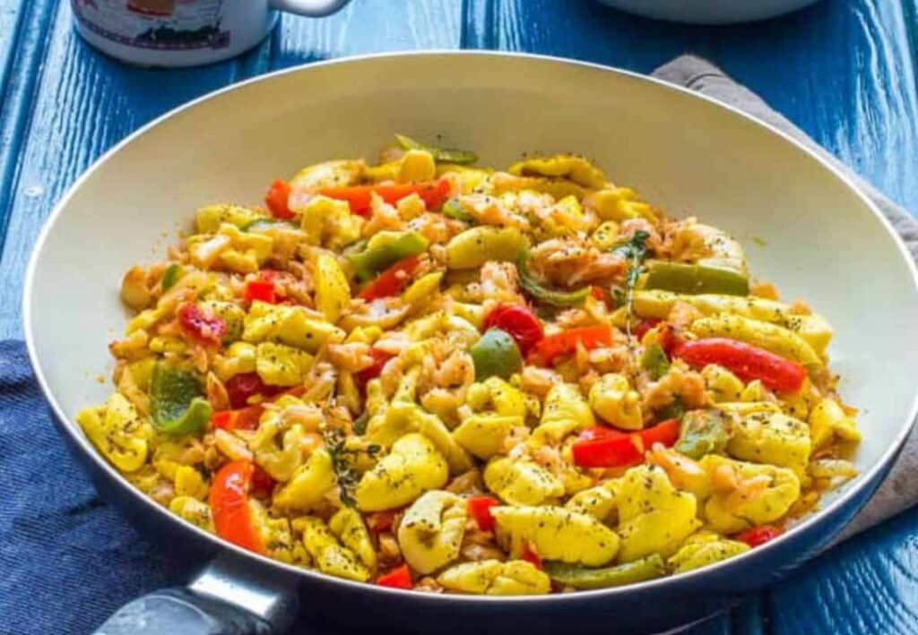
Being island nations, obviously seafood plays a fair role in Caribbean cooking. The first one that you will likely run across is the conch fritters. These are basically just deep fried critters from the conch shell. The next is peppered shrimp which is the spicy go to snack option for the masses. After this the usual mix of stews, soups and curries arrive.

It is not that any of this food in the Caribbean is bad, it is just the same everywhere, on every menu, with little else on offer. Every meal you order will be some variation on the things above. After a period of time, you will be craving something (anything) else.

Cruise Companies

There are currently 37 (of the 51 ocean going) cruise companies that operate in and around the Caribbean. They all offer similar types of cruises (and ports) but the price can vary greatly between them however, usually the higher the price the more inclusions there are (eg. drinks, better wines, wifi etc).

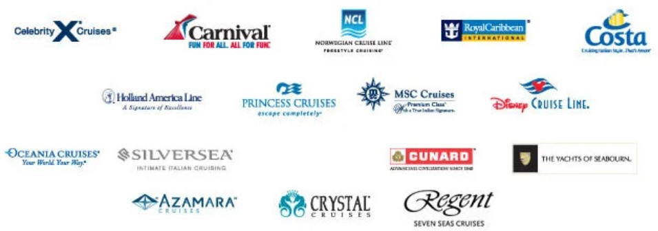
The normal type companies include Carnival, Royal Caribbean, NCL and MSC. Some catering to the premium services include Holland America, Celebrity and Princess. From here you get into the Ultra-Premium (Oceania, Azamara), Luxury (Cunard), Ultra-Luxury (Regent Seven Seas, Crystal, Silversea. And then there are the specialty type cruises (Disney, Windstar, Star Clippers and Virgin).

Some companies specifically target their cruises at families and children.

While others (like Viking and Virgin) do not accept people under 18 on board.

Cruise durations

The duration of your cruise (along with the company) is quite indicative of the type of cruise that you can expect. Cruises typically range from 2-15 nights taking in as many ports as is manageable within the allocated time frame. Cruises between 2 and 5 days tend to be booze cruises or full of little children with short attention spans. These usually never take in more than 2 ports.

Seven to 10 days is by far the most common cruise taken as it fits nicely with the usual US 2 week vacation period and allows for travel days for those outside a port town. This will typically take in 4-7 ports and will provide a nice mix of sailing days and port activities. The crowds tend to be a bit older than the party boat crowd and the ports tend to be a bit more interesting too.

Cruises over 10 days tend to cut out many of the kids and the younger adults that need to return to work (bearing in mind that US generally does not get the 4 weeks that we Aussies are used to). This means it is (generally) an older, more established cruise ship clientele.

The really long ones (trans-Atlantic and trans-Pacific etc.) tend to be for the seasoned cruisers, typically retired and under no time pressures to return to something.

Eastern vs Western Caribbean

Northern vs Southern Caribbean

Because the Bahamas (along with the Turks & Caicos) are close to Florida they are particularly desirable northern route locations for the short (booze cruise style) cruises originating in Florida.

Some cruise lines have created a southern route, moving Aruba, Barbados, Bonaire, Curacao, Grenada, and Trinidad & Tobago into this category as most of the route lies outside of the usual hurricane belt.
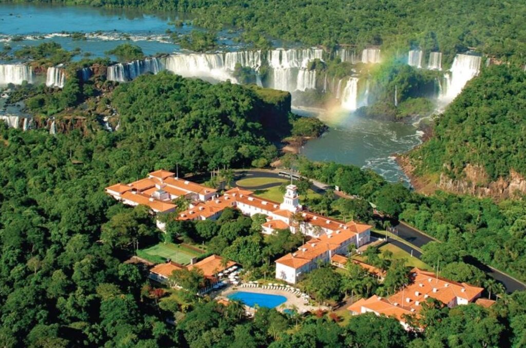
Cruise Ships

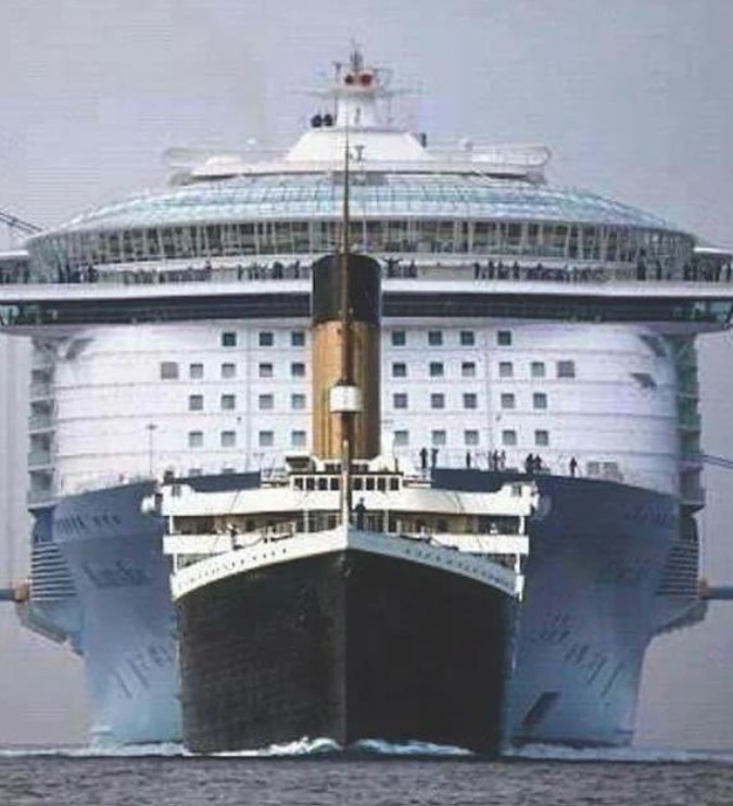
Modern cruse ships have been (and continue) getting bigger and bigger with every iteration.

The image on the left is a comparison of the Titanic (front) as compared with a modern day cruise ship.

I will focus on Royal Caribbean here as it has just launched the World’s largest ship (the Icon of the Seas).

The oldest in the fleet is the Grandeur of the Seas it is a 279 meter long, 32 meter wide ship that was built to house around 2000 passengers and an additional 750 crew.

It has two floors of dining rooms, three specialty restaurants, a theatre delivering Broadway-style shows, a gym, a spa, sports court, multiple bars, a sprawling casino, rock climbing wall two pools and more hot-tubs.

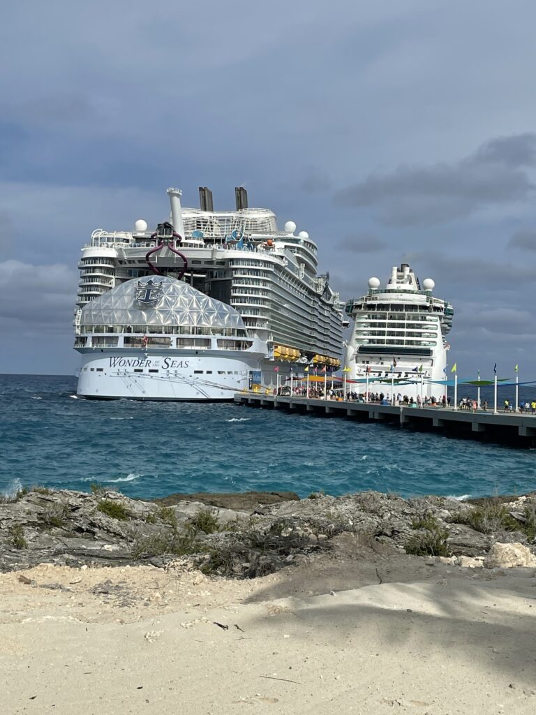
And with all of this, is by far the runt of the fleet offering the least amount of options and activities of the entire company. We have sailed on it three times and it is lovely.

The largest is more than 4 times the size and holds nearly 10,000 people at 365 meters in length.

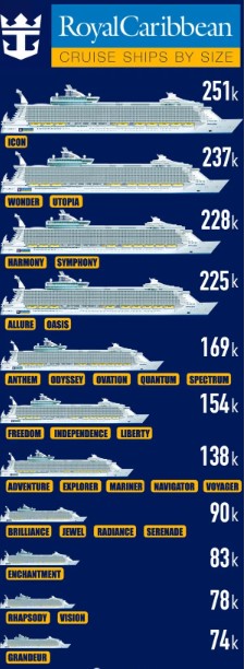
In 2009 when the Oasis of the Seas was introduced as the biggest ship in the world it had a capacity (at double occupancy) of 5,400 guests. The newest offering (the Icon of the Seas) was launched in January this year and is quite frankly ridiculous. The ship will feature 20 decks, 18 of which are for guest use. These decks have been split into “neighborhoods,” that include a Central Park packed with live plants.

Other features include:

  • the world’s largest water park at sea (six slides including an open free-fall slide, a 46-foot drop slide, family raft slides and a pair of mat-racing slides.
  • a three-deck cluster of pools,
  • a waterfall,
  • seven pools – including a swim-up bar, suspended infinity pool and the “largest pool at sea.”

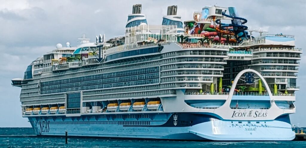
Cruise ships have gone beyond the usual buffet, main dining room and pool bar dining options. The new ship offers more than 40 options including 15 bars and more than 20 dining options.

Lets be honest here, this is not for me in fact it seems (having not been on it) terrible.

It is too big, has too much going on and will permanently be filled with screaming kids and their entitled parents.

Typically it is more the parents that I have an issue with rather than the kids, that just wanna have some fun.

But that is the joy of cruising, the RC fleet offers me another 27 ships that will be less confrontational than its latest offerings.

Our Cruises

We have now done 14 cruises in multiple destinations (Australia, Asia, Alaska and Iceland). These 14 cruises have put us to a loyalty level (kinda like frequent fliers) that gives us enough perks (free coffee and drinks etc) to make it beneficial to stay with the same company. Not that we dislike any of the others or particularly recommend this one but our perk level has bred loyalty.

Within the Caribbean, we have done a few different itineraries throughout the region that have seen us going to many of the ports (some of them on multiple occasions). Most of the ports left positive (or at least neutral) impressions, with only really Colon in Panama and Falmouth in Jamaica leaving negative impressions.

Aruba and Curacao are on the top of the list of frequency of our visits (more due to the itineraries that a conscious choice).

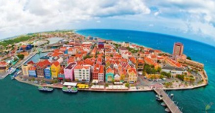
They are both Dutch colonies and are lovely. The streets are clean and the building and housing is typically European and is brightly painted. The beaches are clean and swimming and snorkelling abounds.

Barbados, Bahamas, Jamaica and St Maarten are next on the list of our multiple visitations and these four could not be more different if they tried. Barbados is alive and thriving during the week with turtle sightings straight off the beach. But it is tumbleweeds in town on the weekends (Sunday especially).

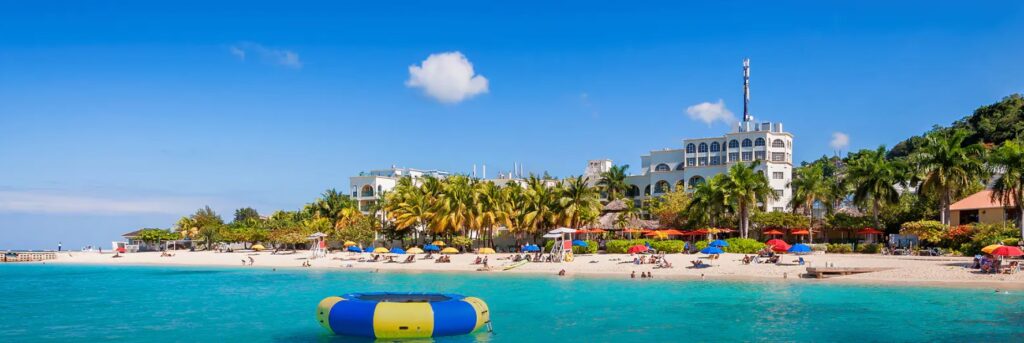
Jamaica was one of my least favourite of everywhere we have visited so far. It gave a feeling that you were not safe, even in the touristy bits it saw me having cannabis, cocaine and sex offered within 10 minutes of landing. Beyond the offers, there was a very uneasy feeling that purveyed. The first three blocks from port was neat and calm, but if you kept walking there was an overwhelming sense that you were about to be mugged.

We came here the next time and skipped town and headed to a resort fee-paying beach, it felt better but was a full on party beach. We paid for the transport and a beach chair and settled in for some sun, food and drinks. The enclosed resort option is beautiful and feels much safer, so if you are happy holidaying in a compound then it can be lovely.

Bahamas is an absolute tourism machine that had built its entire economy around its pirating history and the modern cruise port. The main centre is Nassau where there are a few natural attractions (old fort and some historical aspects) but the place has developed to exploit and profit from the cruise ships.

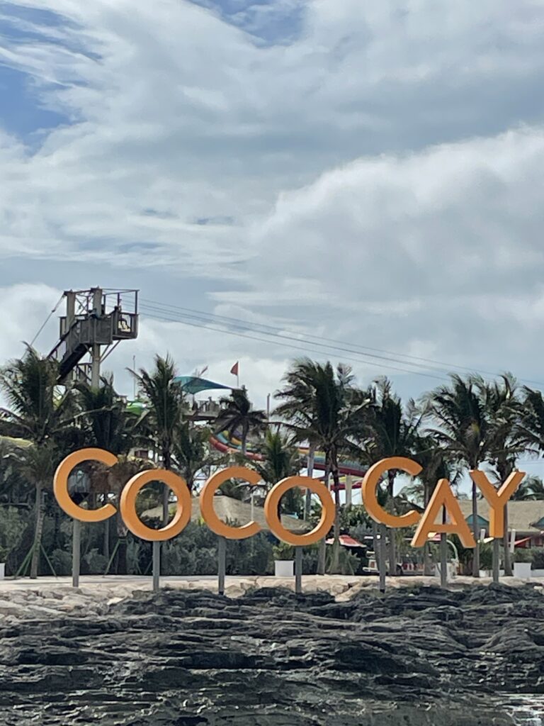
Coco Cay is part of the Bahamas tourist machine but this part of it is owned (or at least leased) by the cruise company.

It is a destination of its own, upon arrival you immediately enter into a world of waterparks, theme parks, shopping and beach walks where the tourist is king.

Everything on the island has been put there to amuse, entertain or fleece the clientele from a cruise ship..

St Maarten is the dual island with a Dutch and French side. It is well placed to cater to the cruise ship crowds, but maybe a little more subtly than is the case in the Bahamas. We have been here twice now (one at each side of the island) and enjoyed both of them immensely.

The rest of the places we have been to have (so far) only been single stop-ins but they have all left an impression. So here is our summary of our visitations to date.

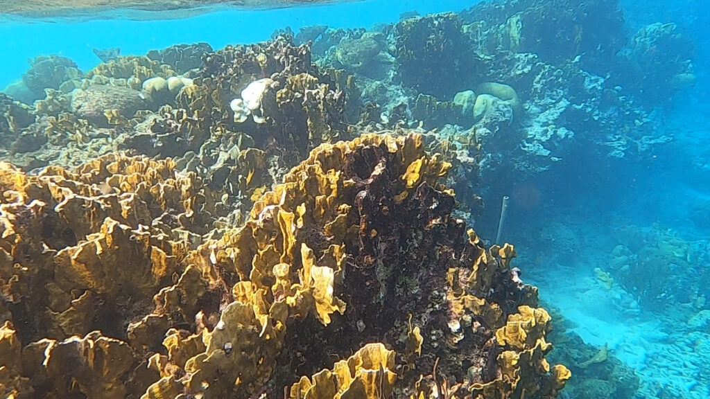
Bonaire (Kralendijk), was the pick of the stunning water so far. Great snorkelling coupled with a cute little town centre with all of the tourist appeal.

Cayman Islands (George Town) is a tax haven and tourist mecca for the European style tourists. Resorts aplenty, nice water and with a bit of effort some nice snorkelling and diving (once you get away from the resorts). The clarity of the water and the various shades of blue deliver exactly what I imagine when I get to a tropical island. And this place delivers that at almost every glance. 

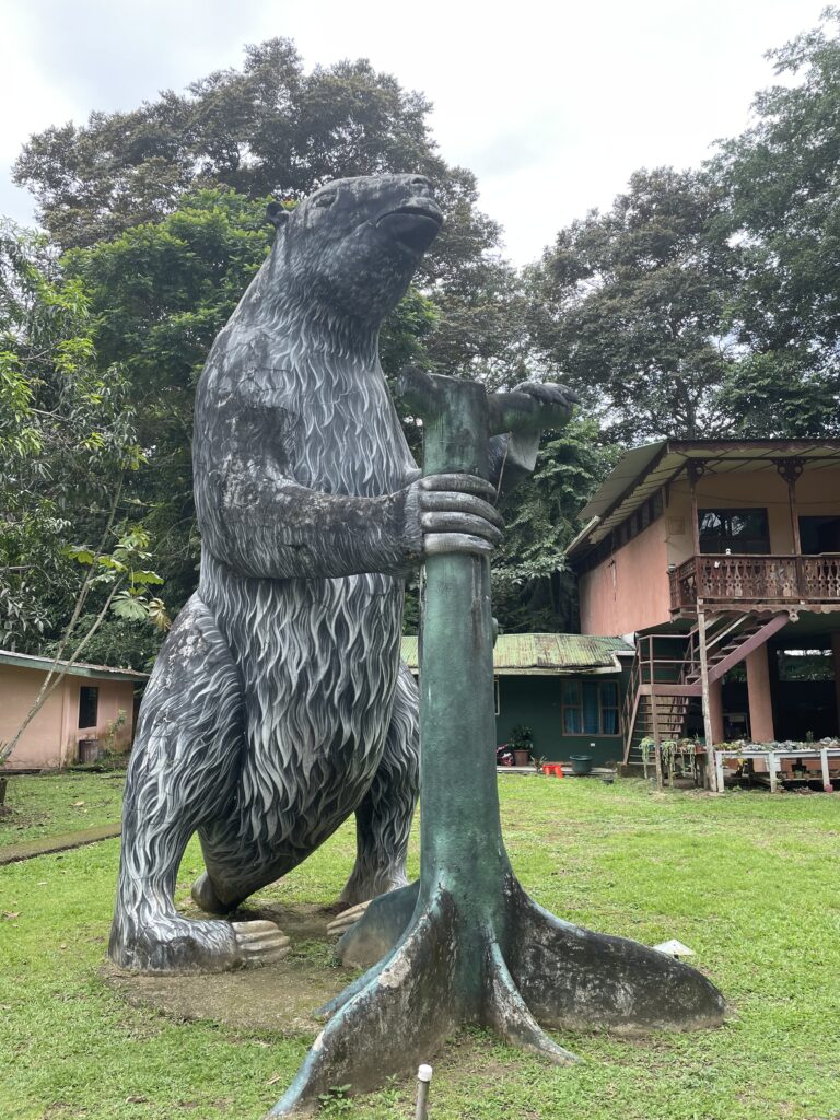
Costa Rica (Puerto Limon) I did love but it was mainly because I got to see and play with sloths (and with more time would have played with turtles). The wildlife is the main attraction and we really enjoyed it.

But the town centre was pretty sketchy and all the razor wire did ring a few alarm bells in our heads.

Dominican Republic (Puerto Planta) was amazing. The initial bit was tourist heaven (or hell if you prefer) with all of the water parks, pool and bars as soon as you land. If you never went any further, you could have several great days just in the manufactured bit.

But if you keep walking, you get into an authentic town centre and with a little more you land on the historic fort. There is a thriving local street art scene and the people are amazingly friendly. Based on our dip of the toe into the water I have already decided that the Dominican Republic needs at least a fortnight (if not more) to explore and enjoy.

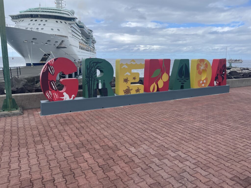
Grenada (St Georges), was nice but our arrival saw us in a town with super steep hills. The result was a nice waterfront promenade and burning calves for anything else.

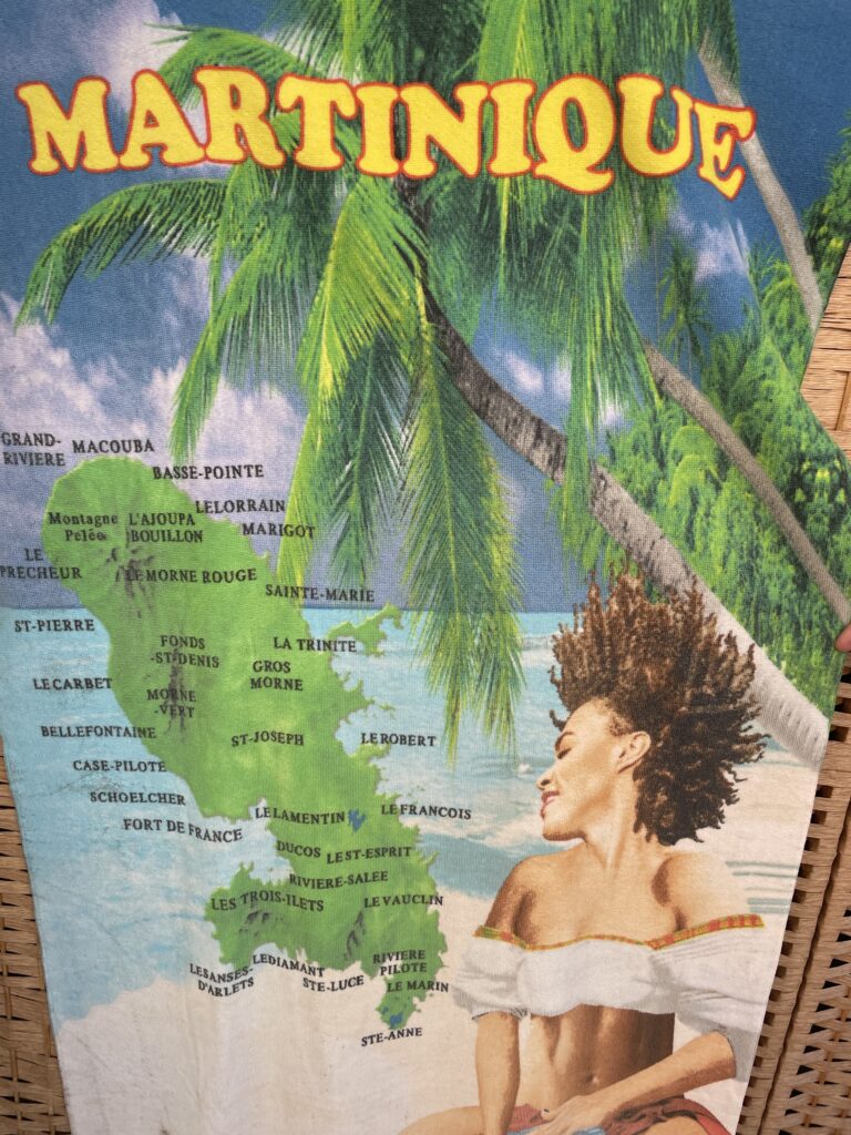
Martinique (Fort De France) was nice without being amazing and nothing about it made me want to rush back.

The town centre was ok as was the fort. It was good to come and spend a day exploring but that was about it.

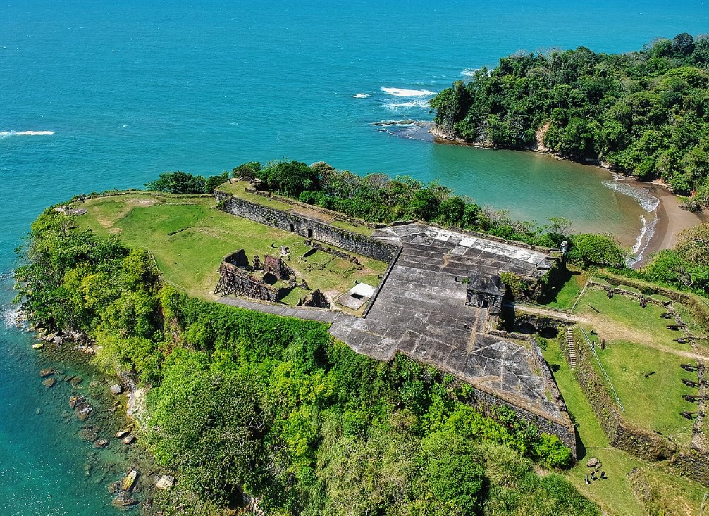
Puerto Rico (San Juan), was amazing and much like the Dominican Republic this place needs more time devoted to exploring. The Island has almost 300 miles of coastline and nearly the same number of beaches. A predominately walled city there is a huge level of fortification (especially to the sea) with all of the gates and things that you would expect from such a town.

Two huge 16th century Spanish forts and stunning views make it an incredible place to visit. The smiles and happiness that you are greeted with here is something to behold. I am very happy to come back here again and explore more of the island.

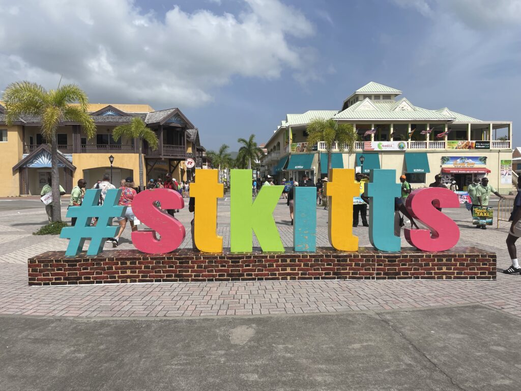
We popped into St Kitts & Nevis (Basseterre), and loved it. It was clean and easy to navigate with a really great feel to it.

The Beers

I really need to finish on the usual subject (for me anyway) the beers. Beer was introduced to the Caribbean by the British in 1880, and now each of the islands tend to brew their own with a few mass produced ones that service the region.

The first one you will likely find is the iconic Red Stripe from Jamaica. This will be closely followed by Carib which originated in Trinidad and Tobago and has since started brewing in St Kitts and Nevis and Grenada. Presidente (from the Dominican Republic) is sold widely through the region and Kalik (in multiple options) dominates the Bahamas.

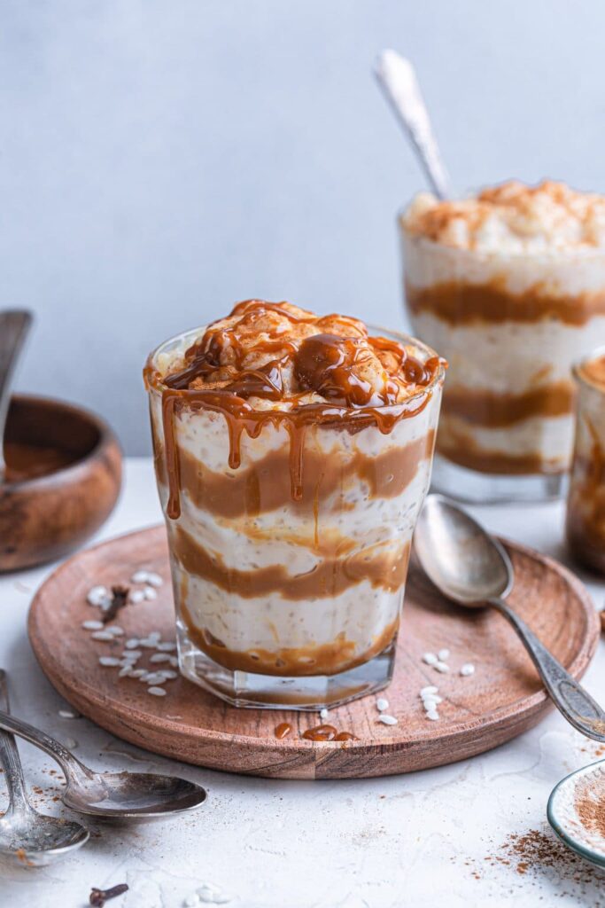
For the most part, the beers are all pretty good. They are typically light lagers that lend themselves to sipping on a beach in the sun.

Panama

Panama is a small nation (about 3.8 million people) that occupies the narrow stretch of land that connects North and South America. It also embraces around 1,600 islands off its Atlantic and Pacific coasts.

The nation runs about 770km long and between 60 and 180km wide. The famous canal cuts the nation in two at a width of 82km, with an average depth of 13m.

The Panama Railway

Fifty years prior to the building of the Panama Canal, the Panama railway operated, between the cities of Colon and Panama. The Spanish created the Camino Real (royal road), and later the Las Cruces trail to transport cargo and passengers across Panama. This provided a vital link between the coasts. These remained the main routes across for more than three centuries. By the 19th century rail travel had developed and it was time to design a cheaper, safer, and faster alternative. The Panama railway became the main shortcut for people making their way to California for the gold rush.

The Panama Canal

In 1881, the French started building the canal, but progress halted due to engineering problems and high worker mortality (Over 20,000 workers died during French building efforts). The US took it over in 1904 and completed the project with newly available technology ten years later (at least another 5000 died).

The canal is 82 kilometers (51 miles) long and has been providing a shipping shortcut for over a century. It takes about 8 hours to cross which saves days if a ship had to navigate down and around South America and back up the other side. This saves nearly 20,000 km.

In 1999, control passed back to Panama.

In the year it opened (1914), about 1000 ships used the canal.

Today, nearly 15,000 ships pass through it annually. The ships currently use both lanes of the lock only to move in one direction at a time.

The one-millionth ship crossed the canal in 2010, 96 years after it opened.

The original canal locks are 33 meters wide 300 meters long and 12 meters deep. The locks, located on the Atlantic and the Pacific sides, lift and lower the vessels to/ from the Panama Canal which is situated 26 metres from sea level.

The term ‘Panamax‘ was invented to describe ships built to fit through the canal. This existed for a century until in 2016, a third, wider lane opened for larger commercial shipping, capable of handling ships nearly 3 times bigger.

Every ship that passes through the canal pays a toll based on its size, type and volume of cargo. Tolls are set by the Panama Canal Authority. Tolls for the largest cargo ships can run about $450,000. Cruise ships pay by berths (number of passengers in beds). The per-berth fee set in 2016 was $138; a large cruise ship can pay hundreds of thousands of dollars to sail through the Canal. 

Colon

Oh my, initial impressions are not good. I have immediately gone to the Richard Pieper scale of civilisation as this place is the lowest that we have been on this scale since leaving India over a decade ago. The scale (of my invention) measures the nature of a city or region against a range of categories that include:

  • Smell (typically sewage but often just rotting trash on the sides of the road and the sulphur smell that comes from rotting biological matter in waterways.
  • Open drains (usually only becomes an issue when the place is filthy)
  • Rubbish – this was everywhere and we watched people throwing trash straight on the ground in front of us
  • Footpaths
  • Stray dogs

Well quite frankly, Colon only passed one level of this test, it did have reasonably functional footpaths. As for everything else that we saw, this place was a filthy disgusting, smelly, living slum. It was so bad in fact that the local bin chickens were actually vultures.

Colón is a city of around a quarter of a million people that is the seaport on the Atlantic entrance to the Panama Canal. It is the capital of the province and was founded in the 1850 as the Atlantic terminal of the Panama Railroad (then under construction to meet the demand during the California Gold Rush).

Much of the city was destroyed in the Colombian Civil War of 1885 and again during a massive fire in 1915. As town was such a fizzer the only really interesting thing to do is to take a cab (30 mins) over to the entry to the Panama Canal.

The Gatun Locks are the old of locks taking you into the Gatun Lake. The older lock and narrower canal has a bit more character than the newer Agua Clara Locks.

If you are particularly keen you can keep going out to Fort San Lorenzo, the ruins of a 15th to 17th century fort. We did not as our time in port was tight and we had wasted it walking through the slums.

Traditional Tribes

The three largest indigenous groups in Panama are the Kunas, Emberás, and Ngöbe-Buglés all of which still live in the remote areas of the country. They have their own dialects, languages, and customs and most of them also speak Spanish. The national traditional dress for women is a long, full white cotton dress decorated with colourful embroidery called a pollera. Men wear a traditional montuno, which is a white cotton shirt with embroidery and short pants.

Fun Facts

  • The inventor of “MURPHY’S LAW“, – anything that can go wrong will go wrong – was Edward Murphy Jr. who was born in Panama.
  • The lowest toll ever paid was 36 cents, by American Richard Halliburton who swam across the canal in 1928.
  • Panama has more bird species that the entire continental USA.
  • The Panama hat (toquilla straw hat) is actually from Ecuador.

Ok, I will go back to the adage of the difference between the Atlantic and Pacific Coasts here in Central America. The Costa Rican example was a bit similar but this place was very poor. Perhaps the Pacific coast and Panama City would have offered more. It may be worth going through the canal on a ship, and Panama City may have more on offer, but Colon lives up to its name and may well be the arsehole of the world.

Costa Rica

Costa Rica is a central American country of around five million people

It is bordered by Nicaragua to the north and Panama to the south. It shares a maritime border with Ecuador.

Costa Rica is a democratic and peaceful country that has not had an army since 1948. The government invests funds that it would have spent on an army into education, healthcare and pensions. Making it consistently one of the happiest places in the world. It also boasts an average life expectancy of 80 years.

Coffee was first planted in Costa Rica in 1808, and by the 1820s, it surpassed all else as the (tobacco, sugar, and cacao) as the primary export. Coffee remained the main export well into the 20th century, creating a wealthy class of growers, known as the Coffee Barons.

The Central Valley has the ideal conditions for producing coffee: altitude above 1,200 meters (4,000ft); temperatures averaging between 15°C and 28°C (59°F and 82°F); and the right soil conditions. By the mid-1800s an oligarchy of coffee barons had risen to positions of power and wealth, for the most part through processing and exporting the bean, rather than by actually growing it.

Education

Costa Rica has no military. In place of this, it has (until fairly recently) been investing all of the money it would have spent on education. Children spend 205 days in school every year and it is 100% free and mandated. For those of lesser means, lunches are provided by the government and corporate sponsorships cover backpacks, bags and equipment.

This spending resulted in Costa Rica having the highest literacy rates in most of the Americas, even surpassing the USA.

The previous government reduced this expenditure (from 8% to 3%) and the literacy rate visibly dropped.

So they were voted out at the first opportunity and the funding reinstated.

Green Credentials

Costa Rica’s real story is about how it managed to successfully grow its population and economy without destroying its natural resources. In the 1960s Costa Rica’s government realised that it their land use practices were not sustainable. In the late 1980s, they employed and implemented a National Conservation Strategy for Sustainable Development. This strategy made decisions based on input about the economy, demography, industrialisation, agriculture and energy. It had 5 main pillars:

  • a system of national parks,
  • debt reduction through land conservation,
  • development of ecotourism,
  • sustainable forestry practices, and
  • collaborations between government and industry to develop valuable natural pharmaceutical products.

Biodiversity – Once upon a time up to 90% of the country was covered by forests. Today only about 28% of the forest remains, but this is now in protected areas. There are 12 ecological zones and over 100 national parks, reserves or refuges. Costa Rica is the most biodiverse country in the world, with a whopping 500,000 species of wildlife (900 of which are birds) many of which are classified as rare or endangered. 

Volcanos – Costa Rica is part of the Pacific Ring Fire Circle and has over 200 volcanos tracing back over 65 million years. Around 100 show any signs of activity and only five are classified as active. the five active ones are Arenal, Poas, Rincón de la Vieja, Irazu and the Turrialba. The last one is currently active and should not be visited.

Interesting Eco Facts

  • Costa Rica is 98% deforestation-free.
  • They generate 99% of their electricity from renewable sources, such as hydro, wind, and solar power.
  • 80% of their renewable energy generation comes from hydroelectricity.
  • Costa Rica recycles 60% of its waste. T
  • All students in Costa Rica take sustainability courses from elementary school through university.

Sloths

We saw virtually none of the town (to be fair there was not really that much to take in) as Jill had booked us on a tour. The tour was to take in the local sloth rescue facility, a banana plantation and a boat ride through the jungle canals.

To say that sloths are a long term favourite of mine is an understatement and the opportunity to see them up close was awesome and, as our day panned out, we even got to see some in the wild.

The sanctuary specialised in rescuing sick, orphaned, abandoned or injured sloths. Particularly like my 3 armed little buddy in this video.

The sloth sanctuary got us up close and personal with about a dozen sloths (both 2 and 3 toed) while giving us the threatened habitat speech.

The talk even took us into the evolution of the sloth-type spiel which linked them to 4-5 meter tall prehistoric ancestors.

After the sloths came a local banana plantation (the second biggest earner of Costa Rica). To say this was interesting would have been a stretch. It was a small plantation, with some leaf cutter ants, and some bananas and that was about it. Jill did get to see some hummingbirds, but those little suckers are quick and were long gone before cameras could come out. But it was an ok way to kill an hour while staring at overpriced tourist trinkets.

From the banana plantation, we were off to a jungle cruise through the canals that act as the main transportation system of the country. As the roads are so poor and the ground is pretty wet, the inland canals provide the main means of transportation of both people and goods.

Our first sight getting on the boat was a small (maybe a metre) Caiman that was right near the launching site. From here we putted slowly along the canals looking for wildlife, which we found. There was a nice array of birds and lizards about with the odd sloth or two and some shagging monkeys in the trees.

We topped off our boat trip with some fresh fruit (pineapples, banana and watermelon), there was a table with some unidentifiable local fruits, but they were not on offer and then off to the ship for a speedy departure.

Turtles

As you would have worked out by now, turtles have become one of my favourite animals, having had the opportunity to swim with them. Well Costa Rica is home to some of the most important turtle nesting beaches in the world. Both the Pacific and Atlantic coasts have nesting sites, representing five of the world´s seven species of turtles. These are the: olive ridley turtle, giant leatherback, green, hawksbill and loggerhead.

Costa Rica is incredibly progressive in many ways, but as a random visitor, it seems pretty primitive. The houses are mostly run-down huts, and the sheer volume of razor wire in place is always troubling (although Jill did raise the option that it may be keeping the monkeys out). It does however seem like there is a distinct difference (in this region at least) between the Pacific and Atlantic (or Caribbean) coasts. The Atlantic coast settlements around the Caribbean are pretty basic and infrastructure is sparse.

Bolivia

Bolivia is a landlocked country in South America that is bordered Brazil, Paraguay, Argentina, Chile and Peru.

The administrative capital (and seat of government) is La Paz. The constitutional capital is Sucre (the seat of the judiciary). While the largest city and main industrial center is Santa Cruz de la Sierra.

Before Spanish colonisation, the area that is now Bolivia was part of the Inca Empire. But in the 16th century, Spanish conquistadors took control of the region and found it to be rich in silver deposits. Spain built its empire, in large part ,upon the silver that was extracted from Bolivia’s mines.

Bolivia was named after Simón Bolivar (officially José Antonio de la Santísima Trinidad Bolívar Palacios Ponte y Blanco) who was a Venezuelan leader that led the majority of South America (Colombia, Venezuela, Ecuador, Peru, Panama, and Bolivia) to independence from the Spanish Empire. Bolivia gained its independence in 1825.

Lake Titicaca is about the only thing I had heard about from Bolivia and we didn’t get near it. It is the largest lake in South America and sits high in the Andes mountains on the border of Bolivia and Peru. The western part of the lake lies within Peru while the eastern side is located in Bolivia, near La Paz.

Five major river systems feed into Lake Titicaca (Ramis, Coata, Ilave, Huancané, and Suchez) and more than 20 other smaller streams also empty into Titicaca. There are 41 islands on the lake, some of which are densely populated.

Most importantly, Lake Titicaca is the legendary birthplace of the Inca civilization, and is also believed to hold precious Inca treasure.

The other thing that I had seen about Bolivia was about the Yungas Road. This is more commonly known as death road. I had seen documentaries of cars, trucks and buses trying to navigate (and pass each other) on this stretch of road, often in pouring rain, with landslides taking place underneath vehicle tyres. All of this on the side of a cliff with inches to spare.

The steep slopes, lack of guardrails, narrow width of the road (3 meters in some places), weather conditions (rain and fog would reduce visibility), muddy terrain and loose stones made it the most dangerous road on the planet. It was infamous for its dangerous conditions and deaths. Before an alternate route was built it averaged 209 accidents with 96 deaths per year.

In July 1983, a bus fell from the Yungas Road into a canyon, killing more than one hundred passengers (I am still trying to work out how you get 100 people in a bus) in one of the worst road accidents in Bolivia. Until the mid-1990s, 2-300 drivers fell off to the cliff each year.

When it stopped being used as a vehicle road (due to the danger) it has now become a 60 km downhill mountain biking route between La Paz and the Yungas region.

Even as a cycle path, at least 18 cyclists have died on the road since 1998.

Santa Cruz de la Sierra

This mouthful translates as the Holy Cross of the Mountain Range and is the largest city in Bolivia, with a population of around 2.4 million.

The city was first founded in 1561 by Spanish explorers and remained fairly small until the mid-20th century.

But now it is the most important business center producing nearly 35% of Bolivia’s GDP, and receiving over 40% of all foreign direct investment in the country.

Our arrival here was great. We checked in to a local hostel that was right in the middle of things (restaurants, clubs and bars) and a relatively short walk (1.5 km) to the heart of town. Having arrived fairly late (and not that hungry) we settled into a local cafe for some refreshing beverages and a light snack. As it turned out our snack was quite considerable and our beverages were very refreshing.

As we finished up and returned home, a great storm hit that dumped rain for about the next 10 hours or so. So the next day we kicked back waiting for the rain to ease before starting our schlepp around the tourist sights in town. The first thing that we hit on the walk was the Parque El Arenal which is a park with a large lake, fountains, and an epic mosaic mural by artist Lorgio Vaca.

After the park I saw the local barber and decided it had been a while since I had been Manpered.

So I pulled in for a haircut and a straight razor shave.

I still highly recommend these.

Next stop was the main square (the Plaza 24 de Septiembre) which is a large square filled with plants, tall palm trees and benches. Until recently, sloths were hanging from tamarinds’ branches bordering the square. They are now in the zoo. And they had the coolest little old dudes wandering about in yellow offering to sell you a coffee.

The square is dominated at one end by the Cathedral Basilica of St. Lawrence.

The rest of the square is surrounded by government buildings and shops. There is an artisanal alley close by with very cool local handicrafts. Which i would have got some if space was not an issue. 

Plaza Calleja is a huge fizzer, billed as the centre of South America.

It is just a tiny park with the centre allegedly marked with a wooden cross and a sign with city names and distances.

If you take a good look at any map it is not really the at the centre of South America.

The tourist blurb billed a Christ the Redeemer, similar to Brazil, right here in Santa Cruz de la Sierra.

Needless to say we were underwhelmed when we found it holding up traffic as a roundabout, at a busy intersection, just North of town.

Having blitzed town we opted to take a private tour that cost us about $100 for the driver for the day but involved a 6am pick up and a whole day exploring with a 5:30 pm drop off. So for almost 12 hours of his time and the fuel and guidance $100 (for the two of us) it was a steal.

Samaipata 

About 120 kilometres (and over 3 hrs driving) to the southwest of Santa Cruz de la Sierra in the foothills of the Andes (still at just under the height of Mount Kosciuszko) is the small town of Samaipata.

The town itself is seriously nice and small with colonial buildings and narrow cobblestone streets. The centre is set around a really nice, and seriously well used park, which seems to be the focal point for all activities in the tiny town (under 5000 people).

But the main reason for coming was to see the El Fuerte de Samaipata or Fort Samaipata. But before we did, a quick pop into the Archaeological Museum (a four room display) for a poke about (one $11 ticket does both) before heading up the mountain to see the main attraction.

But before you get to the site, you are met with some pretty spectacular mountain, farmland and jungle views from the foothills of the Andes.

This is a UNESCO listed pre-Columbian archaeological site. The site encompasses buildings of three different cultures: Chané  (pre-Inca), Inca and Spanish. It is believed to have been started by the Chané but there are also ruins of an Inca plaza and residences, from the late 15th and early 16th centuries.

The archaeological site is about 20 hectares (49 acres) and is divided into a ceremonial sector and an administrative/residential sector. The ceremonial sector is a large rock (220 x 60 metres) that has been almost completely covered with carvings of both Inca and pre-Inca origin. At the highest point of the rock you find “coro de los sacerdotes” (choir of the priests) . This is 18 niches carved into the rock, that were believed to be seats.

The residential and administrative sector is believed to have been an Incan provincial capital. It has a large plaza about 100 metres on each side bordered by a “kallanka,” (rectangular building typical of Inca cities). The kallanka is 70 metres long and 16 metres wide and was typically used for public gatherings, feasts, and housing visitors and soldiers. The kallanka at Samaipata is the second largest in Bolivia.

Having milled about taking photos for a few hours we headed back to town for some well-needed lunch and a look around the tourist shops in the rain.

This was a fantastic day that saw us hiking up and down the side of a mountain and checking out some Incan ruins. I did not know it existed before now, but really loved the opportunity to get out and about amongst it.

About 35 minutes from Santa Cruz you can find the Biocenter Güembe Mariposario, which is a combined eco-park and a pool complex. The park is home to the world’s largest butterfly sanctuary and houses a diverse collection of orchids in its “orquideario“. There is an aviary where you can see scarlet macaws, toucans, parrots, peacocks and other colourful tropical birds, along with the odd monkey. Having seen birds, butterflies and not particularly being into pool developments we passed on this, but by all accounts it is ok.

On our middle evening in Bolivia we had a very ordinary meal that we decided to top off across the road with an extraordinary dessert.

It was extremely decadent, totally unnecessary, over the top and was magnificent.

Well Bolivia has been great. This goes on the list of places to come back to to get up high in the mountains to La Paz and Lake Titicaca. We did not make it this time as time was tight and we both knew full well the effects of altitude after our earlier Everest adventure.

The next trip will include the long awaited Machu Picchu in Peru which sits at a similar elevation as Lake Titicaca and Cusco. If you want to play about at decent elevations we found last time around that it is best to spend some time acclimatising. So it may be a nice trip to bounce about at the 3500-4000 meter elevation level for a while doing so.

Paraguay

Paraguay is a landlocked country in South America, bordered by Argentina, Brazil and Bolivia.

There is a population of about 6.1 million with around 2.3 million living in the capital and largest city of Asunción and surrounds.

The Spanish originally colonised Paraguay in the early 1500s and in the early 19th century got its independence from Spain. It went through some odd governments, internal wars and some dictators until 1989 when it installed a democratic system of government.

Paraguay is home to the world’s largest water reserve. The Guarani Aquifer, is located underneath Paraguay, Uruguay, Brazil and Argentina. It stretches 1.2 million square kilometres and holds 40,000 cubic kilometres of fresh water. It could supply fresh drinking water to the world for around 200 years.

In addition, Paraguay has the world’s second largest hydro-electric powerplant. Shared with Brazil, the Itaipu Dam is built on the River Parana. It generates nearly all of Paraguay’s electricity as well as Brazil using approximately 90% of the energy generated too.

Bizarrely, Paraguay has the world’s largest Navy of any landlocked country in the world. It may not have a coastline, but it has naval aviation, a coastguard and a river defence corps too. The Paraguayan navy operates on the country’s rivers and can access the ocean through Argentina.

Paraguay is first and foremost a tax haven. According to our hostel owner, it is corrupt, but not as corrupt as all of the countries around it. Paraguay offers global citizens, remote entrepreneurs and digital nomads offshore fiscal residency. Other nations that offer this require you to spend at least 3 or 6 months per year in the country but in Paraguay you only need to visit once every three years (after the original setup). All offshore earnings are tax free and local earnings are taxed at favourable rates.

Money

After walking around Argentine with hundreds of essentially $1 bills, the situation in Paraguay was very different. The first thing that Jill handed me was a 100 million Guarani note (about $20).

So if you want to be an instant billionaire, change around $200 bucks worth of local currency and you are all set.

Asuncion

Asunción is one of the oldest cities in South America and the longest continually inhabited area and is known as “the Mother of Cities”. From Asunción, Spanish colonials launched expeditions to find other cities. According to the 2022 Census, just under half a million liver here and up to 2.3 million live in the greater metro area.

Doing our early research there were about two interesting (ish) things to see in town and due to the timing of cheap flights, we would be here for around 4 days. So we had plenty of time to poke around and get a feel for the place rather than just dart about. This was a good thing too as the temperatures for our visit started at around the 37-degree mark and climbed from here, so hiding in the air conditioning in the afternoon was in order.

The city has some stunning old architecture, but like Valparaiso it has all pretty much been left to rot away. There is a little bit of street art (but not very much. But that which there is, is related to the native tribes that existed before Spanish Colonisation. There were five linguistic groups (Guarani, Maskoy, Mataco Mataguayo, Zamuco and Guaicurú) covering 19 Indigenous tribes.

Our walkabout took us through one of the few parks in town, there were others but they were fenced off and locked off from the public. We found the old and derelict railway station that ran with steam trains through to its demise in 1999.

Panteon Nacional de los Heroes is the mausoleum of the country, where the remains of various significant figures lay. The remains include the first president, the heroes of the Chaco War against Bolivia, the children martyrs of Acosta Ñu (an 18th century battle) and two Unknown Soldiers.

The Asuncion Cathedral is dedicated to the House of the Virgin of the Assumption and is the seat of the catholic church in the city.

Casa de la Independencia is basically just a small but important house.  In this house the emancipation of the country (from Spanish rule) was planned.

A group of Paraguayans (known as the heroes of independence) emerged from this house on the evening of 14 May 1811, to declare the independence of Paraguay.  It is one of the few colonial houses that remain in Asuncion and gives a view of what Paraguay was like 200 years ago.

Palacio de López is a palace that serves as workplace for the President of Paraguay and is also the seat of the government of Paraguay.  Our visit saw about 20 riot police just milling about in the park with full riot gear. Nobody was fully geared up but riot shields, helmets and shotguns were all about. But as it was a 42 degree day, nobody had enough energy to protest anything much.

Paraguay has a history of protests, with major protests being held in 1986, 1999, 2012, 2017 and again in 2021.

Jill did manage to spot one restaurant on our wander around town.

But for some reason the idea of eating at the Rusty Colon did not appeal.

The Icono Tower is the tallest building in town (at 37 storeys).

It is a bizarre spindly-looking thing sitting all out on its own. Apparently it is one of the most dominant skyscrapers in South America.

But really it looks like someone randomly jammed a red needle into the ground and forgot about it.

La Costanera de Asuncion is basically just a boardwalk/ promenade type area along the river.

But there is very little on the river.

It is a nice walk (apart from the 42-degree day that we picked) but there really is nothing to see.

We really did try very hard to find things to see and do in Asuncion, but there was very little on offer. The lack of tax revenues comes with a lack of infrastructure investment. There are no functioning footpaths, tourist sights or any sort of formal infrastructure. The parks were run down or closed up, the one good thing was that the internet worked well. Restaurants and cafe’s were quite cheap and the food was ok (if a little carbohydrate and cheese heavy).

We got taken out by the hostel owner for his favourite meal (Korean if you can believe it) and it was good.

A huge lunch for 3 of us, with a beer and a wide variety of dishes kicked in at about $40.

All of our other meals came in cheaper than this and were pretty good.

If you are looking to get off the beaten path (as if heading to Paraguay was not already this) then about 400km away you can find the Ruins of Jesús de Tavarangue. These are the ruins of a Jesuit mission that was designed to bring the local Indian tribes (the Guarani people) into settlements. These sorts of missions were established by the Jesuit Order of the Catholic Church early in the 17th century. This one was not finished as the Jesuit order was expelled from Paraguay in 1767.

Paraguay was interesting enough, but this is probably going to land in the been there, done that box.

Buenos Aires – Mark II

Leaving Puerto Iguazu on a 40-degree day had seen us sweltering all day with no access to our air conditioning and a 6 pm flight. We had hiked the falls on both sides with temps around 37 degrees but on the day we left it really cranked it up. Anyway, we were out and on our way back to Buenos Aires. Having blitzed it pretty well last time around we thought we could just kick back and enjoy.

How wrong were we. For all that we had seen there was so much more that we missed. This became painfully obvious when we (finally) got to our Air B&B apartment (more about the finally comment in a minute) and found that this was a whole section of town that we had missed (Plaza del Congreso). Jill had us booked in to a stunning little studio apartment right in the heart of town.

So we hopped off the plane, grabbed our Uber ($8) to the apartment and all was going swimmingly until we were about 650 meters away from it. When we tried to turn right, there was a motorbike policeman blocking the road banning access.

Now we have been using a learn Spanish App called Duolingo which has been great and has taught us some great stuff. I can now identify a green dress (la vestido verde) but needless to say that the content of the following conversation was not covered in our learn a language app.

In conversations with our Uber driver and later the motorbike cop we found out (with the help of live translate apps) that apparently there was a major demonstration that had turned into a riot, right in front of our accommodation. The protestors were throwing rocks at police and the police were responding with rubber bullets and water cannons. We were told that it was being dealt with and to grab a coffee or a meal and when the bike moved then it would be safe to head to our apartment.

Needless to say, the language app did not cover this level of detail. The news the following day had the photos below.

So we found a restaurant, had a couple of (one litre) beers a steak, a quarter chicken and some unplanned but delicious calamari all for about $33.

After the feed we headed out and the cop was gone, so we lugged our bags the other 650 meters to the site of riot. Along the way the local council was out with water blasters and leaf blowers cleaning up the streets and within around an hour you could barely tell anything had happened. By the next morning, apart from a few stray rocks, all evidence of a protest was gone and the Plaza del Congreso was back to being a tourist mecca.

The temperature in Buenos Aires was also in the mid-high 30’s and hiding in the air conditioning seemed like an awesome option. But breakfast awaited. So I hunted about and found a place just to the side of the congress building (scene of the riot) for three coffees, a smoothie and a couple of croque madame’s (under $16).

Argentinian Economic Crisis

Argentina was once a booming and brilliantly functioning first-world nation and remains a member of the G20. The infrastructure that is here and the efficiency of the systems reflects this. It is the second-largest economy in South America but decades of economic mismanagement, has placed it in an economic crisis.

Argentina nosedived into economic crisis in 2018 and has never fully recovered. Annual inflation has been above 50% most of the time since then; it reached 103% in February. This has resulted in soaring inflation and a booming black market for American dollars.

Since the 1950s, Argentina has spent more time in recession than almost any other nation, according to the World Bank. Nearly 40% of Argentines live in poverty, compared to about 25% at the start of the crisis. Between 1989 and 1991 Argentina experienced hyperinflation when it surpassed 3,000%, until they defaulted on their debt.

Recently the central government borrowing has gone from $63 billion to over $140 billion. The government has been introducing increasingly harsh austerity measures in the country. This has included spending cuts and privatisation which have been increasing interest rates, reducing employment, and massive devaluations in the peso.

Argentinian Food

To say that meat is king in Argentina would be the most ridiculous understatement ever made. Barbeque (Asado) commonly known as parrilla is at the heart of this. It originated with the gauchos, or cowboys, who would subsist on the abundant cows dotting the country. You can easily expect to find beef, pork, ribs, sausages, blood sausages and sweetbreads hot off the fire.

Chimichurri is the national go to. It is a green salsa made of finely chopped parsley, oregano, onion, garlic, chilli pepper flakes, olive oil and a touch of acid, such as lemon or vinegar.

I have had it in Australia and never got what the fuss was about, but now I understand.

Provoleta is a dish of pungent, sharp, discs of the cheese, topped with chilli flakes and herbs, then grilled. The nearly melted cheese is served slightly caramelised on the outside while being gooey and smokey on the inside. Top it off with olive oil or chimichurri.

Dulce de leche (loosely translated as ‘milk jam’,) is a thick caramel, the result of condensed milk being slowly reduced until sweetened and sticky. 

It is used in almost every desert and is amazing.

We had it in so many forms it wasn’t funny, and they were all good.

Alfajores is one of the uses for the Dulce de leche. They come in any number of ways but are essentially two melt-in-your-mouth biscuits with dulce de leche in between. Some are dipped in chocolate others are rolled in coconut, but they are all good.

Empanadas are not solely Argentinian, but having had them in multiple countries, I think that the Argentinian ones so far have been the best.

They are basically the south American version of pasties. They can be filled with virtually anything that you want.

The Argentinian ones I have had seem to have had the pastry to filling ratio right.

Yerba Mate is a local version of a herbal and caffeine type drink. It is everywhere.

Leaves from the yerba mate plant are dried, chopped and ground into a powder, or steeped, like tea as whole leaves into hot water.

It comes in little pots with a metal straw that doubles as a sieve. Not being a tea drinker, we never tried it, but it is absolutely everywhere you look, so there must be something going for it.

And of course, papas fritas or more commonly for us, chips.

These are everywhere, and come with everything. It is almost impossible to find any other type of vegetable.

This is truly the land of meat and carbs, maybe one of the reasons I have grown to love Argentina.

Iguazu Falls

Iguazú Falls or Iguaçu Falls (depending on which country you are in) are waterfalls on the Iguazu River at the border of Argentina and Brazil. The falls are taller than Niagara Falls (in Canada) and wider than Victoria Falls (on the Zimbabwe/Zambia border). It is truly one of the most impressive waterfalls in the world and lives up to all the hype.

Some context

The falls are on the tri-border of Argentina, Brazil and Paraguay, however there is no views of the falls available from the Paraguay side.

In fact Paraguay is a bit of a tax haven and is cheaper (than Brazil at least) and has no sales tax. So if shopping is your thing then planning a quick trip across the Friendship Bridge (over the Paraná river) to Ciudad del Este for some tax free items might be on your list.

It was not on ours, although we did toy with the idea.

Foz do Iguaçu is the Brazilian town of the tri-national region, bordering the Argentine city of Puerto Iguazú and the Paraguayan city of Ciudad del Este. Our trip saw us having 2 days on the Brazil side and 3 days in Argentina.

The semicircular waterfall is a bit over 80 m high and 2,700 m in diameter and is made up of many cascades producing vast sprays of water, it is one of the most spectacular waterfalls in the world. At one point along the edge of Iguacu Falls, an observer can stand and be surrounded by 260 degrees of waterfalls.

Around 80% of the falls are on the Argentinian side, while the remaining 20% is on the Brazilian side. The falls are made up of 275 individual waterfalls that drop water anywhere between 60 to 82 meters (depending on what they hit on the way down). In the local language (Guarani/Tupi) the word Iguazu means “big water”.

Some Animals

Both the Brazilian and Argentinian sides of the border are surrounded by sub-tropical rainforest National Parks. The parks are home to over 2,000 species of plants, an impressive array of birds, thousands of butterflies and mammals such as tapirs, jaguars and monkeys (not that you are likely to see anything resembling a jaguar or puma in the tourist areas). And a new one for us was the Coati.

When listening to the tourist spiel on the bus they kept saying don’t feed the monkeys or the Coatis. We heard Coyotes and were perplexed. As it turns out, a coati is a scavenging racoon-type thingy, that is overly inquisitive, a touch aggressive and not at all afraid of humans.

So much so that after examining one of the trails, we opened our backpack to get a drink of water and the nearest Coati made a beeline towards us looking for food. We grabbed the bag and moved away from the biting, scratching oversized rat-looking thing. Reading about them afterwards, if you leave your bag they will open it and ransack the food and beverages within.

The Brazilian Side – Foz do Iguacu

OK, so our first entry was into the Brazilian side and it must be said that Brazil is by far the most expensive of these three countries.

Our day trip to go to the falls cost us about $400 to do, but it did include a car to and from the park, all fees and even saw us on a boat ride getting soaked by the waters of the Iguaçu.

Looking on the map we got soaked by the Salto dos Mosqueteros and Salto Tres Mosqueteros.

Foz do Iguacu is a city of around 250-300,000 people and as you would expect, the majority of the town is geared around the falls. The tourism and transport sector is strong and the restaurants, shows and cafes also thrive here.

Anyway back to our trip, our car took us to the National Park where we hopped a bus for a 20 minute or so ride to the boat ride. From here we hopped an electric train thing (buggies pulled by a big golf cart) through the forest so as not to disturb the animals, where we got delivered at a rainforest walk that saw us hiking the last kilometer or so to get to the river for the boat ride.

From here you got changed (you were to be going under the waterfall and would be soaked) and left all your important gear in the lockers (for an additional fee). Then it was onto the short funicular down to the pontoons and onto one of the waiting boats. And this is where the fun starts. A quick 10 minutes or so up the river, through a series of about 4-6 rapids and all of a sudden the forest open up to expose the Argentinian side of the falls.

While only 20% of the falls are on the Brazilian side the best views can be found from the Brazil side as you get to see all of the falls. In addition to this, you actually get to walk out onto platforms over the bottom of the falls and get wet from the spray (more about this later).

After the boat ride (and soaking) you go back to dry off, and get your things before taking a petrol jeep up the hill (too steep for the golf buggy) where you meet the electric cart, back through the forest and out onto the road again to wait for the next bus to take you to the next viewing point.

And what a spot to drop you off. Outside the Hotel das Cataratas, the closest hotels to the falls on the Brazilian side. Sadly our budget did not stretch to this.

Not to be outdone, the Argentine side also has the Gran Meliá Iguazú. Needless to say, we didn’t stay here either.

From this point, you head down to a cliffside nature walk along the river where you get amazing photos of the Argentinian side (without the bumping and thumping of a moving boat). To say that this is amazing is an absolute understatement. Everywhere you look the angle changes and they are all stunning. Our photographs just kept clicking the whole time as every sight seemed somehow different.

This walk along the cliff takes you up and down stairs, along dodgy paths and will have your calves and thighs burning as this is a day that you will easily get your 10 thousand steps up (and many of them vertical).

The path eventually spits you our at Salto Santa Maria which is the base of what would be considered the main falls. This area has a walkway over the top of the water and has amazing views of the biggest attraction, the devils throat (Garganta Del Diablo).

The legend

And of course, like any great natural feature, there has to be a local legend to explain its existence. In this instance the serpent god (M’Boi) was considered the God of the waters, protector of the river, nature and son of Tupã, the God of the Indians. But M’Boi fell in love with a local girl (Naipi) who was already engaged. He demanded that instead of marrying her fiancé (Taruba), she be sacrificed to him. 

They decided to run away but M’Boi chased them and in a rage sliced the river, creating the falls and condemning the lovers. 

Eventually, he transformed Naipi into a giant stone and Taruba into a tree on the other side of the falls, so that they would forever be apart.

A rainbow often forms from Taruba’s tree on the Brazilian side to Naipa’s rock on the Argentine side, which is said to symbolise their love.

However, the Serpent God is believed to still jealously watch the lovers from one of the deepest parts of the river, which is also known as the Devil’s Throat. Approximately one million litres of water per second is known to flow over the falls at the Devil’s Throat (or Devil’s Cauldron).

The Devil’s Throat is the most impressive of all of the 270 odd falls. It is a U-shaped cataract which has 14 falls plunging more than 350 feet. About half of the river’s flow falls into a long and narrow chasm. The canyon is 80–90 m wide and 70–80 m deep. It is estimated (by wiki) that almost 13 million litres of water flow over the falls every minute.

Having monstered the falls on the Brazilian side we had a night of Brazilian BBQ (cos you gotta do that) where too much meat is never enough. What we learned was that an all you can eat BBQ might have been fine in your 20’s, but in your 50’s it is too much of a stretch. After this we got ready for the ride over to the Argentinian side to check it out from over there.

Crossing the border

Going from Foz do Iguacu to Puerto Iguazu is a 15km ride that involves crossing a land border. There are several ways to do it and the price ranges from $7 (for both of us) to well over $100, depending upon how cheap, easy, quick and efficient you want it to be. As it turns out we chose the cheap, slow and completely inefficient option.

As we are dodgy cheap backpackers, the $100+ private car was not an option (although after our nightmare probably should have been) so we grabbed ourselves an Uber to the local bus station. Here we stuffed around for about 20-30 minutes trying to work out what bus to catch. Having found the bus we needed we paid $7 and waited in the heat for the next 45 minutes for our bus (they come every 30 mins according to the spiel).

Once on we rode for about 10-15 minutes when we got kicked off to clear Brazilian immigration. The information was to clear immigration and get on the next bus with the same ticket.

After taking about 6 minutes to clear immigration, we saw the next bus departing (I guess he was early). So we sat in the sun for another 45 minutes waiting for the next bus (which did not stop) and then another 15 minutes until another arrived to drive us about 2km so we could clear the Argentinian Immigration.

Everybody off the bus and then out the other side (at least this time the bus driver waited for everybody). The next bus arrived at the same time and they consolidated the two buses taking us the next 10-15 minutes into the town of Puerto Iguazu.

Thankfully, our hostel was a short walk (in 37-degree heat) and we settled in and hid in the air conditioning until after 4 pm when the money exchange opened.

Side Note

Usually when travelling the use of credit or debit cards is the king. In every country, using a money exchanger at the airport (Travelex comes to mind) is almost always the worst and most expensive way to exchange your money. In some nations where cash is preferred (notably in Asia) getting the cash is usually best done from an ATM and then spent in the small stalls and trinket shops that deal solely in cash.

But not in Argentina. In Argentina there are two rates of currency exchange, the official one (where $1USD=827AP) and the black market one.

The black market rate is much higher (20-25%) and often changes based on the type of bill you swap out (eg a $50 bill will change at 940 while a $100 will change at 980).

This rate goes up the further you move away from Buenos Aires too. I got 940 in Buenos Aires but got 1050 on day one in in Puerto Iguazu and 1102 on day three (all considerably better than the official rate in the low 800’s).

This means that a meal for two costing 50,000 pesos (a very expensive and lavish meal with drinks) would cost you $93 Australian if you paid by credit card or only $69 Aussie if you paid cash.

Sadly, the bank notes come to you in 1000’s. So changing out money on the streets sees you walking around with huge wads of essentially $1 bills.

The Argentine economy is almost single-handedly ensuring the future of the rubber band industry.

The Argentinian Side – Puerto Iguazu

The Argentinian side of Iguazu is way cheaper than the Brazilian side, for accommodation, food, drinks, ticket prices and tours. If we had known this differential beforehand we would have scheduled our visit considerably more different (but more about this later).

Our first meal in town was not our usual cheap and cheerful but a flash joint with table cloths and table lighting. The night before we had done the Brazilian BBQ and were in a meat coma and then we found the Argentinian Parrilla (basically the same thing but cheaper).

The next morning it was off to the falls from the Argentinian side. Thankfully this was much cheaper and much easier. Rather than the $400 that we paid the day before, we paid $52. This did omit the private driver and boat ride but included the bus rides to and from the National Park and all entrance fees.

Fair warning, the Argentinian side does have even more walking than the Brazilian side. But it is considerably flatter, with fewer hills, less stairs and is on better paths. There is a train to take you some of the way, but there will be much walking.

Iguazu Falls is one of the natural wonders of the world, and for good reason. Wandering its grounds is pretty special and the attention paid towards protecting the National park is excellent. As you head through there is a myriad of boardwalks, pathways, platforms steering you through and allowing you to discover the waterfalls pouring every which way, while also stopping the hoards destroying nature.

Bring a rainforest there are critters. So using the best of safety concerns the Argentinians have put up a sign that basically translates to…don’t be a dickhead.

The rest it up to you.

I am very ok with this sort of approach to stupidity.

Because the Iguazu Falls straddles the border there are very different vantage points and views from either side. And all of them are gorgeous.

The Argentinian side has two main trails, the upper and the lower. There used to be an extra train stop that took you to the a platform above the Devil’s Throat but major rains and flooding took out the platform and it is unlikely to be reopened. The upper trail takes you up high and you get to see the top of the falls (which really isn’t that interesting as you see a cliff with water running over it).

The bottom trail however offers the best views with the water falling and cascading and the rainbows and all of those things that that you expect and come to see when you head to a waterfall.

After our blitz around the falls, we were off to another Parrilla for yet another meat fest. We really tried to order vegetables, but meat really is king here. My favourite part was that they served my 740ml beer in a high hat on ice. We got the mixes seafood entree and followed it with a 900gram tomahawk steak to share. While we may have been at a flash restaurant, my inner caveman came out and I gnawed upon that bone like my life depended on it. Something that my wife was more than eager to immortalise on film.

The best way to do it

Having seen the falls from both sides we felt that we were well placed to offer our insights and suggestions of how best to go about this if we were to do it again.

The bus transport from Argentina is efficient, reliable, clean, cheap and airconditioned. The Brazilian side however is woefully inefficient. But from Puerto Iguazu, there is also buses that will take in the Brazilian side without having to deal with buses taking off and leaving you to wait.

Point number one…you need to see both sides. It is amazing and every view is different and all angles are amazing. But the Brazilian side is absolutely the best, but it is also the most expensive (not prohibitively though so don’t be too scared). If you wanted the 5 star experience you could still do it on the Brazil side without destroying a budget.

So if we had our time over we would have stayed the 3-4 days on the Argentinian Side (saving money on both food and accommodation) and visited the Argentinian side first. We would have done the boat ride from the Argentina side, saved a ton of money and got wet at exactly the same falls.

The next day we would get up early and catch the Argentinian bus over to Brazil and do that side of the waterfalls. Over here you get better views (even if farther away) of 80% of the falls and you also get up close and personal with the remaining 20%.

But any way that you choose to see the Iguazu (Iguacu) Falls I am certain that you will not be disappointed.

Santiago

Our first trip to Santiago was just a sampler to see if we would like the place and this time around we weren’t even planning on stopping. But the earthquake in Valparaiso saw us popping in for an extra couple of days.

The thing that I had forgotten was just how close to the Andes the city was. And that you could be at ground level sweltering at mid 30’s temperatures while staring at snow covered peaks. By rights the long vista would indicate a cold climate, but I wandered around in shorts sweating.

Upon arrival, what we found out was that we had gotten pretty good at identifying and visiting the main tourist sights of a city. We pulled up the things to do in town pages and found that the lists were basically made up of all the things that we had done the first time around.

Clearly, #1 on the list was to make your way to the top of Cerro San Cristobal. This is the hill overlooking the city with the broad views, the funicular to get up and the statue of the Virgen de la Inmaculada Concepcion. Well, we clearly ticked all of those the first time around.

#2 on the list was to shop at the historic Mercado Central Santiago that dates back to 1872, well big tick here too, we even got the version of the shopping centre that included the dancing girls. #3 was to take a stroll in the various parks and squares around the city of Santiago, notably the Parque Forestal, that was another big tick.

#4 was to visit the Historic Museo de Bellas Artes. This was more a check the pretty building from the outside than a go in and wander about thing for us.

Needless to say that the list went on and the ticks kept on racking up. It was interesting to me that the main square (Plaza de Armas) only came in at about #8 on the list and the main cathedral was even lower.

The Metropolitan Cathedral of Santiago, tick.

La Moneda palace is the Presidential Palace and pseudo parliament house area, tick.

Basilica de la Virgen de Lourdes and Gruta, tick.

So for the most part, we had seen all that there was to see (of note) in the city of Santiago. So with that in mind, it was time to bounce about and experience the food, wine beer and general feel of the place.

We liked Santiago our first time around and nothing on this trip has changed that opinion. The prices are relatively comparable with Australian prices (maybe a little cheaper). The graffiti that we saw in Valparaiso was here too but more effort had been put into cleaning it up. The streets felt as though they were safe (as long as you are aware of your surroundings) and the food is good (if a little heavy on the carbs).

We found a nice little spot and Jill got her much overdue ceviche fix. And before you knew it our second Santiago stint was over. And as we flew out of the airport, once again we were met with the snow capped peaks of the Andes within minutes.

Valparaiso, Chile

Our lead-in to coming here was filled with expectation as the research on this city seemed to promise so much. We were coming off a long period on the ship so were looking forward to being on land and eating dodgy street food again. So much so that we factored a whole week into staying here exploring the olden and current wonders that it had to offer. Even if it meant having to schlepp our bags again.

Lets set this up a bit, Valparaiso sits on the Pacific coast of Chile and was considered one of the most important port towns in the world, up until the building of the Panama Canal. In its heyday, the city provided respite to thousands of sailors heading from Europe to California.

Prior to the Panama Canal, ships from Europe would travel south down the coast and cut through the Strait of Magellan (to avoid rounding Cape Horn) in order to get to the Pacific Ocean.

During the gold rush it was a major trade route and became known as “the jewel of South America”. It is the home of Latin America’s oldest stock exchange, the continent’s first volunteer fire department, Chile’s first public library, and the oldest Spanish language newspaper in continuous publication in the world (El Mercurio de Valparaíso). In 2003, the historic quarter of Valparaíso was declared a UNESCO World Heritage Site.

Because of all of this trade in the 18th 19th and the 20th centuries some amazing colonial and post colonial-style buildings were built, along with palaces and estates of wealthy businessmen.

Well, Valparaiso was a bit of a disappointment. Since the building of the Panama Canal, the place has pretty much gone to pot. The stunning old buildings are now just crumbling down, are boarded up or are in just a disgraceful state of disrepair and neglect. What promised so much yielded a city in neglect.

Rioting and protests (over inequity) took place between 2019-2022 after economic assessments identified that 1% of the population in Chile controls 26.5% of the country’s wealth, while half of the population have only 2.1%. The trigger to the conflict and protests was the raising of metro fares. But this 3 years of unrest have left virtually every surface of the city scarred or vandalised.

But the recent rioting belies the decades of neglect that preceded it. To say that Valparaiso is poor is an understatement. Makeshift street markets are everywhere with people trying to sell the most inane low-value items just to make a buck. Used clothes and shoes, toiletries, and even used phone chargers lay on blankets on the streets while someone tries to turn over some cash from them. It is like a permanent car boot sale on every street (without the car boot).

Plazuela Anibal Pinto is the practical if not official heart of town. It features the statue of Neptune that was built in 1892. From the plaza as you look up the hill you will see a bright yellow house perched on the top of a cliff.

This house is on the corner of a barrio (neighbourhood) known as Concepción. The Concepcion neighbourhood is the home of all art in Valparaiso. Everywhere you look is street art of varying kinds. Some are mere graffiti that gets reinvented almost daily while others are exceptional murals by well-known artists. This area is the key to revitalising and reinvigorating the town.

We took a funicular up the steep hill to the Concepcion Barrio to check out some of the amazing street art. We wandered the streets and took our happy snaps and dodged the tour groups as they similarly checked out the artworks.

As great as this neighbourhood (Barrio) was, and as much potential as it held for revitalising the city there was still work to be done. From high on the hill, surrounded by artworks, there was only about 2-3 places to sit and have coffees, cakes and lunch. There was not a bar in sight and restaurants were almost invisible. An entrepreneurial spirit could set this place alight.

And then of course the whole thing was ruined by a recent trend of mugging tourists. The short-sightedness of people astounds me more and more often every day.

Funiculars

Between 1883 and 1916, around 30 funiculars (bizarrely, sources seem unsure of the exact number) were constructed to connect the businesses of the Lower Town with the residential districts on the hills above. Many of these still survive and are officially listed as National Monuments, although not all of them are currently in service.

These Funiculars save some serious leg work for the princely sum of about 50c. As we were at the bottom of the plaza, we took the Ascensor Concepcion, one of the first funiculars built in Valparaíso.

Palacio Baburizza is the former residence of Croatian businessman Pascual Baburizza located in Valparaíso, Chile. It was built in 1916 by Italian architects, and eventually turned into a museum in 1971, and declared a historic monument in 1976.

The Plaza Sotomayor is the original customs square and is lined by the old buildings of the city that fill the full blocks of the surrounding streets. But mostly it is dominated by the palatial blue-coloured Edificio Armada de Chile (headquarters of the navy). The focus of the square is a monument that honours the Chilean sailors who fell during two battles that took place in 1879.

At the northeastern side of the square are two similar towers, which create a sort of gate entrance to the port from the city. 

The statues were nice, or they would have been if they were not all covered in spray paint and pigeon shit. The parks were nice, even if mostly used as urinals and beds for the homeless. It is not that this place was terrible because it wasn’t. It was just the disappointment of how far it had fallen from where it once was and where it could be.

Despite the poverty and threats of muggings, at no point did we feel unsafe. The town was nice, if a little dishevelled and mostly friendly. The prices were pretty comparable with what you would pay for things in Australia, but the quality of what you would get was lesser.

I guess the thing for us was that our accommodation was substandard. We were paying a high price for a place that had no interest in having guests. It was a hostel, but in reality it was more of a rest home for lazy millennials. They had carved themselves a beautiful niche for themselves where they listened to music with noise cancelling headphones and ate free food and did nothing. They had multiple wifi options but only theirs worked. The ones for the paying guests would not even connect.

The list of what was wrong was too long to get into but suffice to say the place was terrible. So after a couple of days when we were woken at 3am by a massive thump that was enough. As it turns out, we had just experienced our first earthquake. The town was set against an ocean and on the side of a mountain. Neither places you really want to be in the case of a major earthquake.

A mere 5km from where we were was the epicentre of a 5.0 magnitude earthquake. So we got up at 3am, packed our bags and dressed for a rapid departure (in the fear of aftershocks etc).

The rest of the evening/morning was drama-free but with all else going on in Valparaiso, we took this as a good enough sign that it was time to move on. So we found our way downtown and hopped on a bus and went to the capital of Santiago.

Valparaiso could have been an amazing experience, and can again be one. I am certain if our accommodation was not so shitty we might have been less inclined to dash away. A quick investment in some urban renewal and a curbing of petty street crime and this place could once again be fantastic.

A few public toilet blocks, some paint given to those seeking jobs and this place could be very different. They are already trying. There has been an addition of market stalls along Avenida Argentina where the open-air food market takes place every Wednesday or Saturday. If this was open to the other marketeers in between times the place would be tidied up and given an aura of legitimacy rather than the current version.

It would be interesting to come back in 3-5 years to see if progress is made. It is now on the cruise ship ports of call so there is regular trade starting. A clever plan, well executed could see this place getting back towards its former glory.

Ushuaia

Leaving Antarctica we started heading back north towards the South American mainland. As we did so however we arrived at the unpopulated area of Tierra del Fuego as our first landfall. Here we were met with a brutal, unforgiving and unprotected landscape that had a single lighthouse perched exposed to the elements.

High on the hill, up from the lighthouse is the Monument to the Albatross. The monument is a large sculpture featuring the silhouette of an Albatross in honour of the sailors who died while attempting to ’round the Horn’.

It has been estimated that 10,000 lives and 800 ships have been lost in this region alone.

It was erected in 1992 through the initiative of the Chilean section of the Cape Horn Captains Brotherhood.

From the outcrop we continued through the Beagle Channel past some of the most amazing arctic landscapes that you will ever find. We were headed west towards the southernmost city on the planet, Ushuaia, Argentina.

Ushuaia has a population of around 82,000 and sits below 54 degrees south latitude. The name is derived from a native word meaning “bay towards the end”. The city sits on the bay and is surrounded on the north by the Martial mountain range and on the south by the Beagle Channel.

The area had been inhabited by indigenous people for more than 12,000 years. It was first encountered by a European in 1520 when spotted by Ferdinand Magellan. Even after Argentina achieved independence, this territory remained under indigenous control until the 1870s. European immigration followed due to a gold rush and rapid expansion of sheep farming on large ranches in the area.

With so many maritime deaths and such hazardous wind and ocean conditions it is unsurprising to find a naval station in Ushuaia and a heap of statues dedicated to the lost souls of mariners who have perished in these waters.

The people are friendly and the welcome is authentic. A smallish town with some very odd choices of architecture, given the temperatures that are about. I was very surprised to see tiny little houses made of corrugated iron. Some had the steep roofs that you would expect but others just seemed out of place, especially when the Martial mountain range, with its snow-covered peaks, loomed everywhere.

Along with being the southernmost city on the planet, Ushuaia is known as the launching point for two main forms of adventure tourism. These are the many Antarctic Cruises (noting that only ships of under 300 people can get onto the ice) headed south and the many motorcycle tours headed north through Patagonia. So arrival here will see a bunch of both boats and adventure tourer motorcycles.

I must say that my original plan was to ride through Patagonia on motorcycles, but if this is the summer temperature, then I might rethink that plan. On the flat at sea level the wind is brutal and the temps are chilling. I can only imagine what they would be like on some of the windy and icy mountain passes.

And of course, in this part of the world, you will see your fair share of albatrosses. With 11 foot wingspans, they are the master of gliding and picking up wind currents. We watched some soar for over 20 minutes without a single flap of their wings.

In the Beagle Channel, there are several small islands that are inhabited by a range of seals, cormorants and penguins. And there are tours operating daily that will happily take you out to get your fill of photographs.

As has become a thing for us, we took note of some of the very cool street art that is dotted around the town. It really is a way of adding interest to otherwise drab walls and when done well can be an attraction in its own right.

The refreshing thing for us about being in Ushuaia (as it has been throughout Argentina) was the pricing. Things are not obscenely priced. Being so remote we expected to be destroyed on the prices being charged but were very pleased to find that a beer could be obtained for as little as $1.50 and $10 would get you a meal as well.

For about $22 there was an all you can eat crab and lamb shack. The lamb was on racks, roasting over open fires while the smell and smoke filled the air. But having been on a ship, this sort of eating was unnecessary, even if incredibly tempting.

We were here in the height of summer and the place maxed out at about 8 degrees Celsius. This was a once in a lifetime style destination and while it was nice, I cannot see us making our way back here anytime soon.

Travelling the world in a pre and post COVID state